Download
1 / 21
210 likes | 408 Views
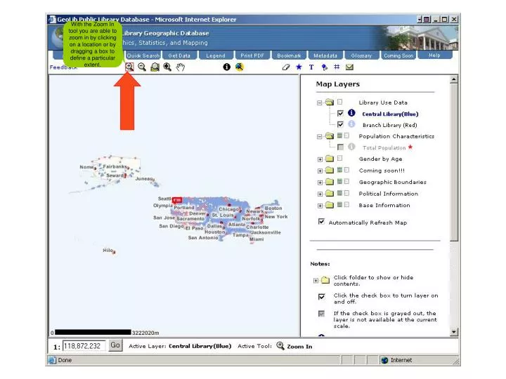
With the Zoom In tool you are able to zoom in by clicking on a location or by dragging a box to define a particular extent.

E N D
With the Zoom In tool you are able to zoom in by clicking on a location or by dragging a box to define a particular extent.
To zoom out on a map, pick the Zoom Out tool. Define the extent of the area that you wish to zoom out to by clicking on a location or by dragging a box to define a particular extent.
The Zoom to Full Extent button zooms you to the full extent of the map. The full extent is often the extent of the map displayed when the viewer is initially launched.
The Zoom to Previous Extent button allows you to jump back to your last map extent. Note that this function remains inactive until you change extents.
The Pan tool lets you navigate around the map. To move around the map hold the mouse button down while you drag the pointer across the map, whatever part of the map you grabbed, will end up wherever you release the mouse button.
The Graphics markup tool allows you to draw points and rectangles on the map. The Text markup tool allows you to add text directly to the map.
The Location markup tool marks the Latitude and Longitude coordinates for a particular map location.
The Grid markup tool places a grid on the map. This grid covers the extent of your current map extent.
The Clear Select map function clears selected features, added text, and graphics.
Thank you for viewing this help demonstration. Now close the window to access map.