Download
1 / 6
70 likes | 81 Views
There are four different types of geological formation and group. In western part of the project area, calcitic nature of Upper Plateau Limestone is found nearby north south trending intra formational fault. About two third of the mapped area is consisted of red coloured sandstone, siltstone, marl and conglomerate of Kalaw Formation in age of cretaceous. In centre of the formation, permo carboniferous aged Plateau Limestone, triassic aged Natteik Limestone and jurassic aged Loi An Group are exposed as inliers. The two formations, Natteik Limestone and Plateau Limestone, are cross cut by northeast trending faults interpreted with aerial photo analysis of the area. The project area lies within the Kalaw Formation. Five main types of rock mass classes are identified according to CRIEPI. They are CH, Cl, CM, CH and D class. The Lugeon values at the Upper Keng Tawng dam site area are less than 5 lugeon after the grouting. The main purposes of Tawng dam regional development The project electricity 51 MW and average energy in annual is 267 MWh. Man Deih Cing | Hla Myat Htwe "Geotechnical Investigation of upper Keng Tawng Dam" Published in International Journal of Trend in Scientific Research and Development (ijtsrd), ISSN: 2456-6470, Volume-3 | Issue-5 , August 2019, URL: https://www.ijtsrd.com/papers/ijtsrd26678.pdf Paper URL: https://www.ijtsrd.com/engineering/geological-engineering/26678/geotechnical-investigation-of-upper-keng-tawng-dam/man-deih-cing<br>

E N D
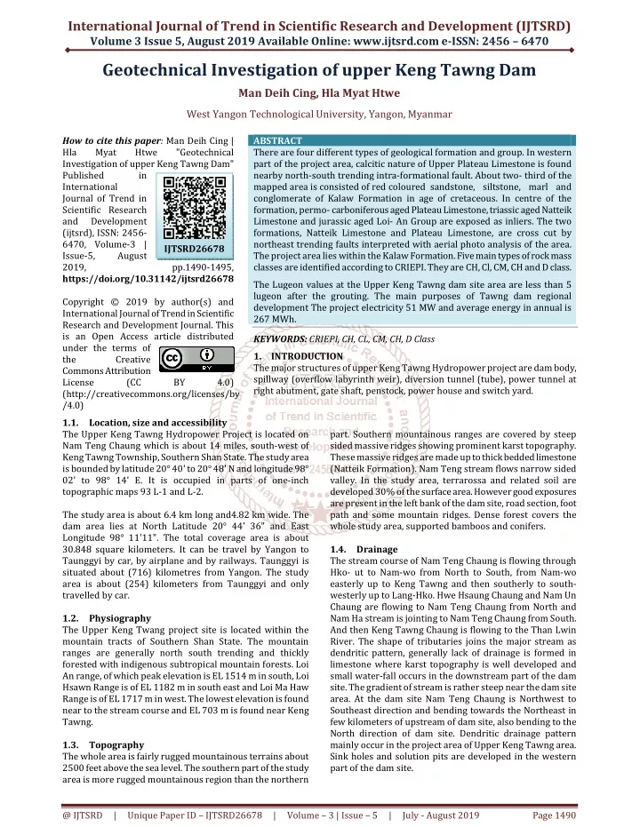
International Journal of Trend in Scientific Research and Development (IJTSRD) Volume 3 Issue 5, August 2019 Available Online: www.ijtsrd.com e-ISSN: 2456 – 6470 Geotechnical Investigation of upper Keng Tawng Dam Man Deih Cing, Hla Myat Htwe West Yangon Technological University, Yangon, Myanmar How to cite this paper: Man Deih Cing | Hla Myat Htwe Investigation of upper Keng Tawng Dam" Published in International Journal of Trend in Scientific Research and Development (ijtsrd), ISSN: 2456- 6470, Volume-3 | Issue-5, August 2019, https://doi.org/10.31142/ijtsrd26678 Copyright © 2019 by author(s) and International Journal of Trend in Scientific Research and Development Journal. This is an Open Access article distributed under the terms of the Creative Commons Attribution License (CC (http://creativecommons.org/licenses/by /4.0) 1.1.Location, size and accessibility The Upper Keng Tawng Hydropower Project is located on Nam Teng Chaung which is about 14 miles, south-west of Keng Tawng Township, Southern Shan State. The study area is bounded by latitude 20° 40' to 20° 48' N and longitude 98° 02' to 98° 14' E. It is occupied in parts of one-inch topographic maps 93 L-1 and L-2. The study area is about 6.4 km long and4.82 km wide. The dam area lies at North Latitude 20° 44' 36" and East Longitude 98° 11'11". The total coverage area is about 30.848 square kilometers. It can be travel by Yangon to Taunggyi by car, by airplane and by railways. Taunggyi is situated about (716) kilometres from Yangon. The study area is about (254) kilometers from Taunggyi and only travelled by car. 1.2.Physiography The Upper Keng Twang project site is located within the mountain tracts of Southern Shan State. The mountain ranges are generally north south trending and thickly forested with indigenous subtropical mountain forests. Loi An range, of which peak elevation is EL 1514 m in south, Loi Hsawn Range is of EL 1182 m in south east and Loi Ma Haw Range is of EL 1717 m in west. The lowest elevation is found near to the stream course and EL 703 m is found near Keng Tawng. 1.3.Topography The whole area is fairly rugged mountainous terrains about 2500 feet above the sea level. The southern part of the study area is more rugged mountainous region than the northern ABSTRACT There are four different types of geological formation and group. In western partof the project area, calcitic nature of UpperPlateau Limestone is found nearby north-southtrending intra-formational fault. About two-third of the mapped area is consisted of redcoloured sandstone, siltstone, marl and conglomerate of Kalaw Formation in age ofcretaceous. In centre of the formation, permo-carboniferous aged Plateau Limestone, triassicaged Natteik Limestone and jurassic aged Loi-An Group are exposed as inliers. The two formations, Natteik Limestone and PlateauLimestone, are cross cut by northeast trendingfaults interpreted with aerial photo analysis ofthe area. The project area lies within the KalawFormation. Five main types of rock mass classesare identified according to CRIEPI. They areCH, Cl, CM, CH and D class. The Lugeon values at the Upper Keng Tawng dam site area are less than 5 lugeon after the grouting. The main purposes of Tawng dam regional development The project electricity 51 MW and average energy in annual is 267 MWh. KEYWORDS: CRIEPI, CH, CL, CM, CH, D Class 1.INTRODUCTION The major structures of upper Keng Tawng Hydropower project are dam body, spillway (overflow labyrinth weir), diversion tunnel (tube), power tunnel at right abutment, gate shaft, penstock, power house and switch yard. "Geotechnical IJTSRD26678 pp.1490-1495, BY 4.0) part. Southern mountainous ranges are covered by steep sided massive ridges showing prominent karst topography. These massive ridges are made up to thick bedded limestone (Natteik Formation). Nam Teng stream flows narrow sided valley. In the study area, terrarossa and related soil are developed 30% of the surface area. However good exposures are present in the left bank of the dam site, road section, foot path and some mountain ridges. Dense forest covers the whole study area, supported bamboos and conifers. 1.4.Drainage The stream course of Nam Teng Chaung is flowing through Hko- ut to Nam-wo from North to South, from Nam-wo easterly up to Keng Tawng and then southerly to south- westerly up to Lang-Hko. Hwe Hsaung Chaung and Nam Un Chaung are flowing to Nam Teng Chaung from North and Nam Ha stream is jointing to Nam Teng Chaung from South. And then Keng Tawng Chaung is flowing to the Than Lwin River. The shape of tributaries joins the major stream as dendritic pattern, generally lack of drainage is formed in limestone where karst topography is well developed and small water-fall occurs in the downstream part of the dam site. The gradient of stream is rather steep near the dam site area. At the dam site Nam Teng Chaung is Northwest to Southeast direction and bending towards the Northeast in few kilometers of upstream of dam site, also bending to the North direction of dam site. Dendritic drainage pattern mainly occur in the project area of Upper Keng Tawng area. Sink holes and solution pits are developed in the western part of the dam site. @ IJTSRD | Unique Paper ID – IJTSRD26678 | Volume – 3 | Issue – 5 | July - August 2019 Page 1490
International Journal of Trend in Scientific Research and Development (IJTSRD) @ www.ijtsrd.com eISSN: 2456-6470 1.5.Climate, Rainfall and Vegetation The Upper Keng Tawng project area is a little hot and humid sub-tropical climate. Having the fairly rainfall in May to September. Annual average rainfall is about 55 inches (Upper Keng Tawng). Surrounding area is thickly forest. Teak trees, Padauk, Pine trees are common in these areas and other various of hard woods are very common. 1.6.Purposes of Study The main objectives of geotechnical investigation of this area are; 1.To illustrate the geological map and engineering geological map of the study area 2.To identify the types of rocks of the study area 3.To describe the geological structures of the area 4.To understand the process of grouting and various types of laboratory processes 5.To calculate the RMR, GSI, Q system and Lugeon values of the study area 6.To study the quarry site, borrow areas, crushing plants and batching plants 7.To analyze the geotechnical properties of soils and rocks 1.7.Methods of Study 1.7.1.Field methods The following field methods are performed to determine the physical and mechanical properties of collected soil and rock samples. Trends of conspicuous outcrops, fault trace and fold axis were demarcated on the aerial photographs. The exposures and structural aspects are measured by Bruton compass. The contact and traverse line are recorded by using GPS. The stratigraphic succession of different rock units was established on the basic of lithologic character, faunal content and stratigraphic position in the field. The nature of rock type and constructions materials are investigated in the field using various methods, including test pits, test trenches diamond core drilling. 1.7.2.Laboratory Methods The following laboratory tests are performed to determine the physical and mechanical properties of soil and rock samples. A.Moisture Content Test B.Unit Weight Test C.Atterberg limits D.Grain Size Distribution Test e. Direct shear Test 2.REGIONAL GEOLOGY OF THE STUDY AREA Four different types of formation and group are recognized in the Upper Keng Tawng Hydropower project area. In regional investigation, Upper Plateau Limestone of calcitic nature is found in the western part with nearly north-south trending intraformational fault. Nearly two third of the mapped area is occupied by outcrops of Kalaw Formation, Red sandstone, siltstone, marl and conglomerate. In the center of this formation, the Plateau Limestone of Permo- Carboniferous age, Natteik Limestone of Triassic age and Loi-an Group of Jurassic age are exposed as inlier. The two formations, Natteik Limestone and Plateau Limestone are cross-cut by Northeast trending faults detected by photo geology in this area. The regional geological map of the study area is shown in figure (1). Figure (1) Regional Geology Map of the study area Stratigraphic succession of Keng Tawng Area Group/ Formation Alluvium Yellow to light brown, light grey, fine-graineds and with rock fragments, Quartz grains, feldspar and iron oxide Kalaw Red Bed reddish color and brown to pale brown sandstone and red conglomerate, band intercalated sandstone. Loi-an Group purple to pale brown limestone, conglomerate, sandstone and silt. Natteik limestone pale brown, limestone. Plateau limestone dark micritic, commonly massive and poorly bedded limestone Lithology Age Quaternary to recent (Cenozoic) Fine-medium grained, Upper Jurassic to Cretaceous (Mesozoic) thin with Medium to thick bedded, Middle to Upper Jurassic (Mesozoic) reddish gritty Dark blue and pale blue and Middle Triassic (Mesozoic) Permian to Carbonifer ous (Paleozoic) massive Bluish grey, pale grey to Figure (2) Natteik Limestone at Quarry Site @ IJTSRD | Unique Paper ID – IJTSRD26678 | Volume – 3 | Issue – 5 | July - August 2019 Page 1491
International Journal of Trend in Scientific Research and Development (IJTSRD) @ www.ijtsrd.com eISSN: 2456-6470 Figure (6) Fault observed at the road cut of the right bank. 2.1.3. Joint In the project area, joints are very common in sandstone, conglomerate, siltstone and marl. Sheeted joints and parallel joints are found in siltstone and fine grained sandstone. Highly weathered, less than 1 to 0.15 cm spaced jointed, fine grained sandstone is grouped as low rock mass strength unit at the abutment of Nam Teng Chaung. High angle to vertical joints are abundantly occurred and less amount of sheeted joints are found in sandstone outcrops. Joint spacing is between 25 cm and 5 cm of this sandstone taken place in medium rock mass strength unit with slightly altered and highly weathered condition. These joints were plotted on a joint rose diagram three sets of joints are observed; (1) longitudinal or strike joints, (2) cross or dip joints and (3) oblique or diagonal joints. Figure (3) Kalaw Red Bed at left abutment 2.1. Geological Structure 2.1.1. Folds The major fold is seen between the Kalaw Red Bed of conglomerate and sandstone. The fold, anticline, occurred within the three formations of plateau limestone, Natteik Formation and Loi-an series. The syncline is formed in the Kalaw Red Bed. The synclinal axis is trending northwest- southeast and plunging towards north. Figure (4) Synclinal fold structure observed at downstream of right bank. 2.1.2. There are ten photo-lineaments (probable weak zones) showing in the regional geological map. These lineaments are tending nearly N-S, NW-SE and NE-SW in direction. In westernmost part of the map area, one of lineaments is occurred along a series of sink-holes of Plateau Limestone as a clear evidence of weak zone. Fault Figure (7) Joints rose diagram of the study area. 2.1.4. Seismicity of the study area Figure (8) Seismic source zones within the faults of 200km of the project Figure (5) Fault observed at bench slope of the left bank. @ IJTSRD | Unique Paper ID – IJTSRD26678 | Volume – 3 | Issue – 5 | July - August 2019 Page 1492
International Journal of Trend in Scientific Research and Development (IJTSRD) @ www.ijtsrd.com eISSN: 2456-6470 3.ENGINEERNG INVESTIGATION OF UPPER KENG TAWNG DAM 3.1.Engineering geological investigation at Upper Keng Tawng Dam GEOLOGY AND GEOTECHNICAL Figure (3.1.d) Studying photo at the left abutment of Upper Keng Tawng dam axis 3.2.Engineering geological conditions of river section Table (3.2) River Section Of Dam Site Drill Holes Location And Depth Holes No RO 650.90 986.92 ADD 728.247 1011.428 698.207 Depth of Hole 50 m 50 m X Y Z 705.96 Figure (3.1.a) Main dam boreholes location plan map Figure (3.2) Calcareous tufa in river section of dam site Figure (3.1.b) Foundation rock class along the Upper Keng Tawng dam axis Table (3.1) Left Abutment of Dam Site Drill Holes Location and Depth Holes No X Y L1 1028.14 816.12 707.14 L2 1054.47 866.62 L3 1105.02 963.36 753.50 Z Depth of hole 50 m 50 m 50 m 721 Figure (3.3) ADD 20 working photo at river section 3.3.Engineering geological conditions of right abutment Table (3.3) Right Abutment Of Dam Site Drill Holes Location And Depth Holes No X Y R 1 936.98 628.60 712.68 R 2 919.45 598.10 730.11 R 3 903.02 564.14 750.12 Z Depth of Hole 50 m 40 m 45 m Figure (3.1.c) Outcrop photo near the left abutment of Upper Keng Tawng dam axis @ IJTSRD | Unique Paper ID – IJTSRD26678 | Volume – 3 | Issue – 5 | July - August 2019 Page 1493
International Journal of Trend in Scientific Research and Development (IJTSRD) @ www.ijtsrd.com eISSN: 2456-6470 Table (3.5) Rock Quality Evaluation of left abutment of dam site.(By using CRIEPI classification) Figure (3.4.a) Slope cutting near the right abutment of Upper Keng Tawng dam axis Table (3.6) Rock Quality Evaluation of river section of dam site.(By using CRIEPI classification) Figure (3.4.b) Diamond Core Drilling at right abutment of Upper Keng Tawng dam axis 3.4.Geotechnical parameters for Upper Keng Tawng Dam foundation rock masses Table (3.4) Dam foundation rock classes identified by using CRIEPI compared with RMR classification (Central Research Institute of Electric Power Industry Table (3.7) Rock Quality Evaluation of right abutment of dam site.(By using CRIEPI classification) @ IJTSRD | Unique Paper ID – IJTSRD26678 | Volume – 3 | Issue – 5 | July - August 2019 Page 1494
International Journal of Trend in Scientific Research and Development (IJTSRD) @ www.ijtsrd.com eISSN: 2456-6470 4.CONSTRUCTION MATERIAL AND LABORATORY TESTING FOR UPPER KENG TAWNG HYDROPOWER PROJECT 4.1.Types of construction materials include 1.Core materials 2.Shell and Rock materials 3.Filter materials 4.Limestone (Rip- rap and Rock toe) 4.1.1.Laboratory Tests The following tests are carried out for valuable information. 1.Moisture content 2.Unit weight (density) 3.Atterberg limits (plastic limit, liquid limit) 4.Grain- size distribution 5.Direct Shear Test The testing results are evaluated by USCS classification of soil type. Borrow soils are suitable for CL type soil or GC type soil should be used center material of filling in the Cut-Off trench for Rock Fill Dam. 4.1.2.Core Material At the upper portion of the hilly terrain in left bank and downstream area, the residual soils are mostly covered. Three proposed borrow areas had already investigated. Test pits were dug for borrow area “A” and “B”, and “C”. The surface of the terrains is deeply weathered being covered with reddish soil and completely weathered rocks seemingly available for core materials. The total estimated volume of core materials is available as 1.19 Mm3. The borrow area “A” is about 2.8 km away from dam site. Borrow area “B” is about 1.3 km distance from the dam site. Borrow area “C” is 1.8 km from dam site. All of these borrow areas are located at the left bank of the dam site. 4.1.3.Laboratory results for Core Materials In the core materials are divided into two parts. They are Borrow “A” and Borrow “B”. According to the laboratory results, the contents of soil samples from borrower “A” are observed as clay (20~30%), silt (10~17%), sand (3~18%) and gravel (44 ~ 58%) respectively as shown in figure (4.3). Atterberg’s limit result shows that liquid limit (LL) plastic limit (PL) and plasticity index (PI) are 32.9~44.7%, 13.9 ~ 20.4% and 18.5~24.3% respectively. Water content of the soils ranges from 11.4 to 13.6 % and specific gravity is ranging from 2.661 to 2.689. The results of direct shear test depicts that the soil has cohesive strength (c) is 0.1435 to 0.169 kg/cm2(14~16kPa) and angle of internal friction (Φ) is 29.76° to 27.18°. The soil types are observed CL and GC. At the near surface, the soil type CL having the permeability value 1.89×10⁻⁶ to 4.34x10- 7 cm/s is occurred. As the results of borrow “B” soil samples, it is observed as clay (15.4~32%), silt (9~23%), sand (3~17%) and gravel (43~59%) respectively. Atterberg’s limit result shows that liquid Limit (LL), plastic limit (PL) and plasticity index (PI) are 39.3~46.7%, 18.6~27.2%, and 15.4~23.5% respectively. Water content of the soils ranges from 2.524 to 2.721. The results of direct shear test depicts that the soil has cohesive strength (C) is 0.108 to 0.879 kg/cm2 (10.6 ~ 86.2 I<Pa) and angle of internal fraction (Φ) is 16.12° to 31.46°. The soil types are observed as CL, SC, and GC. However, after the wet analysis, gravel percent is lower down to 5.21%. At the near surface, the soil type CL having the permeability values of 1.41 x 10⁻⁶ to 4.81 x 10⁻⁸cm/s. The permeability value of SC soil is 2.52 x 10⁻⁶ to 8.89x10⁻⁷cm/s and of GC soil is 1.12 x 10⁻⁶ to5.27×10-8cm/s. Even GC soil has very low permeability value i.e, the finer content is rather high. 4.1.4.Filter sand Sand materials could be exploited along the stream course of the Nam Teng Chang. The expected volume of 0.11 Mm3 is available along the stream course, upstream right bank and downstream left bank of the dam site. 4.1.5.Laboratory testing for filter sand Fineness Modulus (FM) of sand material is ranging from 2.9 to 3.73 and the permeability is of 1 × 10⁻³ to 4 × 10⁻³ cm/s. The percentage of finer particle content is about 0.38%. 5.CONCLUSION Types of rock classes are identify by CRIEP, they are CH, CM, CL, and D class. Totally 7 number of drill holes have been performed along the dam axis. Through the dam alignment, thickness of overburden soil cover is about 2 to 10 m and it is reddish brown color, gritty sand, silty sand and rock fragments of sandstone and conglomerate with siltstone\ mudstone. The dam is located within reddish brown colored sandstone, conglomerate and siltstone of Kalaw Formation in Cretaceous age. Most of the site is covered by colluvium and talus including grit, cobbles and boulders of conglomerate and sandstone in a red clayey soil. The discontinuities of joint is mainly observed on sandstone and the condition of joint is 60 to 70 degree sub-vertical dipping and its surface is slicken-sided to rough with iron stained. The permeability value is of ranging from 1.15 x10⁻⁴ to 5.62x 10⁻⁵cm/s and the SPT N-value is of 69 showing the soils of rather high relative density and dense in condition. The permeability of foundation rock is within 0.32 to 32.7 Lugeon. The RQD value of sandstone is ranging from less than 11% to 10 % i.e. very poor to excellent RQD and the TCR value is of less than 10 to 100%. In conclusion, the Lugeon values at the Upper Keng Tawng dam site area are less than 5 Lugeon after the grouting. The main purposes of Upper KengTawng dam are supply electrical energy for regional development and national demand. The project has been planned to produce electricity 51 MW and average energy in annual is 267 MWh. ACKNOWLEDGEMENTS I am very much thankful to my supervisor Dr. Hla Myat Htwe, Lecturer, Department of Applied Geology for her closely supervision, critically reading the manuscript, valuable suggestions and editing. I deeply thank U Aye Lwin (A.S.E), Assistant Director and all geologists of the department of hydropower Implementation (DHPI) for their initiative suggestion supporting valuable documentaries during my field investigation and providing facilities. REFRENCES [1]Aye Lwin, July, (2010): “Feasibility Study Of Upper Keng Tawng Hydropower Project”. [2]WREUT W-02(2007): “Geology of Dam Site, Upper Keng Tawng Hydropower Project”. Links: www.wikipedia.org www.researchgate.net @ IJTSRD | Unique Paper ID – IJTSRD26678 | Volume – 3 | Issue – 5 | July - August 2019 Page 1495