Download
1 / 16
160 likes | 234 Views
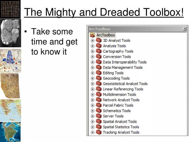
The Mighty and Dreaded Toolbox!. Take some time and get to know it. Vector Analysis. Generalization. ArcToolbox -> Data Management Tools -> Generalization -> …. Generalization (100 meters). Original. Generalized to 100 meters. Generalization (1000 meters). Original.

E N D
The Mighty and Dreaded Toolbox! • Take some time and get to know it
Generalization • ArcToolbox -> Data Management Tools -> Generalization -> …
Generalization (100 meters) Original Generalized to 100 meters
Generalization (1000 meters) Original Generalized to 1000 meters
Polyline Geometry • Use an “Equidistant Projection”
Polygon Geometry • Use an “Equal Area” Projection
Making Centroid Point Layers • Add fields for X and Y • Use “Calculate Geometry” to add the X and Y coordinates of the centroid • Open the dbf in Excel • Save the dbf to a tab-delimited text file • Use “Tools -> Add X Y Data” to add the text file as points
Buffering • Creates polygons around existing vector features • ArcToolbox -> Analysis -> Proximity -> Buffer
Dissolving • ArcToolbox -> Data Management Tools -> Generalization -> Dissolve • Combines features based on a common attribute value ArcGIS Help
Clip • ArcToolbox -> Analysis Tools -> Extract -> Clip • ArcToolbox -> Data Management Tools -> Raster -> Raster Processing -> Clip ArcGIS Help
Intersection • ArcToolbox -> Analysis Tools -> Overlay -> Intersect • ArcToolbox -> Spatial Analysis Tools -> Local -> Combine ArcGIS Help
Vector Processing • Perform math on attributes using “Field Calculator” • Query attributes to select desired features • Right click on layer -> Selection -> Create Layer from Selected Features • New Shapefile and Layer • Perform spatial analysis • Repeat