Download
1 / 31
310 likes | 447 Views
ASIA. Location (Physical Features & Countries) FSMS Standard SS7G9.a Days 1-3. ASIA GEOGRAPHIC UNDERSTANDINGS. SS7G9 – The student will locate selected features in Southern and Eastern Asia.

E N D
ASIA Location (Physical Features & Countries) FSMS Standard SS7G9.a Days 1-3
ASIAGEOGRAPHIC UNDERSTANDINGS • SS7G9 – The student will locate selected features in Southern and Eastern Asia. a. Locate on a world and regional political-physical map: Ganges River, Huang He (Yellow River), Indus River, Mekong River, Yangtze (Chang Jiang) River, Bay of Bengal, Indian Ocean, Sea of Japan, South China Sea, Yellow Sea, Gobi Desert, Taklimakan Desert, Himalayan Mountains, and Korean Peninsula
FIRST FIVE Agenda Message: Today we start our study of Southern and Eastern Asia. Before school tutoring is Tuesday starting at 7:30a. Standard: Locate selected features in Southern & Eastern Asia including rivers, mountains, Seas, Deserts, Oceans, Bays and the Korean Peninsula. Essential Question for Monday 11/4/13: What are the major geographic features in Southern & Eastern Asia? Warm Up for Monday 11/4/13: Name three things that you know about Asia. TODAY WE WILL: • Introduce the map of Southern & Eastern Asia
Answers E.Q. Answer for Monday November 4th: Ganges River Yellow Sea Indus River Indian Ocean Huang He (Yellow River) Sea of Japan Mekong River Gobi Desert Yangtze River Taklimakan Desert Himalayan Mountains South China Sea Bay of Bengal Tibetan Plateau Korean Peninsula Warm-Up Answer:
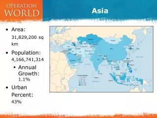
ASIAGEOGRAPHIC UNDERSTANDINGS Physical Geography Introduction The southern and eastern parts of Asia are home to almost half of the world’s population. The geography of this large area is varied, containing some of the world’s longest rivers, highest mountain ranges and large extensive deserts.
ASIAGEOGRAPHIC UNDERSTANDINGS The Indus River Indus River begins in the mountains of Tibet and flows almost 200 miles through the country of Pakistan before emptying into the Arabian Sea. The Indus River valley is one of the richest farming areas in this region. Many different civilizations have lived along this river throughout the centuries.
ASIAGEOGRAPHIC UNDERSTANDINGS Ganges River The Ganges River is India’s most important river. It begins in the Himalayan Mountains and flows southeast through India and Bangladesh before emptying into the Bay of Bengal. The water of the Ganges carries tons of rich sediment (topsoil, silt and minerals from the mountains) that is gradually spread along its path enriching the farmland and creating a large, fertile delta at the mouth of the river.
ASIAGEOGRAPHIC UNDERSTANDINGS Ganges River cont. Because so many people live and work along the Ganges, the water in the river is heavily polluted. The country of Bangladesh is located almost completely in the Ganges River delta. Monsoon Season Heavy flooding in this part of the world during the monsoon season (a seasonal prevailing wind, lasting several months, bringing heavy rains) often causes great hardships for those living in this country.
FIRST FIVE Agenda Message: After-school tutoring is Wednesday from 4-5p. Progress Reports go home Friday for all classes. Standard: Locate selected features in Southern & Eastern Asia including rivers, mountains, Seas, Deserts, Oceans, Bays and the Korean Peninsula. E.Q. Tuesday, 11/5/13: How does the Yellow River get it’s name? Warm Up: What percentage of the world’s population is found in India & China combined? TODAY WE WILL • Continue review on map of Southern & Eastern Asia
Answers E.Q. Answers for Tuesday November 5th: The yellow dust blowing out of the Gobi Desert is picked up by the Huang He and carried along as loess (another name for silt), giving both the river and the sea a yellowish color. Warm-Up Answers: India & China combined have about 1/3 of the world’s population
ASIAGEOGRAPHIC UNDERSTANDINGS Indian Ocean Further out to sea is the Indian Ocean, which is the third largest ocean in the world. Mountains & Plateau The Himalayan Mountains form the southern border of China. This high ground spreads to the north to form the Tibetan Plateau.
ASIAGEOGRAPHIC UNDERSTANDINGS Mountains & Plateau cont. This area is sometimes called “the roof of the world” because of its high altitudes. This wide area of mountains and high plateau blocks any moisture coming from the rivers and seas to the south. The Himalayan Mountains form India’s eastern border with China and Nepal.
ASIAGEOGRAPHIC UNDERSTANDINGS Mountains & Plateau cont. These high mountains form a barrier between India and countries to her north and east. The Himalayan Mountains stretch for almost 200 miles. The highest mountain in the world, Mount Everest, is on the border between Nepal & China.
ASIAGEOGRAPHIC UNDERSTANDINGS Deserts As the mountains begin to level off in the north, the land becomes desert. Here one finds the Taklimakan Desert and the Gobi Desert. The Taklimakan Desert is over 600 miles in length, one of the longest deserts in the world.
ASIAGEOGRAPHIC UNDERSTANDINGS Deserts cont. To the east and in the central part of China is the Gobi Desert, which can be one of the “hottest” and also one of the “coldest” places in the world. Much of the Gobi Desert is covered with sand and rocks.
FIRST FIVE Agenda Message: After-school tutoring is today from 4-5p. Progress Reports go home Friday for all subjects. Standard: Locate selected features in Southern & Eastern Asia including rivers, mountains, Seas, Deserts, Oceans, Bays and the Korean Peninsula. E.Q. Wednesday 11/6/13: How does the Yellow Sea gets it’s name? Warm Up: What percent of the world’s population lives in S&EA? TODAY WE WILL: • Continue map review of Southern & Eastern Asia
Answers E.Q. Answers for Wednesday November 6th: The yellow dust blowing out of the Gobi Desert is picked up by the Huang He and carried along as loess (another name for silt), giving both the river and the sea a yellowish color. Warm-Up Answers: Half the world’s population can be found in S&EA
ASIAGEOGRAPHIC UNDERSTANDINGS China’s River China’s fertile farming areas lay north and east of the Gobi desert region. The Huang He, or Yellow River, begins in the Tibetan Plateau. It flows toward the east and finally empties into the Yellow Sea.
ASIAGEOGRAPHIC UNDERSTANDINGS China’s Rivers cont. The yellow dust blowing out of the Gobi Desert is picked up by the Huang He and carried along as loess (another name for silt), giving both the river and the sea a yellowish color. The Yellow River is also used for transporting people and goods, though annual floods make conditions along the river’s path dangerous.
ASIAGEOGRAPHIC UNDERSTANDINGS Yangtze River The Yangtze River also begins in the Tibetan Plateau. This river travels east until it reaches the East China Sea. The Yangtze River is China’s longest river stretching for over 3,400 miles. It goes through fertile farming land and is one of China’s main transportation routes.
ASIAGEOGRAPHIC UNDERSTANDINGS Yangtze River The city of Shanghai is China’s most important port, and is located at the mouth of this river. The Yangtze River and Huang He River are connected by the Grand Canal, one of the world’s oldest and longest canal systems. The oldest part of the canal was built 2,000 years ago.
ASIAGEOGRAPHIC UNDERSTANDINGS Mekong River Flowing through China, Myanmar (formerly known as Burma), Thailand, Laos, Cambodia, & Vietnam, the Mekong River affects the lives of over 60 million people, many of whom are the poorest in the world. One of the regions most important crops, rice is grown extensively in the Mekong River Basin.
ASIAGEOGRAPHIC UNDERSTANDINGS Oceans, Bays, & Seas Indian Ocean The third largest of the world’s five oceans is the Indian Ocean. It’s Relative Location is between Africa to the west, Asia to the north, Australia to the east, and the Southern Ocean to the south.
ASIAGEOGRAPHIC UNDERSTANDINGS Bay of Bengal The Bay of Bengal is an arm of the Indian Ocean with India to the west and Myanmar to its east. The Ganges River flows into the bay. Sea of Japan The Sea of Japan is an arm of the Pacific Ocean that lies between the Korean Peninsula and the Island of Japan.
ASIAGEOGRAPHIC UNDERSTANDINGS South China Sea The South China Sea lies between Vietnam and the Philippine Islands. Weather in the region is marked by violent monsoons and typhoons. Yellow Sea This arm of the Pacific Ocean lies between China and Korea. It gets its name from the Yellow River which flows into the sea.
FIRST FIVE Agenda Message:Progress Reports go home Friday for all classes. S&EA Geography Quiz is Wednesday November 13th. Standard: Physical Geography; Locate selected features in Southern & Eastern Asia including rivers, mountains, Seas, Deserts, Oceans, Bays and the Korean Peninsula. E.Q. Thursday 11/7/13: What is an Archipelagos? Warm Up: Where does the Ganges River Start, what country does it flow through, and what body of water does it flow into? TODAY WE WILL: • Continue map review of Southern & Eastern Asia
ANSWERS E.Q. Answer for Thursday November 7th: A group of islands Warm-Up Answer: The Ganges River starts in the Himalayan Mountains, flows through India & Bangladesh, and flows into the Bay of Bengal.
ASIAGEOGRAPHIC UNDERSTANDINGS Southern & Eastern Asia Landforms • Himalayan Mountains (Nepal, Tibet, Pakistan, Bhutan, India, and southwestern China) • Subcontinent (also known as India) A large landmass that is part of a continent, but is geographically separate from it. • Tibetan Plateau (southwestern China) The highest plateau on earth. Nicknamed, “the roof of the world”. • Korean Peninsula (North and South Korea) • Archipelagos (Indonesia and the Philippine Islands) A group of islands. Indonesia has the 4th largest population in the world and is made up of over 17,000 islands.
ASIAGEOGRAPHIC UNDERSTANDINGS Korean Peninsula The Korean Peninsula juts out from northeastern China in between the Yellow Sea and the Sea of Japan. Since 1948, this peninsula has been divided into two countries: Communist North Korea and Democratic South Korea.
FIRST FIVE Agenda Message: Progress Reports go home today. Make sure your parents sign them and return to home room. Standard: Locate on a world and regional political-physical map Pakistan, India, China, Japan, Indonesia, North Korea, South Korea, and Vietnam. E.Q.Friday 11/8/13: India considers the Ganges River to be sacred. What is their main religion? Warm Up: Name the seven countries in Southern and Eastern Asia that will be our focus for this unit. TODAY WE WILL: • Complete Geography & Political highlights of S&EA including Maps
Answers E.Q. Answers for Friday November 8th: Hindu Warm-Up Answers: Pakistan India China Japan Vietnam North Korea South Korea