Download
1 / 33
330 likes | 421 Views
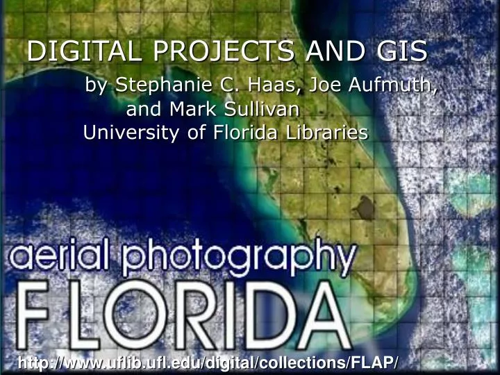
DIGITAL PROJECTS AND GIS by Stephanie C. Haas, Joe Aufmuth, and Mark Sullivan University of Florida Libraries. http://www.uflib.ufl.edu/digital/collections/FLAP/.

E N D
DIGITAL PROJECTS AND GIS by Stephanie C. Haas, Joe Aufmuth, and Mark Sullivan University of Florida Libraries http://www.uflib.ufl.edu/digital/collections/FLAP/
Between 1937 and 1970, the U.S. Department of Agriculture created more than 88,000 black and white, 9 x 9 aerial photographs with 2,200 accompanying photomosaic indexes of Florida. County codeFlight no. Tile no. Flight date
Originally intended to assist farmers determine accurate assessments for their farms and to provide information on crop determination and soil conservation, today these images provide some of the oldest land use/cover information available. They are used extensively in agriculture, conservation, urbanization, recreation, education, hydrology, geology, land use, ecology, geography, and history.
In 2002, the Digital Library Center at UF received an LSTA grant to digitize the aerial tiles from 1937 to 1952 and make them available through a map server. A renewal grant in 2003 permitted the digitization of the aerials through 1970.
Objectives • Scan 80,000+ Air Photo Tiles +2,200 indexes • Geographically Reference Index Sheets • Create Spatial Index Data Base Linked to Individual Air Photo Tiles • Deliver Spatial Index and Photos via the Internet
A Collaborative Effort • Map and Imagery Library • Digital Library Center (DLC) • Government Documents • Library Systems • Florida Center for Library Automation (FCLA)-stores MrSID images • Geomatics Program (Civil Engineering)
Select Tiles Map Library & DLC Staff Host SIDs on MrSID Web Server FCLA Staff • Scan Indexes and Tiles • Prepare Images & Create SIDs • Create Photo Tile Database • Process Tile Requests DLC Staff • Support Tile Database • Support Mapserver • Modify ArcIMS Systems Staff • Process Tiff Indexes • Create GIS Tile Point Layer • Create GIS Database • Manage ArcIMS Site GIS Staff WORKFLOW Original Tiffs Archived
Aerial tiles were scanned on flatbed scanners Erasing crayon markings that were unanticipated added up to 2 min/tilein preparation time Cost added an additional$6,000 to scanning labor. (Not much funeither!) Microteck 1800XL flatbed scanners 10-12 Tiles/hr 80,000+ Tiles 615 DPI Greyscale – 8bit
DEALING WITH 88,000 aerials Mark Sullivan, a student programmer with the DLC, created two programs that became critical to the project’s success. The first tracked tiles through the digitization chain: 1) recorded date received, 2) student assigned, 3) completion of scan-including scanner used and time scanned, and 4) CD number holding TIFF image.
The second tool: • Automated image collection from disparate • scanning locations, • Performed basic image manipulation for quality control, • Created MrSID compressed image for serving, and • 4) Stored data in the database.
CREATING the GIS INTERFACE STAFFING: 6 Geomatics StudentsSummer Cooperative Program Minimal Experience • SOFTWARE USED:Leica’s Erdas Imagine – Image Clean Up • Adobe Photoshop – Image Clean Up • ESRI’s ArcGIS – University Site License • Workstation – Georeferencing/Rectification • ArcMap – Georeferencing QA/QC • ArcIMS – Internet Map Server • Geomatics Coordinate Transformation Program
HARDWARE • 2 Designated Dell Precision 350 Workstations • 3 Additional Library Computers • 460 GB storage • 3 DVD drives • 1 5GB tape drive
Aerial Index Sheets: Photo Tile Mosaic for Alachua County, FL Legend and Sheet Index
Scanned photomosaics index sheets were geographically rectified
ANCILLARY LAYERS USED TO RECTIFY THE INDEXES 67 Counties 3 Meter DOQs Roads Rivers Lakes TRS County Boundary
Image Processing and GIS Data Ground Control Layer Sheet DOQQ Real World Pixel
Tieing Together County Indexes Sheet 1 Sheet 2 Pixel Pixel
Individual aerials were linked by matching the flight text string (upper right corner) with the text string on the rectified indexes. Index Individual aerial tile
Aerial Tile Layer and associated database Each aerial dot represents a searchable record in the layer’s database. Tile records have 9 fields.
LAYERS AVAILABLE with associated symbols
Two quick comments: Even though the individual aerial tiles were not rectified.The resolution is sufficient for use in some GIS projectsand several thousand have been FTP’d to agencies andcompanies. Because the map interface uses GIS tools, we developedseveral guides on how to use the collection. These guides are available off the top level page.