Download
1 / 14
140 likes | 401 Views
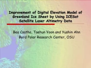
ICE, CLOUD, AND LAND ELEVATION SATELLITE – 2 (ICESat-2) Snapshot Status June 16, 2010. ICESat-2 LRD: October, 2015 Project Phase: A Code 425.

E N D
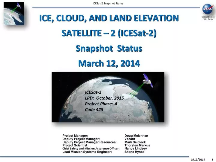
ICE, CLOUD, AND LAND ELEVATION SATELLITE – 2 (ICESat-2) Snapshot Status June 16, 2010 ICESat-2 LRD: October, 2015 Project Phase: A Code 425 Project Manager: Doug MclennanDeputy Project Manager: VacantDeputy Project Manager Resources: Mark SeidleckProject Scientist: Thorsten MarkusChief Safety and Mission Assurance Officer: Nancy LindseyLead Mission Systems Engineer: Shane Hynes
ICESat-2 Snapshot Topics
ICESat-2 Mission Concept • In contrast to the ICESat design, ICESat-2 will use micro-pulse multi-beam photon-counting approach. • Provides: • Dense cross-track sampling to resolve surface slope on an orbit basis. • High repetition rate generates dense along-track sampling. • Advantages: • Improved elevation estimates over high slope areas and very rough (i.e., crevassed) areas. • Improved lead detection in sea ice. ICESat-2 Key Facts: Orbit: 600km, 91-day repeat, with monthly Sub-cycles, ICESat orbit Laser Rep. Rate:10 kHz Number of beams: 9, with unequal energy Along-track sampling: 70 cm Wavelength:532 nm Website: icesat.gsfc.nasa.gov/icesat2
Current Science Activities • May 2010 SDT meeting Highlights: • Resolved open trades • Preliminary approval of design • Suggest revisions of Level 1 Science Requirements. ICESat-2 simulator for sea ice: • Land Ice sub-group: • Including forward-scattering effects. • Reassessment of whole ice-sheet requirement. • Several iterations with project on performance model. • Sea Ice sub-group: • Developed ICESat-2 simulator. • Analysis of lead-width distribution, lead detection ability. • Analysis of precision of lead sea surface height and freeboard measurements. • Ecosystem sub-group: • Working with sub-sampled photon counting data from SigmaSpace aircraft flights. • Five independent assessments of canopy detection. Simulated ICESat-2 data from aircraft flight with added solar background noise): Next SDT meeting: Seattle, WA Sept./Oct.: SRR overview, MABEL, performance assessment.
ICESat-2 Aircraft Simulator: MABEL MABEL remains on schedule, and on budget for Oct. 2010 aircraft int. and Testing MABEL fiber box schematic: System Status: • Cost, Schedule, and Technical look good. • Preliminary review with flight operations (ER-2): layout, dimensions, specifications • Waiting for cost estimate for Goose Bay, Canada ops. In Spring 2011 (in conjunction with Op. IceBridge) Sub-system Status: • Laser progressing very well • Mechanical design progressing • Opto-mechanical parts ordered • Optical fibers and box on order • Prototype beam splitter in fabrication • Data system progressing. Developing new time of flight card. • Interface definition and design progressing. Simulated MABEL data over ice sheet (solar background noise removed): Next status update to SDT: May 10-12, Boulder CO
LV Comparison CBE Instrument Mass 398kg NTE Spacecraft + PAF 734kg Propellant 197kg Total inc margins 1431kg
ICESat-2 Launch Segment TDRSS GPS White Sands Complex (WSC) Science Team NSIDC Laser Ranging Station GES DAAC GSFC FDF Ground Network Conjunction Assessment Sci Computing Facility POD/PAD GPS Navigation Signal • L&EO support • Maneuver support • X-Band downlink • S-Band up & down • Precision Orbit • Precision Attitude • Off-Nadir Requests • Data Archive • Distro to Public • Ancillary Data Provider ICESat-2 Space Segment • Alg Development • Product Validation • Assess conjuncts Spacecraft ATLAS S-Band Contingency/Early Ops ICESat-II Observatory Raw Data, Telemetry Same as ICESat Tracking Data • Obs. Position ICESat-2 Ground Segment Maneuver/TOO Plans, Approvals X-Band Science S-Band CMD & TLM Mission Operations Center Science Investigator-Led Processing System Instrument Support Facility • Planning and Scheduling • Command and Control • Trending and Analysis • Flight Dynamics Raw Data, Cmds/ TLM • ATLAS Planning and Sched • ATLAS Health & Safety • ATLAS Cmd Generation • Process TOO Requests • Ingest L0 • Generate L1 & L2 Products • Store Mission Data • Provide data to SCF & NSIDC Level 0 Datasets L0 /1A data, Precision Orbit/ Attitude Data CMD Rqsts/ Telemetry Ephemeris Data/ Reports Ancillary NOAA Analysis Data Science Data & Plans Level 1-3 Products/ Algorithms Orbit Deter/ Maneuver Info Cal/plans Feedback Level 0-3 Products
Instrument Overview • Multi-beam Micropulse Laser Altimeter • Single laser beam split into 9 beams • 10 m ground footprints • 10 kHz rep. rate laser (~1mj) • Multiple detector pixels per spot • On-board boresight alignment system • Laser Reference System gives absolute laser pointing knowledge Ground Track and Footprint Redundant Etalons and Detectors Boresight Alignment Mechanism LRS Radiators 0.5 to 1m telescope S/C provided trackers and SIRU Telescope Alignment Monitoring LTR Instrument Electronics Beam Expander Redundant Lasers
Model Status • Tony’s charts
Spacecraft Update • RSDO Study Status • Met with RSDO to review Study RFO. All looks good for a April 30 release (15 applicable docs nearing final draft) • Added 3 weeks to SC Study duration • 1 week for proposal and 2 weeks more for study • More time is better for vendors and project • Will fold results into SRR/MDR and SC procurement RFO • Extra study time moves study completion to Aug 13, which moves SC procurement RFO to Sep 10 and Award to Jan 11 • Extra study time increase study cost from $1.2M to $1.5M • RSDO vendor pool • Vendors awarded under RSDO Rapid-III include: Ball, GD, LM, NG, OSC, Surrey, Thales (France), Thales (Italy) • Ref attachment for catalogue specs • SRD status • SRD final review continues. Plan to complete final draft next week • Launch Vehicle • Using Delta-II 7320-10 as limiting case • Working with systems and instrument teams on mass, volume fit
Budget & Schedule Fiscal Year Calendar Year