Download
1 / 16
160 likes | 256 Views
McIDAS-Lite. Dave Santek Program Manager dave.santek@ssec.wisc.edu Space Science & Engineering Center University of Wisconsin-Madison 5 December 2002. Overview. Space Science & Engineering Center McIDAS McIDAS-Lite. SSEC: Data. National archive for GOES data

E N D
McIDAS-Lite Dave Santek Program Manager dave.santek@ssec.wisc.edu Space Science & Engineering Center University of Wisconsin-Madison 5 December 2002
Overview • Space Science & Engineering Center • McIDAS • McIDAS-Lite
SSEC: Data • National archive for GOES data • Real-time, global geostationary & polar satellite database • World-wide ancillary meteorological data • Direct ingest capability
SSEC: Software • McIDAS • Vis5D • VisAD • IAPP • IMAPP
IMAPP • MODIS portion of the International MODIS/AIRS Processing Package (IMAPP) • Funded by NASA • Software to turn direct broadcast MODIS and eventually AIRS data into science products. The current suite of MODIS products consists of: • Calibrated, navigated 36 channel radiances (L1B) • Cloud Mask (MOD35) • Cloud Top Properties (MOD06) • Cloud Phase (MOD06) • Atmospheric Profiles (MOD07) • Software is freely distributed.
Cloud Top Pressure Low Mid High
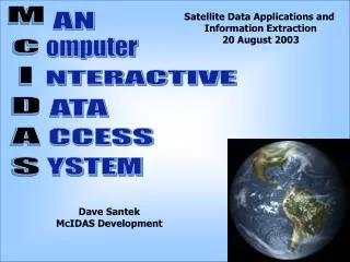
McIDAS • Man computer Data Access System • First released in 1973 • Developed to track clouds • Ported through 4 generations of computers • Integrates many types of meteorological data • Used world-wide
One Day of Arctic Orbits MODIS band 27 (6.7 mm)
McIDAS-Lite • Functionality subset of McIDAS-X • Browse local or remote data • Input data formats • McIDAS image file • MODIS HDF files • Level 1b • Level 2 products
McIDAS-Lite • Output data format • Graphical [GIF, JPEG] • Flat files • netCDF • Geolocate data • Calculate physical quantities • Basic analysis functions • Basic image color enhancement
McIDAS-Lite • Client/server system • Local data • Remote data • ADDE [Abstract Data Distribution Environment] • TCP/IP • Subsecting and sampling • Compression
McIDAS-Lite Status • First release: January 2002 • Used in satellite meteorology class • 200 downloads this summer • 1300 data requests over last 3 months • Version 1.2 released in September 2002
McIDAS-Lite Platforms • Unix workstations: • AIX, Solaris, IRIX, HPUX • PCs: • Solaris, Redhat Linux, Windows/SFU • MacOS X?
Web Links • Main SSEC page • www.ssec.wisc.edu • McIDAS-Lite • www.ssec.wisc.edu/mclite • IMAPP • cimss.ssec.wisc.edu/~gumley/IMAPP • McIDAS • www.ssec.wisc.edu/mug • Data Center • www.ssec.wisc.edu/datacenter