Download
1 / 66
740 likes | 1.17k Views
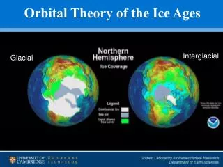
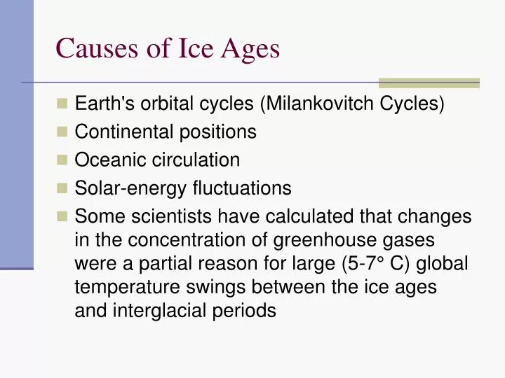
Causes of Ice Ages. Earth's orbital cycles (Milankovitch Cycles) Continental positions Oceanic circulation Solar-energy fluctuations

E N D
Causes of Ice Ages • Earth's orbital cycles (Milankovitch Cycles) • Continental positions • Oceanic circulation • Solar-energy fluctuations • Some scientists have calculated that changes in the concentration of greenhouse gases were a partial reason for large (5-7° C) global temperature swings between the ice ages and interglacial periods
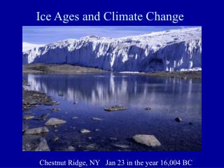
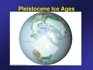
Ice Ages • Occur at intervals of about 150 - 200 my and last for millions of years • Cenozoic Era • Evidence from marine sediments shows fairly continuous record for climate change • Indicates decreasing deep-water temperature • Build-up of continental ice sheets. • Deep-water cooling occurred in three major steps about 36, 15 and 3 mya (continues today)
Ice Ages • Louis Agassiz • Geologists called deposits that could not be explained by the normal action of rivers and seas diluvium. • Thought they were produced by extraordinary floods of vast extent. • Agassiz, a Swiss geologist who initially worked on fossil fish, demonstrated that diluvium was actually a ground moraine formed by continental glaciation
Pleistocene Glacial Events • 20 cycles of advancing and retreating continental glaciers • Up to 30% of the Earth's surface was glaciated periodically • Large portions of Europe, North America (including Greenland), South America, all of Antarctica, and small sections of Asia were entirely covered by ice. • Because so much water was taken up as ice, global sea level dropped approximately 140 meters
Great Ice Age of Pleistocene Era • Began ~ 1.6 mya • World’s climate cooled • Cool summer, mild winter • Winter period became longer • Short summers (little melting) • Snowfalls accumulated as ice
Great Ice Age • Four major periods of glaciation • Nebraskan • Kansan • Illinoisan • Wisconsinan • Most recent • Wisconsinan stage glaciation (70-10 kya) • Glacial Maximum 18-20kya • Only stage that has good geological and paleontological records • Most important for Great Lakes
Wisconsinan Stage • Four global ice sheets (northern hemisphere) • Greenland • Eurasian • Cordilleran - western N. Am. • Laurentide – eastern N. Am. & Great Lakes!
Ice sheet at 18kya Eurasian Ice Sheet
Laurentide Ice Sheet • Moved south from Canada • North Central and North Eastern N. Am. • Important for Great Lakes formation • Spread as far south as Northern Pennsylvania, Ohio, Indiana and Illinois
Laurentide Ice Sheet • Ice cap spread southward eventually covered eastern N. America south to Ohio and Missouri River Valleys • Northern regions: 3-6 miles thick • Southern regions (Chicago) 1 mile thick • 85% of Illinois covered at some point by ice • Areas not involved are called driftless • Relic habitat • Relic species • Temperatures about 15–20oC colder than today
View as PPT slide series. Observe direction of ice flow, size of lakes. Note reduced volume in L. Michigan around 10kya.
Movement of the Ice • Ice moved as a series of lobes • each lobe sought out the lowest spots on the landscape • These were mainly ancient river valleys • Glacial lobes are named according to the Great Lakes and bays that eventually occupied the enlarged depressions after the ice had disappeared
Glacial Lobes • Superior Lobe, with the Keweenaw lobe as an offshoot • Lake Michigan lobe, with its Grand Traverse and Green Bay appendages • Huron Lobe, with its subordinate Saginaw Lobe • Erie Lobe • Ontario Lobe
Movement of the Ice • Slowly the lobes made their way southward out of the old widened river valleys • During the climax of the last, or Wisconsinan stage of glaciation, all the lobes were welded together south of the Great Lakes region • Lobes reunited in area that is now Ohio, Indiana, and Illinois • Southernmost limit reached ~ 20 kya • About 200 miles south of Chicago • Ohio River formed at southern boundary
Maximum extent of Wisconsinan stage ice (18-20 kya)
Movement of the Ice • Glacier advanced southward (also east and west) as one broad sheet of ice or glacier with slightly lobate front. • Formation of lake basins • Moving ice scoured bedrock surface in river valleys • Bedrock around Chicago was a form of limestone called dolomite (contains magnesium - yellowish) • Gouged valleys deeper and broader
Movement of the Ice • Not until the ice melted back into southern Michigan did the ice front again become separated into distinct lobes • Saginaw Lobe • Michigan Lobe • Huron-Erie Lobe
Glacial Retreat The Great Lakes are Born
Retreat Of The Ice Margin • Main lines of evidence for process come from the end moraines left behind • The Saginaw lobe was thinner than the Lake Michigan and Erie lobes and therefore melted faster and was the first to begin its retreat.
Retreat Of The Ice Margin • As the margins of these lobes retreated, glacial meltwater and precipitation drained southward to the Gulf of Mexico because higher land or glacial ice blocked flow in other directions • Sand and gravel, which these meltwater streams could not carry, was laid down as outwash, in broad, flat outwash plains • Ice-marginal lakes (or proglacial lakes) formed where the land in front of the ice margin sloped toward the ice, allowing meltwater to pond directly in contact with the ice.
Retreat Of The Ice Margin • The retreat of the margins of the Michigan and Huron-Erie lobes resulted in the impoundment of water between the ice margin and moraines formed previously by the glacier • Tops of moraines were at higher elevations than was the ice margin • A series of lakes came into existence, one side of which lay against the ice margin • These lakes are called proglacial lakes • First phase of the complex development of the present Great Lakes.
Glacial retreat and the formation of proglacial lakes along the ice margins. As the glaciers melted back the depressed crust began to slowly rebound, tilting the proglacial lakes to the north.
Ice Flow - weight of ice causes it to flatten down and push outward. Compresses continental surface. Land around Great Lakes is still rising a few feet per century as a result of the ice melting away. Also called crustal rebound
Proglacial Lakes • Lake Chicago • Lake Saginaw • Lake Whittelsey • Lake Keweenaw • Lake Algonquin • Early Lake Erie • Lake Iroquois • Early Lake Ontario • Lake Minong • Lake Chippewa • Lake Stanley • Lake Hough • Early Lake Nipissing • Lake Barlow
Other Important Proglacial Lakes • Glacial Lake Agassiz • Glacial Lake Ojibway
Steps to the modern Great Lakes • 13.8 kya first proglacial lakes to form • Glacial Lake Maumee (M) from the Huron-Erie Lobe • Drained to the southwest, out the Maumee-Wabash-Ohio to the Mississippi River • Glacial Lake Saginaw (S) • Drained westward into Glacial Lake Chicago. • Glacial Lake Chicago (C) from the Michigan lobe • Drained west and south through Chicago-Des Plaines-Illinois rivers to the Mississippi River (P)
Steps to the modern Great Lakes • 12,500 years ago • Another lower drainage way referred to as the Ubly Outlet (U) was uncovered in southeast Michigan by the retreating ice margin • Carried water northward from the Erie basin. • Formed Glacial Lake Whittlesey (W) • Drained into Glacial Lake Saginaw
Steps to the modern Great Lakes • 11,000 years ago • Most, if not all, of the basins of Lakes Michigan and Huron were deglaciated • One large body of water, Lake Algonquin (A), resulted from the coalescence of Glacial Lakes Saginaw and Chicago. • This lake was more extensive than the present Lakes Michigan and Huron (582 ft or 175 m above sea level) because its altitude was more than 20 feet higher (605 ft or 182 m).
Steps to the modern Great Lakes • 11,000 years ago • Lake Algonquin • Drainage out of Lake Algonquin changed • Went through Glacial Lake Iroquois into Atlantic via the Hudson River of New York • Glacial Lake Duluth (D) formed • Predecessor to Lake Superior
Steps to the modern Great Lakes • 9500 years ago • Complete deglaciation of great lakes area • Final stages of modern lake formation • Glacial Lake Duluth grew in area • The present-day Great Lakes formed as the earth’s crust, depressed from the weight of the ice sheets, rebounded after deglaciation. • This formed the St. Lawrence River
Steps to the modern Great Lakes • About 9,000 years ago, the early stage of Lake Superior, called Lake Duluth, drained southwest out the St. Croix and Mississippi rivers, along what is today the Minnesota-Wisconsin border.