Download
1 / 14
140 likes | 146 Views
Explore the geological history of Monroe, Michigan, and discover how the region's clay-rich soil and flat terrain were shaped by glacial activity thousands of years ago. Dive into the ancient lakes and glaciolacustrine deposits that make Monroe unique.

E N D
So why did they start dredging the harbor almost 200 years ago?
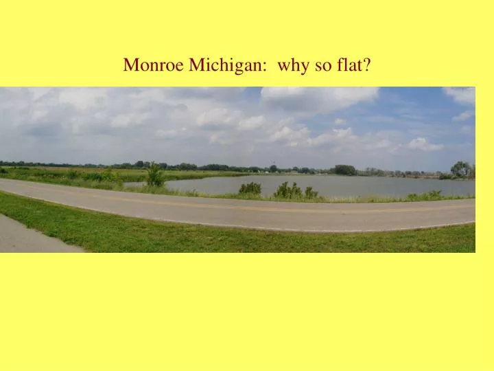
So how in the natural world do you get a place very flat with very clay rich soil in the Midwest.. The heartland of the country?This may require looking back thousands of year!
Over the past million years the Midwest was covered by glaciers..more than once. The last major advance ended about 14,800 years ago and covered all of Michigan.
The lakes changed shape depending on where the front of ice was.
There was only a brief time when the area under Monroe, Michigan was not part of a lake.
The present day map of the area shows the outline of the old lake shore which goes into Ohio as well.
The soil descriptions on the map below all indicate silt and clay soils, as you can read on the next slide
Soil descriptions 13A—Blount loam, 0 to 3 percent slopes Typical profile 0 to 8 inches: Loam 8 to 22 inches: Clay 22 to 60 inches: Silty clay loam Parent material: Clayey till 14A—Del Rey silt loam, 0 to 3 percent slopes Typical profile 0 to 9 inches: Silt loam 9 to 24 inches: Silty clay loam 24 to 60 inches: Silty clay loam Parent material: Clayey glaciolacustrine deposits 21—Lenawee silty clay loam, 0 to 2 percent slope Typical profile 0 to 10 inches: Silty clay loam 10 to 33 inches: Silty clay loam 33 to 60 inches: Silt loam Parent material: Clayey glaciolacustrine deposits 52—Warners silt loam, 0 to 2 percent slope Typical profile 0 to 12 inches: Silt loam 12 to 60 inches: Marl Parent material: Fine-silty alluvium over marl
A larger view of the area showing the extent of the early Lake Erie. The light green shading is areas with elevations less than 100 meters ( about 330 feet) above present lake level. It also outlines the old lake shore
What do we learn from the soils and the maps? • All the soils have similar parent material: clay rich till. • All the soils are on very gentle slopes, 0 to 3 percent. • These soils are frequently listed as glaciolacustrine in origin, which means glacial lake beds. • The soils are silt and clay down to 36-60 inches. • If you go back to slide 4 you will see some samples of the soils. • The large map of the Lake Erie area shows that Monroe Michigan was part of the lake in an earlier time. 10,000 years ago we would have been underwater for many many years!