Download
1 / 25
250 likes | 445 Views
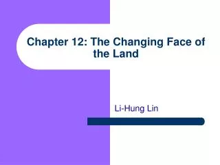
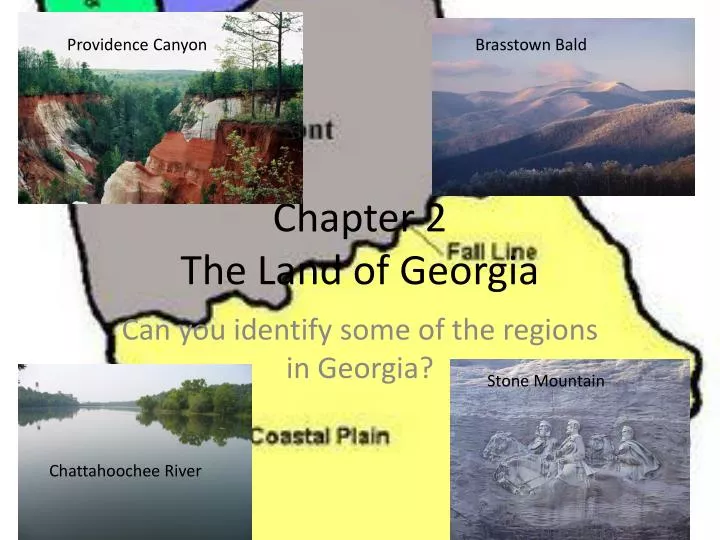
Providence Canyon. Brasstown Bald. Chapter 2 The Land of Georgia. Can you identify some of the regions in Georgia?. Stone Mountain . Chattahoochee River. Physical Geography of Georgia. Georgia Landforms Landforms - is a land formation found on the earth’s surface

E N D
Providence Canyon Brasstown Bald Chapter 2The Land of Georgia Can you identify some of the regions in Georgia? Stone Mountain Chattahoochee River
Physical Geography of Georgia • Georgia Landforms • Landforms - is a land formation found on the earth’s surface • Erosion – the wearing away of soil and rock by natural forces such as wind or rain. • Mountains, Hills, and Plains • Elevation – the height of a land formation above sea level • Precipitation – water which reaches the earth from the atmosphere in either solid or liquid form • Relief – the difference in elevation with a landform from base to top. • Slope – the steepness of a landform, measured in degrees of a circle.
Physiographic Regions • Physiographic provinces – is a region defined on the basis of similarities in physical geography, such as land formations, elevation, rocks, minerals, and soils.
Coastal Plain • Coastal Plain – Georgia’s largest physiographic province covering all of Georgia south of the Fall Line (60%). • Upper Coastal Plain • Lower Coastal Plain • Sediment – settled deposits of earth and rock caused by water erosion • Fall Line – the line (zone) that marks the farthest inland shoreline of the prehistoric ocean. • Zone – a region several miles wide that separates one geographic region from another.
Characteristics of Coastal Plain • Covers all of Georgia south of the Fall Line (60%) • Fall Line is interior boundary, and the Atlantic Ocean is the southeastern boundary. • River travel is possible to Fall Line • Flat, low relief; no steep hills or rocks; some wetlands; clay, sand, and limestone soil. • Pine Barrens and the Okefenokee Swamp found here • Peanuts, peaches and pecans – agricultural products of the Coastal Plain
The Piedmont • Piedmont - Georgia’s physiographic province that lies between the Fall Line to the south and the three mountain provinces of North Georgia. This hilly region stretches from central Alabama to southern New York. • Bedrock – large areas of solid rock found just below the earth’s surface.
Characteristics of the Piedmont • Located between Coastal Plain and mountains in the north (30%) • Rolling hills and valleys; about 500 feet above sea level • Areas of solid rock; red clay soil; many streams and rivers cross the region • Cotton, soybeans, wheat, beef and dairy, cattle, poultry, and pine trees – agricultural products
Blue Ridge • Blue Ridge – physiographic province stretching from northern Georgia to southern Pennsylvania that includes the highest mountains in the Appalachian Highlands.
Characteristics of the Blue Ridge • Located in northeast Georgia • Mountainous • High amounts of rainfall; numerous rivers start here; high erosion rates; short growing season • Less than 1 percent prime farmland. • Brasstown Bald and beginning of the Appalachian Trail are here. • Apples, corn, vegetables, hardwood timber such as oak and hickory.
Ridge and Valley • Ridge and Valley – the physiographic province located in northwest Georgia, noted for long, often parallel ridges, separated by valleys. This province extends from central Alabama northward into Canada.
Characteristics of Ridge and Valley • Located in northwest Georgia between the Blue Ridge Mountain and the Appalachian Plateau regions • Long parallel ridges of sandstone overlooking valleys; elevation from 700 to 1,600 feet above sea level • Corn, soybeans, wheat, cotton, hardwoods and pine – agricultural products.
Plateau • Appalachian Plateau – physiographic province of high plateaus separated by valleys, stretching from northern Alabama to central New York. About 300 square miles of northwest Georgia lie in the Plateau region.
Characteristics of the Plateau • Smallest region in the far northwest corner of Georgia • Flat or gently sloping land with high relief over valleys. • Sand Mountain and Lookout Mountain are here. • Small amounts of corn and soybeans grown here; hardwoods and pasture land – agricultural products.
Georgia’s Coast • Estuaries – the area around a river’s mouth where fresh and salt water mix. • Tides – the daily rise and fall of the ocean caused principally by the gravitational pull • Coastal Wetlands • Wetland – Low-lying land covered by water all or party of the time, in which special types of plant and animal life are found. Also known as marshes and swamps. • Ecosystem – short for ecological system, it refers to a distinct, natural community of living and nonliving things and their environment • Food Chain – a feeding pattern for living organisms where by one organisms serves as food for another, which in turn becomes food for another, and so on. • Barrier Islands • Barrier Islands – Chain of sea islands off Georgia’s coast that form a barrier, helping block ocean waves and wind from the mainland. • Atlantic Intracostal Waterway – the 1,000-mile-long coastal water highway that stretches from New York to Miami, used for navigation by smaller boats. • Continental Shelf • Continental Shelf – Large flat underwater ledge from the ocean’s shoreline to a major drop-off, about 70 to 80 miles from the coast of Georgia. • Gulf Stream – the current of warm ocean water that flows from the Gulf of Mexico northward along the east coast of the North America, then northeastward across the Atlantic Ocean
Georgia’s Natural Resources • Water Resources • Reservoirs – an artificial lake built to store and control water for such purposes as public water supply, hydroelectric production, flood control, and recreation. • Ground Water – water that lies underground • Aquifers – water-saturated layers of the earth below the surface • Water Table – the upper limit of water-saturated soil • Artesian Aquifer – a deep aquifer in which water is trapped and held under great pressure by denser layers of earth above and below the aquifer • Surface Water – aboveground water stored in rivers, streams, and lakes • Georgia’s Rivers and Streams • Characteristics of Georgia’s Rivers • Shoals – shallow river areas where the bottom is made up of sand or layers of rock • Georgia’s Lakes
Rocks and Minerals • What are the three largest mineral resources found in Georgia • What colors are used to identify them? • What region of Georgia are they found in?
More info on minerals • Georgia is the world’s leading producer of Kaolin. • Before the American Revolution Kaolin was shipped to England’s Wedgewood factory to produce pottery • Today it is used to make to make the glossy print on books and magazines. • Georgia ranks number one in marble production – the world’s largest open pit quarry is at Tate in Pickens County • Marble can be used in many ways – it is crushed to be used for agricultural lime, as a filler for toothpaste and gum, cemetery headstones and monuments • One of the most famous monument is the Lincoln Memorial in Washington D.C.
Photos of Georgia’s Minerals Lincoln Memorial in Washington, D.C. Kaolin Mine in Sandersville, GA
Georgia’s Weather and Climate • Weather – conditions in the atmosphere on any given day. • Climate– Average weather conditions over a time period of at least 25 years. • Climate and Georgia’s Development • Precipitation • Water Cycle – the journey of water from ocean to rainfall, its use and reuse on land, and then its return to sea. • Hurricanes • Tornados • http://climate.engr.uga.edu/tornado/index.html
Air and Ocean Currents • Current – the steady flow or movement of a large body of air or water along a particular path • Air Currents • Trade Winds – constant air currents at sea caused by high and low pressure areas attempting to equalize. Important for sailing ships across the Atlantic. • Prevailing Westerlies – A pattern of winds that blow from the west to northeast. Important for sailing ships across the Atlantic. • Jet Stream – A rapid current of air flowing between 30,000 and 40,000 feet above sea level. • Ocean Currents