Download
1 / 25
250 likes | 447 Views
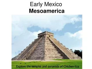
Geospatial Analysis of Archaeological Sites, Water, and Early Agriculture in Ocampo, Tamaulipas, Mexico. Ocampo, Tamaulipas, Mexico. Brian King, GISP – MGIS candidate Dr. Larry Gorenflo – Graduate Adviser May 7, 2013. Department of Geography. Overview. Background. Problem. Tamaulipas,

E N D
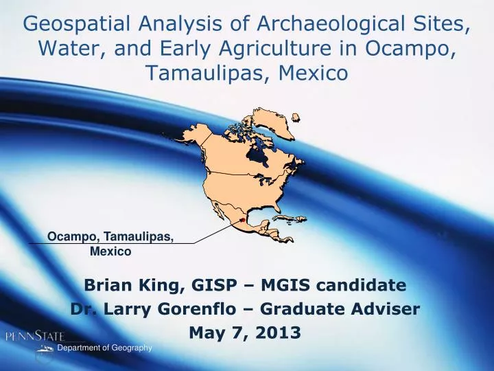
Geospatial Analysis of Archaeological Sites, Water, and Early Agriculture in Ocampo, Tamaulipas, Mexico Ocampo, Tamaulipas, Mexico Brian King, GISP – MGIS candidate Dr. Larry Gorenflo – Graduate Adviser May 7, 2013 Department of Geography
Overview Background Problem Tamaulipas, Mexico Goals and Objectives Study Area / Environment Proposed Methodology Anticipated Results Timeline / References Brian King, GISP
Background In the 1950s, Richard S. MacNeish excavated archaeological sites in a series of dry caves within the project area near the town of Ocampo. He discovered evidence for the local adoption of domesticated plants and the development of a mixed foraging-farming economy that persisted for millennia, before culminating in the establishment of settled farming villages. From 2005 to 2011, Kevin Hanselka returned to conduct survey and archaeological investigations within the same study area. The excavations have identified a cultural chronology covering 9,000 years of occupation, revealing an early economy of hunting and gathering present in the project area before slowly transitioning into low-level food production. Excavations have documented remains of domesticated squash, beans, maize, and gourds, along with a wide range of plants and animals obtained from hunting and gathering. Brian King, GISP
Problem To date, the spatial arrangement of archaeological sites within the study area and the effect of early agriculture on regional organization, are poorly understood. The effects of managing water resources, on the spatial organization of prehistoric cultures in the project area similarly are poorly understood. Extremely challenging mountainous terrain, with elevations ranging from 1,968-5,177 feet above sea level, make detailed field analyses challenging and GIS-based solutions particularly attractive. Few archaeologists have used a GIS to produce a hydrological model allowing for the direct examination of water-related issues important to agriculture, such as floodplains and irrigation potential. Brian King, GISP
Goals and Objective Goal My project goal is to model the river valley floodplain, identify additional water sources located on hill sides, and investigate how these components of local hydrology might have influenced the geographical arrangement of prehistoric sites in the study area. Objective The analysis will include an aspect analysis, least cost distance analysis to water, distance to water, distance to stream confluence, cost distance to stream confluence, slope, topographic variation, and a view shed analysis within the river valley in an attempt to make inferences about the spatial relationships of previously recorded archaeological sites documented in the project area. Brian King, GISP
Study Area Ocampo, Tamaulipas, Mexico Brian King, GISP
Environment Ocampo, Tamaulipas, Mexico Project Area Sites 4659 FT 2035 FT • Steep rugged terrain (travel by walking, burro or horseback) • Tropical savanna climate (Humid) • Dense Forest Vegetation • Perennial and intermittent stream flow Brian King, GISP
Precipitation Project Area Sites Precipitation data for Ciudad Victoria, Tamaulipas, a city located north of the project area. 4659 FT 2035 FT Precipitation mm (Inches) • Average annual precipitation is 700 millimeters (28-inches) • Half of the rainfall occurs between May and September • Short mild winters and long hot summers • Exceptionally heavy rains from occasional cyclones influence overall precipitation amounts. Brian King, GISP
Proposed Methodology Software United States Army Corps of Engineers (USACE) Environmental Systems Research Institute (ESRI) USACE ESRI HEC-RAS HEC-HMS RAS-Mapper HEC-GeoRAS ArcGIS 10.1 3D Analyst Spatial Analyst Modelbuilder Brian King, GISP
Proposed Methodology DATA Instituto Nacional de Estadística y Geografía United States Geological Survey INEGI Stream Network Contours (10m) Precipitation data Temperature data Soils / Land use Data Geology Watersheds / Sub-Basins Vegetation Zones Orthoimagery (1m / 30m) USGS Landsat 7 ETM+ data Pancromatic image 15m All data have been obtained Brian King, GISP
GIS Hydrological Floodplain 30-Foot Contours (INEGI) Create 3D-Terrain / Raster Floodplain Stream Centerline / Tributaries Soils / Precipitation / Landuse The HEC-RAS / HEC-HMS / RAS-Mapper /ArcGIS / HEC-GeoRAS Brian King, GISP
4 Select four Landsat imagesfrom the same year representing a typical precipitation and temperature year 1 2 3 5 Landsat Analysis Create a 3 band composite image simulating a Landsat 4-3-2 combination. (Band 4 is a good band to identify land water) ArcGIS Spatial Analyst Supervised Classification Analysis Digitize training areas of 4-3-2 water pixels and documented water sources provided from ethnographic data. Overlay final source images and run Trend tool in ArcGIS to isolate those areas having extended supply of water at 3-month intervals. Brian King, GISP
Spatial Analysis Spatial Join tool used to combine archaeological Sites to their geomorphic location. Soils Land use Temperature Archaeological Sites (Centroid) Vegetation Geology Elevation Watershed Brian King, GISP
Spatial Analysis Slope(%) Topography Raster Aspect Topography Raster Topo to Raster tool Topography Raster Spatial Analyst Tools Feature to raster tool Soils / Vegetation Feature to raster tool Precipitation Viewshed Topography Raster Feature to raster tool Water Dataset Raster Brian King, GISP
Spatial Analysis Variables Slope(%) Raster Output Aspect Most Favorable Slope Aspect Site Elevation Soils / Vegetation Precipitation Viewshed Water Source Topography Raster Intersect each dataset With Archaeology Site Centroids Soils / Vegetation Precipitation Viewshed Water Dataset Raster Brian King, GISP
Spatial Analysis 1 2 Slope 3 1 Reclass Suitability System 2 Aspect 3 (1) Most Favorable 1 2 Site Elevation 3 1 (2) Favorable 2 Soils / Vegetation 3 1 2 Precipitation 3 (3) Least Favorable 1 2 Viewshed 3 1 2 Water Sources 3 Brian King, GISP
Spatial Analysis The weighted overlay tool will be used to calculate the weighted value for each cell, for each raster dataset. Slope Aspect Site Elevation Final Cost Raster Soils / Vegetation Precipitation Each layer will be assigned a relative importance in percent to create a weighted ranking before these values are combined into a final cost surface raster. Viewshed Water Sources Brian King, GISP
Cost Distance Analysis The final cost surface raster will be imported into the Spatial Analyst cost distance tool to create a cost distance raster from archaeological sites to water sources. The cost distance tool creates a raster surface that is continuous to the defined project boundaries revealing the lowest collective cost from each cell to the nearest source, in this case water sources. It is important to point out that cost can be defined using a variety of variables, including time, level of energy expended. The Spatial Analyst cost path tool will be used to calculate the most efficient path from the site location to water sources. The cost path tool creates a raster that identifies the least-cost path or paths from a specific location to the closest defined cell using the cost raster surface. Brian King, GISP
Anticipated Results I expect that defining the floodplain will reveal potential areas having rich alluvial soils and terraces that can be difficult to identify in this rugged terrain. These areas have a high probability for buried cultural material. I believe the least cost distance analysis will show the relationship of site location to upland water sources and types of terrain. Archaeologists already know that farmers are planting successful crops on steeper terrain, suggesting that more research needs to be conducted on farming techniques and crop selection in relation to water resources. Future research in the area could include a hyperspectral analysis with high resolution imagery and Lidar acquisition to reveal in greater detail those areas having water pools at different elevations. Brian King, GISP
Timeline October 2013 May 2013 10/27 Present Capstone Presentation to The Texas Archaeological Society Meetings in Del Rio, Texas July 2013 05/07 Peer Review 05/20 Revise Proposal 05/28 Begin GEOG596B June 2013 07/17 Draft Capstone Report 07/24 Revise Report 07/31 Submit Final Report 06/12 Floodplain Analysis 06/19 Landsat Analysis 06/30 Geospatial Analysis Brian King, GISP
References Binford, Lewis R., 1980. Willow Smoke, Dogs Tails, Hunter-gatherer Settlement Systems.American Antiquity, Vol. 45, No. 1 (Jan., 1980), pp. 4-20. Dorshow, Wetherbee Bryan, 2012. Modeling agricultural potential in Chaco Canyon during the Bonito phase: a predictive geospatial approach. Journal of Archaeological Science, Volume 39, Issue 7, July 2012, Pages 2098–2115 Flannery, Kent V. (editor) 1976. The Early Mesoamerican Village. Academic Press, Inc., New York. Hanselka, J. Kevin 2010. Informal Planting of Squashes and Gourds by Rural Farmers in Southwestern Tamaulipas, Mexico, and Implications for the Local Adoption of Food Production in Prehistory. Journal of Ethnobiology 30(1):31-51. 2011. Prehistoric Plant Procurement, Food Production, and Land Use in Southwestern Tamaulipas, Mexico. PhD. Dissertation, Washington University, Saint Louis, Missouri. Kelly, Robert L. 1995 The Foraging Spectrum: Diversity in Hunter-Gatherer Lifeways. Smithsonian Institution Press, Washington, D.C. Brian King, GISP
References MacNeish, Richard S. 1956Prehistoric Settlement Patterns on the Northeastern Periphery of Meso-America. In Prehistoric Settlement Patterns in the New World, edited by Gordon R. Willey, pp. 140-147.Viking Fund Publications in Anthropology, No. 23. Wenner GrenFoundation for Anthropological Research, Incorporated, New York. 1958Preliminary Archaeological Investigations in the Sierra de Tamaulipas, Mexico. Transactions of the American Philosophical Society. New Series. Vol. 48, Part 6. The American Philosophical Society, Philadelphia. 1964 The Food-Gathering and Incipient Agriculture Stage of Prehistoric Middle America. In Natural Environment and Early Cultures, edited by R. C. West, pp. 413-426. Handbook of Middle American Indians, Vol. 1. University of Texas Press, Austin, Texas. Smith, Bruce D. 1997Reconsidering the Ocampo Caves and the Era of Incipient Cultivation in Mesoamerica. American Antiquity 8:342-383. 1998aThe Emergence of Agriculture. 2nd ed. Scientific American Library, New York. 1998b Between Foraging and Farming. Science 279:1651-1652. 2005 Documenting the Transition to Food Production along the Borderlands. In The Late Archaic Across the Borderlands: The Transition from Foraging to Farming,edited by Bradley J. Vierra, pp. 300-316. University of Texas Press, Austin. Brian King, GISP
References USACE 2013. HEC-GeoRAS: Features Retrieved on March 12, 2013 from http://www.hec.usace.army.mil/software/hec-ras/hec-georas.html. 2013 HEC-HMS: Features Retrieved on March 12, 2013 from http://www.hec.usace.army.mil/software/hec-hms/features.html. 2013 HEC-RAS:Features. Retrieved on March 12, 2013 from Weatherbase 2013 Ciudad Victoria, Tamaulipas Monthly – All Weather Averages. Retrieved on April 27, 2013 http://www.weatherbase.com/weather/weatherall.php3?s=19467&cityname=Ciudad+Victoria%2C+Tamaulipas%2C+Mexico&units. Brian King, GISP
Acknowledgements Dr. Larry J. Gorenflo Department of Landscape Architecture Pennsylvania State University Dr. J. Kevin Hanselka SWCA Environmental Consultants Austin, Texas Celine Finney and Anaïs King, my supportive wife and daughter. Brian King, GISP
Thank You QUESTIONS Brian King, GISP