Download
1 / 41
420 likes | 681 Views
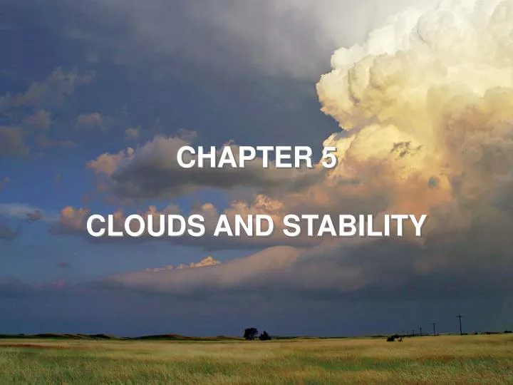
CHAPTER 5 CLOUDS AND STABILITY. Adiabatic processes. Remember that rising air expands and cools, and sinking air compresses and warms When this happens in unsaturated conditions, it is called an adiabatic process – no heat is gained or lost

E N D
CHAPTER 5 CLOUDS AND STABILITY
Adiabatic processes • Remember that rising air expands and cools, and sinking air compresses and warms • When this happens in unsaturated conditions, it is called an adiabatic process – no heat is gained or lost • This is reversible – the air parcel has the same temperature at the beginning and end • But what happens if at some point along its path the parcel becomes saturated, and a cloud forms? (more on this in a minute…)
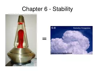
Stability • Simple definition: the condition is stable if an object, when forced to move, will tend to move back to its original position • If it tends to continue moving away from its original position, it is unstable
Parcel theory • In atmospheric science, we often consider the motions of air parcels, which can heat and cool but do not mix in air from the outside • Rising parcels expand and cool, sinking parcels are compressed and warm • At the same height, warm air is less dense than cool air • An unsaturated (dry) parcel will always rise and sink at 9.8°C per km – the dry-adiabatic lapse rate • For the sake of discussion today, we’ll just use the round value of 10 °C per km for the dry-adiabatic lapse rate
Stepped Art Fig. 5.2, p. 123
Moist parcels • When parcels rise and cool, they will eventually become saturated • As they continue to rise, the water vapor will condense into liquid water – a cloud • Remember what happens during condensation: latent heat is released inside the parcel • So, instead of cooling at 10°C per km, it cools slower – usually around 6°C per km – this is the moist-adiabatic lapse rate
Environmental lapse rate • Parcels (individual bubbles of air) always rise and sink at either the dry or moist adiabatic rate • The environment (the air surrounding the parcel) can have a variety of temperature profiles • This environmental rate is measured with radiosondes (on weather balloons) • Since the adiabatic lapse rates are known, we can compare them to the environmental lapse rate to determine whether the parcel will be stable or unstable • If a parcel is forced to rise, and it’s warmer than its environment, it will continue to rise: unstable • If it is forced to rise and is cooler than its environment, it will sink back down to the original position: stable
Absolutely stable • When the environmental lapse rate is less than the moist adiabatic rate (6°C/km) • All parcels will be colder than their environment and sink back to their original position • Example: temperature inversion (temperature increases with height) – acts as a lid • Often occurs at night due to radiational cooling
Neutrally stable • When environmental lapse rate equals the dry-adiabatic lapse rate • Unsaturated parcels will not tend to rise or sink in this condition – they tend to stay where they are • If environmental lapse rate equals moist-adiabatic lapse rate, then the atmosphere is neutrally stable for saturated parcels
Absolutely unstable • When the environmental lapse rate is greater than the dry-adiabatic lapse rate • All parcels will be warmer than their environment and continue to rise • This condition usually only occurs near the surface, and not for very long – the rising parcels will bring the warm air up and cool air will mix down around them
Absolutely unstable No need for a helicopter here! But this would also never happen!
Conditionally unstable • When the environmental lapse rate is between the dry and moist adiabatic lapse rates • Unsaturated parcels will sink back to their original position, saturated parcels will continue to rise • There is instability, on the condition that the parcel is saturated • On average, the atmosphere is in this state (average environmental lapse rate = 6.5°C/km) • This helps to explain why cumulus clouds can grow very tall (into cumulonimbus) – only saturated parcels continue to rise
Conditional instability Need the helicopter here But not here
Changes in stability • Warming at low levels or cooling aloft: increases lapse rate, makes atmosphere less stable • “Warm air advection” at low levels will destabilize the atmosphere • Mixing • If absolutely unstable, mixing will make atmosphere more stable • If stable, mixing can make atmosphere unstable • Lifting or subsidence in layers
Lifting & subsidence in layers If a whole layer sinks, it compresses in the denser air near the ground, top warms more than bottom, and becomes more stable If a whole layer rises, it stretches in the less-dense air aloft, and it tends to become more unstable, especially when the bottom is saturated and the top is dry – convective instability
Forcing for rising motion & clouds • In real life, we don’t have helicopters pulling parcels of air up and down…so what causes air to rise and sink?
Properties of convective clouds • Lifting Condensation Level (LCL) : level at which condensation occurs – this represents the cloud base • Force an unsaturated parcel to rise from the surface • Temperature will decrease by 10 °C per km, dew point by 2 °C per km until saturated • At the point where the T and Td are equal, the parcel is saturated, water can condense, and a cloud can form (T and Td will fall at the same rate above this) • Handy formula: LCL = 125 (T-Td), where T and Td are in Celsius, and LCL will be in meters
Stepped Art Fig. 5.16, p. 134
Properties of convective clouds • Level of Free Convection (LFC) : level at which air will continue to rise without forcing • Force an unsaturated parcel to rise from the surface • Calculate how the temperature cools with height (using dry adiabatic rate when unsaturated, moist adiabatic when saturated) • Find the point where the parcel’s temperature becomes warmer than its environment – above this point, it will rise freely
Properties of convective clouds • Equilibrium level (EL): level above the LFC at which the air will stop rising • Continue the process that you used for the LFC and find the point at which the parcel’s temperature becomes equal to or cooler than the environmental temperature • If the atmosphere is very unstable, this level can be very high, and this situation is conducive to deep cumulonimbus development
Actual soundings – July 2005 Nashville, TN North Platte, NE
Actual soundings – July 2005 Nashville, TN North Platte, NE
Orographic clouds • Mountains can provide the lifting required to bring air to its LCL and/or LFC • On the windward side, clouds often form and rain/snow is common • On the leeward side there is sinking motion – a “rain shadow”
Back to airflow over a mountain… • If unsaturated, temperature will be the same at start and finish • But if saturation is reached…this is no longer reversible • Heat is released in condensation
Mountain wave clouds • In stable conditions above a mountain, waves can set up in the airflow • Clouds can form on the upward parts of the waves, and they appear to be stationary (standing wave clouds) • They sometimes take a “flying saucer” appearance Lenticular wave clouds
SPECIAL TOPIC • Subsidence Inversions • Strong subsidence exacerbates air pollution due to the lack of vertical motion • Pollution is not diluted
FOCUS • Lake Effect Snow (Great Lakes) • Snowstorms that form on the downwind side of one of these lakes are known as lake effect snows • Cold air moves over the lakes when they are relatively warm and not quite frozen • Water vapor absorbed • Becomes snow on edge of lake • Rising motion due to heat addition and slowing/terrain
CLOUD DEVELOPMENT • Changing cloud forms • Stratus clouds can change to cumulus clouds if the top of the cloud cools and the bottom of the cloud warms • Altocumulus castellanus: castle-like towers on altocumulus • If moist stable air without clouds is mixed or stirred it can form stratocumulus clouds.