Download
1 / 48
490 likes | 639 Views
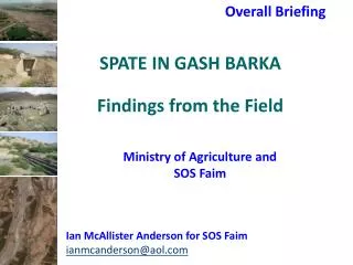
SPATE ENGINEERING GASH RIVER - SUDAN . Lesson 4. IanMcAnderson@aol.com. Gash River in north west Sudan. The Gash River. Known in the past to be fearsome with sharp uncontrollable floods.

E N D
SPATE ENGINEERING GASH RIVER - SUDAN Lesson 4 IanMcAnderson@aol.com
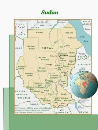
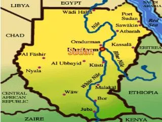
The Gash River • Known in the past to be fearsome with sharp uncontrollable floods. • Historically the river flowed further to the west with the original Delta area close to what is now the New Halfa irrigation scheme. • It rises in Eritrea, some 15 miles south of Asmara, and as the river Mareb, it flows through a relatively narrow valley until it reaches Haykota, where it gradually widens into a sandy-clayey plain, the Tesseney-Omhajer plain. From there it flows in a westerly direction to Tesseney where the river turns northwards into Sudan. • The Gash/Mareb is dry for much of the year, but is subject to sudden floods during the rainy season (July to September). • The river transports considerable amounts of sediment (fine sand and silt) and has been estimated to transport about 5.5 millions tons of sediment annually at Kassala Bridge.
The Gash River • The river continual deposits and picks up material from the river bed and the neighbouring banks to stay in regime. • When the river crosses the border, its slope reduces remarkably and the river gradually deposits the sediment load in its course and the lower Delta. • This gives rise to a very unstable river that that has changed direction many times and that undergoes continuous morphological changes. • The sediment deposits have led to a gradual build up in river channel level (sometimes 1-2 m), especially where irrigation offtakes are located. • In Kassala City, the existing river bed is now some two meters above much of the ground level in the City and thus when breaches occur, considerable flood damage results
The irrigation system in the Gash Agricultural Scheme (GAS) • Command area comprises main, link and some branch canals fed from the Gash River by means of gravity offtakes fitted with stop logs. • The flows in these gravity canals are divided into a number of Misga or distributary canals that directly supply the agricultural land through breaches in the canal banks. • Unit flows are high and these flow across the Misga blocks (of about 3000 feddans) as a wetting front following the line of least resistance and guided by Misga water workers who are instructed by the Sheikh al Misga or water master • The main factors affecting its progress are slope, nature/texture of soil, surface characteristics & its covering.
The design of these systems was first developed in the 1930s and improved upon in the late 1950s. • They were originally developed for the cultivation of cotton using flush irrigation techniques (this is a variation on spate irrigation that utilise fluctuating run-off in the seasonal Gash River) and the design details are reported by C.H. Swan (1959) in the Recorded Behaviour of the River Gash in Sudan. • The considerable amount of sediment that is transported by this river[5% by Volume] is deposited within the canal systems and gives rise to increased annual maintenance costs necessary to provide the design slopes and flows within each of the six blocks that utilise the river water
Design considerations • Maintain velocity • Minimise annual O&M • Do not provide blockages • Use limited available water as efficiently as possible • Adapt application of water to new cropping patterns