Download
1 / 26
260 likes | 372 Views
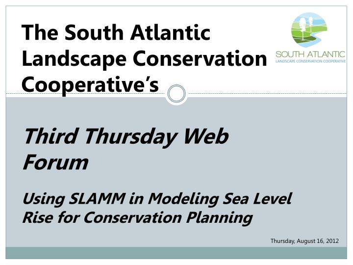
The South Atlantic Landscape Conservation Cooperative’s Third Thursday Web Forum Using SLAMM in Modeling Sea Level Rise for Conservation Planning. Thursday , August 16, 2012. Third Thursday Web Forum Agenda. Introductions Updates

E N D
The South Atlantic Landscape Conservation Cooperative’s Third Thursday Web Forum Using SLAMM in Modeling Sea Level Rise for Conservation Planning Thursday, August 16, 2012
Third Thursday Web Forum Agenda Introductions Updates Monthly Topic: Using SLAMM in Modeling Sea Level Rise for Conservation Planning Questions & Discussion of Monthly Topic Questions & Discussion of SALCC Close
Introductions Janet Cakir, Socioeconomic Adaption Coordinator Amy Keister, GIS Coordinator Ginger Deason, Information Transfer Specialist/Forest Service Liaison Laurie Rounds, Gulf Coast Liaison Hilary Cole, Intern Ken McDermond, Coordinator Matt Rubino, NCSU BaSIC
Updates Natural Resource Indicators Francis Marion NF Forest Plan Revision Kick-off Meeting SE SHPO meeting last week SALCC-funded projects on web Private landowner dialogue Any web site member can share news through a blog post www.southatlanticlcc.org
a tour of new spatial data products SALCCThird Thursday Web Forum
SALCC Introduction SALCCThird Thursday Web Forum In this three part webinar series we will explore newly available spatial products that predict future conditions • 6/21/12: Urban Growth • 8/16/12: Sea level rise • 10/18/12: Land cover a tour of new spatial data products
SALCC Introduction The SALCC is a forumin which the private, state and federal conservation community… develops a shared vision of landscape sustainability cooperates in its implementation; and collaborates in its refinement Mission: Create a shared blueprint for landscape conservation actions that sustain natural and cultural resources
SALCC Introduction What is the Blueprint? An interactive, living plan that describes the places and actions needed to meet the SALCC’s conservation priorities in the face of future change Conservation Priority = Measurable indicator of success
SALCC Introduction About the SALCC area • Portions of 6 States • 89 million acres • 92% private land • 18,700 miles of coastline* *calculated from the NOAA medium resolution digital vector shoreline
SALCC Introduction Why is the SALCC interested in these spatial data? To achieve our mission, we need to be able to understand and model the forces that drive change on the landscape The spatial data products we are highlighting cover the entire SALCC areaand as far as your staff knows, these are currently the best data available for our region Do you know of other comparable data that cover our entire region?
SLAMM Modeling of Sea Level Rise for Conservation Planning Matt Rubino Biodiversity and Spatial Information Center Cooperative Fish & Wildlife Research Unit North Carolina State University SALCC Web Forum 16 August 2012
What is SLAMM? • Sea Level Affecting Marshes Model • Developed by 1Park et al. for EPA in the 1980’s • Simulates nearshore processes such as accretion, erosion, marsh migration due to sea level rise • NOT simply an inundation “bathtub” model • Interface for SLAMM v. 5 developed by 2Clough – Warren Pinnacle Consulting 1 Park, R. A., T. V. Armentano, and C. L. Cloonan. 1986. Predicting the Effects of Sea Level Rise on Coastal Wetlands. Pages 129-152 in J. G. Titus, ed. Effects of Changes in Stratospheric Ozone and Global Climate, Vol. 4: Sea Level Rise. U.S. Environmental Protection Agency, Washington, D.C. 2Clough, J. S. 2008. SLAMM 5.0.1. Technical documentation and executable program downloadable from http://www.warrenpinnacle.com/prof/SLAMM/index.html. SALCC Web Forum 16 August 2012
SLAMMfor Conservation: DSL • Designing Sustainable Landscapes (DSL) Project • Coordinated research project between • USGS Cooperative Fish & Wildlife Research Units of NC and AL • Atlantic Coast Joint Venture • Biodiversity and Spatial Information Center • In part: Predict landscape-level change effects on avian habitats in SE due to urban growth, succession, climate change, and conservation programs • http://www.basic.ncsu.edu/dsl/index.html SALCC Web Forum 16 August 2012
SLAMMfor Conservation: DSL • 2008 – 2010 • South Atlantic Migratory Bird Initiative (SAMBI) region: Southeastern Coastal Plain from southern VA to northern FL • SLAMM Vegetation dynamics SALCC Web Forum 16 August 2012
SLAMM Application in the SAMBI • Requires 4 spatial inputs: • National Wetlands Inventory (NWI) data cross-walked to 23 (22) SLAMM categories • Dikes / Impoundments • Digital Elevation Model – National Elevation Dataset (NED) used at 30m resolution augmented with LiDAR data for NC • Slope derived from DEM • Impervious surface from National Land Cover Dataset http://www.basic.ncsu.edu/dsl/slr.html SALCC Web Forum 16 August 2012
SLAMM Application in the SAMBI • “Site” file information: • Tidal datum data • Sea level rise trend data • from NOAA NOS/CO-OPs stations • downloadable from NOAA website: http://co-ops.nos.noaa.gov/station_retrieve.shtml?type=Datums SALCC Web Forum 16 August 2012
SLAMM Application in the SAMBI SLAMM v5.0 Interface 6 Sea Level Rise scenarios GIS outputs Option to “protect developed” Adjustable simulation time steps SALCC Web Forum 16 August 2012
SLAMM Application in the SAMBI • DSL in the SAMBI: • Ran in 10 year increments from 2000 to year 2100 • Ran with emission scenarios (SLR) • A1B, A2, A1FI, and B2 • Protect Developed • Ran separately for each of 39 8-digit Hydrologic Unit Codes (HUCs) • Outputs available for download from project website SALCC Web Forum 16 August 2012
Example A1B 2100 2000
SLAMM & Vegetation Dynamics: Process Sea Level Rise Modeling: SLAMM Avian Habitat: Species Distribution Models Existing Landscape Conditions Succession & Disturbance Models: TELSA, VDDT Range of Future Landscape Conditions (10, 20, 50, 100 yrs) Scenarios 1, 2, 3, 4… Global Climate Models Alternative Management Scenarios Urban Growth Models: SLEUTH SALCC Web Forum 16 August 2012
SLAMM & Vegetation Dynamics: Scale • DSL in the SAMBI: • Output rasters 30 meters • TELSA modeling polygons MMU ~10 hectares • SLAMM processed by 8-digit HUC ≈ 1800km2 • Scale not appropriate for: • Parcel level threat assessments • Finer scale land cover type transitions • Anything other than regional scale analyses or as a first tier filter for finer scale studies SALCC Web Forum 16 August 2012
SLAMM Issues • Accretion rates – doesn’t allow for vegetative decay after inundation – no build up of new marsh, only inundation of old marsh • Offshore direction forces transitions • Cross-walking/clumping NWI to 23 SLAMM classes means lose of information • Elevation data – NED has numerous problems – potential fix is LiDAR SALCC Web Forum 16 August 2012
Questions? SALCC Web Forum 16 August 2012
SALCC Introduction Next steps and how the SALCC will use this product
Questions/Comments Questions or comments about Matt’s presentation on SLAMM? Questions or comments in general about the SALCC, what we’re doing, where we’re going, etc.?
Contacts Matt Rubino – mjrubino@ncsu.edu Ken McDermond –ken_mcdermond@fws.gov Rua Mordecai –rua@southatlanticlcc.org Janet Cakir –janet_cakir@nps.gov Amy Keister –amy_keister@fws.gov Laurie Rounds –laurie.rounds@noaa.gov Ginger Deason –ginger@southatlanticlcc.org Hilary Cole – hlcole@ncsu.edu