Download
1 / 15
150 likes | 229 Views
Milli -Meter Wavelength Cloud Radars in the Atmospheric Radiation Measurement Program. Allison Parker Remote Sensing of the Oceans and Atmosphere. Abstract.

E N D
Milli-Meter Wavelength Cloud Radars in the Atmospheric Radiation Measurement Program Allison Parker Remote Sensing of the Oceans and Atmosphere
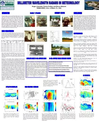
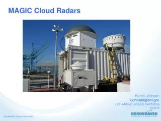
Abstract The milli-meter wavelength cloud radar (MMCR) is the first fully operational, unattended radar for the sole purpose of remote sensing of clouds. The MMCR operates at wavelengths about ten times smaller than conventional radar systems, allowing for better remote sensing of non-precipitating clouds. There are several MMCRs currently in use by the Atmospheric Radiation Measurement (ARM) program in Oklahoma, Alaska, and the western south Pacific. These MMCRs provide statistical surveys of cloud location and frequency, information about cloud microphysical characteristics, and produce data for basic research into cloud microphysics. The data provided by the MMCRs is important for research into climate change and cloud radiative processes.
Atmospheric Radiation Measurement Program (ARM) • Created in 1989 with funding from the US DOE • Primary Objective: Improved scientific understand of physics related to interactions of clouds and radiative feedback processes in atmosphere • Main Sites: Oklahoma, Alaska, and Western Pacific
ARM Field Research SitesSouthern Great Plains - Oklahoma • Dedicated Nov. 1992 • Chosen because homogenous geography, easy accessibility, variability of climate cloud type and surface flux properties, and variation of temperature and humidity Source: www.arm.gov
ARM Field Research SitesHigh Latitudes – North Slope of Alaska • Dedicated July 1997 • Data being used to refine models and parameterizations as they related to the Arctic • Reasons to study climate change in high latitudes include ice & snow, dry climate, & major “pumps” for global ocean currents Source: www.arm.gov
ARM Field Research SitesTropical Western Pacific • Located in Australia, Nauru Island, & Papua New Guinea • Region plays a large role in El Nino • Pacific “warm pool” supplies heat and moisture for deep convective cloud systems that produce high altitude cirrus clouds Source: www.arm.gov
Milli-Meter Wavelength Cloud Radar (MMCR) • Developed by the ARM Program for quantifying properties of radiatively important clouds • Main purpose is to determine cloud boundaries & radar reflectivity up to 20km • Doppler capability for measurement of cloud constituent vertical velocities • Primary Measurements: Horizontal Wind, Radar Doppler, Radar Reflectivity, Vertical Velocity Source: www.arm.gov
MMCR Design • Vertically pointing, single polarization, Doppler system operating at 35Ghz (λ = 8.7 mm) or 94 Ghz (λ = 3.1mm) • Low peak power transmitter for long term reliability • High-gain antenna and pulse-compressed wave forms to maximize sensitivity and resolution Sources: Moran, et al. , www.arm.gov
Examples of MMCR Data Mode 1 – Samples lowest kilometers only with high sensitivity Mode 2 – Most sensitive above 3 km Mode 3 – Good general mode, not as sensitive to thin clouds as Mode 2 Mode 4 – Less sensitive than modes 2 and 3 but does not saturate as easily in higher reflectivity regions
Contributions of the MMCR to the ARM ProgramStatistical Surveys of Cloud Location & Frequency • MMCR data is compared with climate simulations, weather forecast models, and cloud resolving models (1 km resolution)
Contributions of the MMCR to the ARM ProgramRetrievals of Cloud Microphysical Characteristics • Liquid water content vs. height / ice water • Cloud particle phase • Cloud droplet size distribution – number of particles per radius size
Contributions of the MMCR to the ARM ProgramBasic Research into Cloud Microphysics • How does the precipitation process actually work? • When do clouds begin to precipitate?
Sources Atmospheric Radiation Measurement Program, www.arm.gov , 4/23/08. Clothiaux, E., M. Miller, B. Albrecht, T. Ackerman, J. Verlinde, D. Babb, R. Peters, and W. Syrett, 1995: An Evaluation of a 94-GHz Radar for Remote Sensing of Cloud Properties. J. Atmos. Oceanic Technol., 12, 201–229. Moran, K.P., B.E. Martner, M.J. Post, R.A. Kropfli, D.C. Welsh, and K.B. Widener, 1998: An Unattended Cloud-Profiling Radar for Use in Climate Research. Bull. Amer. Meteor. Soc., 79, 443–455.