Download
1 / 24
240 likes | 319 Views
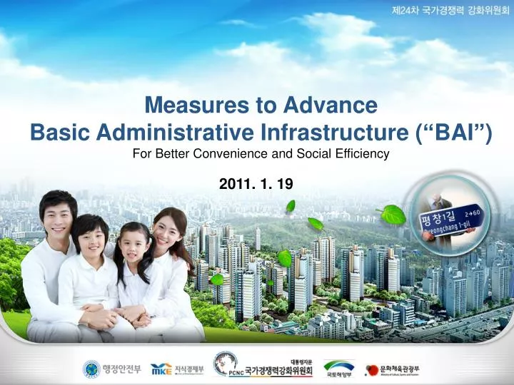
Measures to Advance Basic Administrative Infrastructure (“BAI”) For Better Convenience and Social Efficiency. 2011. 1. 19. Contents. Background. Status of BAI. Advancement Plan. Desired Effects. Background. Background. Unit:Thousand (Mail:million). 1. 50000. Population. 40000.

E N D
Measures to Advance Basic Administrative Infrastructure (“BAI”) For Better Convenience and Social Efficiency 2011. 1. 19
Contents Background Status of BAI Advancement Plan Desired Effects
Background Unit:Thousand (Mail:million) 1 50000 Population 40000 Cellular Phone Foreign visitors X520 increase etc. 30000 Mail quantity 20000 Automobile 2 10000 Foreigner 0 1960 1970 1980 1990 2000 2010 Administrative environment has rapidly changed for the past 50 years • Population X2, Mail quantity X8, Automobile X350 Social adjustment costs increase due to inappropriate BAI(e.g. address system, territory system, postal code, etc.) Annual navigation cost 2.1T, supply cost 0.89T, corporate address refinement cost 8.9M (KRW) Advancing Basic Administrative Infrastructure to reduce social cost and enhance convenience in accordance with the change in social environment
2 Territory System 4 Road Sign English Notation 5 BAI Status Address System 1 Use of lot numbers – difficult to navigate and against international trend No standard territory system – independent management among institutions Branch Number 3 No unified branching system – independent management among institutions Territory/branch based signs – does not comply with road names Romanization – difficult to read for foreigners
Advancement Plan 7/30 7/33
Advancement Plan Lot Address Road Name Address Institutional Base National Base Territory Territory System Romanization Institutional Branch Standard English Road Name National Branch Number Road Sign English Notation Enhance National Competitiveness through Advancing BAI Address System
1 Advancement Plan Adopting Road Name Address System Status &Needs Using land based lot number since 1910s - Disordered lot number (House number 1 next to 60, more than one buildings in a lot number) Majority of countries use road name address • Implementing Address ISO('09.May~) Raised supplementations to road name address - Low uniqueness in road names, long road names, etc.
1 Schedule Schedule Adopting Road Name Address System Advancement Plan Advancement Plan Implementing road name address that is easy to find & conforming to international standard • - Naming roads and consecutively numbering buildings for address Policies for enhancing road name address receptivity • Reflecting Inherent names, simplifying long road names, directions in road names • Extending parallel use, supporting private sector address change, diversifying PR Notification Confirm & notify new address Notification ’11.Mar~Jul Guidelines and confirmation of new address to citizens ’11.Mar~Jul Address Change Change public registrations (1,095 including resident/construction) Change 1,095 public registrations (residence, etc.) ’11.Jul~Dec ’11.Jul~Dec Address Change Use Use Parallel Use (’11 Jul~Dec) / Full Use (‘12 Jan~) Parallel Use (’11.Jul~Dec) / Full Use(’12.Jan~) ’11.Jul~ ’11.Jul~
1 Ex. of New Address Schedule Schedule Adopting Road Name Address System Advancement Plan Advancement Plan Implementing road name address that is easy to find & conforming to international standard • - Naming roads and consecutively numbering buildings for address Policies for enhancing road name address receptivity • Reflecting Inherent names, simplifying long road names, directions in road names Saimdang-ro3gil Saimdang-ro1gil • Extending parallel use, supporting private sector address change, diversifying PR Saimdang-ro2gil Notification Confirm & notify new address Notification ’11.Mar~Jul Guidelines and confirmation of new address to citizens ’11.Mar~Jul Address Change Change public registrations (1,095 including resident/construction) Change 1,095 public registrations (residence, etc.) ’11.Jul~Dec ’11.Jul~Dec Address Change Road NameDae-ro: 8 lanes+ Ro: 2~7lanes Gil: others Building Number 20m interval left odd, righteven Use Use Parallel Use (’11 Jul~Dec) / Full Use (‘12 Jan~) Parallel Use (’11.Jul~Dec) / Full Use(’12.Jan~) ’11.Jul~ ’11.Jul~ “Banpo Dae-ro”
2 Status & Needs Admin Firefight Police Mail Commute(elem.) Adopting National Territory System Advancement Plan ( Ex. of Jongno) Managing administrative territory separately by each institution ·Firefight (law sector, lot number) ·Police(law sector, lot number) · School(elementary/middle: bracket, high: admin sector) · Mail(Mixed use of law/admin sectors) - Difficulty in sharing territorial statistics due to different standards - Limitation in information use due to large Basic Administrative Service Territories - Address refinement costs due to frequent changes in admin sectors
2 Advancement Plan Law Sector Admin. Sector Lot No. BracketGroup JointHouseName Large Sector Basic Unit Sector Adopting National Territory System Advancement Plan • Nationally set/manage minimal unit of basic territory for both public & private use ( U.S. Blocks, U.K. Output Areas, etc.) Current Territory System Basic TerritorySystem(Plan) CityProvince CityProvince District Police 119 Firefighting School(Elem.) District Mail 119 Firefighting Statistical Sector Police School (Elem.) StatisticalSector Mail Admin. Sector Basic Territory ※Unifying different territorial units to Basic Territory
2 Schedule Adopting National Territory System Advancement Plan Plan Setup 30,500 territories based on admin. sector boundaries etc. • - 8~9 considering geographical layouts, population, businesses, etc. • - Granting 5 digit territory number for the basic territory Public & private sector use Use • ※ Public : Police, Firefighting, Mailing /Private: Commerce· Analyses Territory Setup DemoPlan ConfirmationNational Setup ’11.Dec Re-notify demo management & jurisdiction territories Demo Management ’12~’13 Full Use Full use in public/private jurisdiction territories ’14~
3 Adopting National Branch System Advancement Plan Status & Needs Locate through geographical layouts in case of areas without buildings such as fields, mountains, and streams Lack of unification/relations among institutions - Firefighting (Sign), Maritime Police (breakwater), National Park (Sign), KEPCO (Pole) ※ Independent management of mountain area location signs Inconvenience and difficulty in systematic disaster response Firefighting National Park Maritime Police KEPCO
3 Schedule Adopting National Branch System Advancement Plan Advancement Plan Nationwide signs of branch number in grid coordinate concept • - More simplified and systemized than longitude & latitude coordinates • ※U.S. USNG (United State National Grid), Ex.18UJ23370651 Installing unified branch number signs to areas with most frequent access Joint utilization in numerous emergency situations forEmergency Management Agency, Police Agency, Maritime Police etc. Institutionalize/construct branch number system in areas without buildings Infra construction ~’12.Dec Use In phases (communications use other use) ’13.Jan~
3 Branch Number(Ex.) Schedule 마바 ※ Ex.: 마바42314261 마바42314261 42314261(10×10m) Controlpoint Adopting National Branch System Advancement Plan Advancement Plan Nationwide signs of branch number in grid coordinate concept • - More simplified and systemized than longitude & latitude coordinates • ※U.S. USNG (United State National Grid), Ex.18UJ23370651 마바(100×100㎞) Installing unified branch number signs to areas with most frequent access Joint utilization in numerous emergency situations forEmergency Management Agency, Police Agency, Maritime Police etc. “Branch Number” Institutionalize/construct branch number system in areas without buildings Infra construction ~’12.Dec Use In phases (communications use other use) ’13.Jan~
4 Road Sign Advancement Plan Status & Needs - Guiding name is discontinuous and confusing due to lack of relativity Guiding through area, structure names or branch - Difficult to read due to overwhelming information in limited sized signs ※ Many countries use road name guidance within city areas
4 Road Sign Converting to “Korean Road Name Method” linked to new address Schedule Advancement Plan Advancement Plan Division Current Road Signs New Road Name Signs Examples 5.5m×1.35m 4.5m×1.2m Information (Center) road names, (sub) land/structure names Land/structure names Alternatives Finalize new road signs after demo service ~end of ’12 Sign Replacement Replace road signs in phases in nationwide cities ’13~’17
5 English Notation of Road Address Advancement Plan Status & Needs Romanization for English notation of Korean ·Nature/cultural property : 독도(Dokdo), 속리산(Songnisan), 연화교(Yeonhwagyo) ·Admin. district: 도(do), 시(si), 군(gun), 구(gu), 읍(eup), 면(myeon) ·Road name : 대로(daero), 로(ro), 길(gil) - English address becomes too lengthy due to Romanizations ※ 56 Supsokmaeul-ro Ilsandong-gu, Goyang-si, Gyeonggi-do - Notation by pronunciation causing confusion to foreigners ※ Pronunciation (daero, ro, gil) VS. English (Blvd, St, Rd)
5 Schedule English Notation of Road Address Advancement Plan Advancement Plan Simplified Admin. District (Ex.) · (Si·Do) Busan Metropolitan BS / Chungcheongbuk-do CB · (Si·Gun·Gu) Jangan-gu Suwon-si Jangan Suwon ·(Eup·Myeon) Kanghwa-eup Kanghwa / Buseok-myeon Buseok Consider English notation(Blvd, St, Rd) in Tourist spot etc. English notation of address(plan) through converging opinions of professionals Alternatives ~’11.Sep Priority application in guide maps, apply when issuing English documents Priority Application ’12~ ※ Replace during road signs maintenance (renewal) (‘14~)
5 English Notation of Road Address Advancement Plan International Standard of English Notions of Korean (ex.) Current English Notation Improved English Notation (Plan) <House> 100 Jukdol-gil, Buseok-myeon, Taean-gun, Chungcheongnam-do, ROK <House> 100 Jukdol Rd, Buseok, Taean, CN, ROK <Apartment> #705-1105, 56 Supsokmaeul-ro, Ilsandong-gu, Goyang-si, Gyeonggi-do, ROK <Apartment> #705-1105, 56 Supsokmaeul St, Ilsandong, Goyang, GG, ROK
1 Advance living environment and reduce social costs 2 Realize safety through better disaster response system 3 Increase convenience by advancing basic administration 4 Standardize Basic Administrative Infrastructure Desired Effects Enhancement of National Competitiveness through Advancing Basic Administrative Infrastructure
Thank You 24/30