Download
1 / 45
450 likes | 550 Views
Design and Implementation of a Geodatabase for New York State Canal Inspection Data. Ruth Ann Trudell NY State GIS Users Conference Lake Placid, NY October, 2009. Topics. Project Objective Canal History Inspection Methods, Data Storage and Need for modernization Database Development

E N D
Design and Implementation of a Geodatabase for New York StateCanal Inspection Data Ruth Ann Trudell NY State GIS Users Conference Lake Placid, NY October, 2009
Topics • Project Objective • Canal History • Inspection Methods, Data Storage and Need for modernization • Database Development • Lessons Learned
Project Objective Provide a single storage location for all spatial and tabular data pertinent to Canal Inspections.
Canal Management • Operated and maintained by the Canal Corporation, New York State Thruway Authority • Inventory performed by NYS DOT through MOU • Canals managed primarily for recreational purposes and historic values
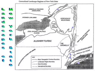
Canal Construction • Parts of canal are embedded in the landscape; parts raised above. • Portions are raised above the surrounding landscape with the use of levees or embankments.
Inspection Process • Inspect every 5 years. • Inspection segments delineated on paper maps. • Embankment conditions documented in field. • Pictures taken at points of interest. • Segments are ranked and rated. • Miles of segments summarized by rating. • Report written summarizing findings.
Current Data Storage • Paper maps, inspection forms and reports. • Disparate spatial files stored on CC and DOT servers. Solution? A Database!
Database Development Steps • Determine Business Needs/Database Structure • Decide upon Database Elements • Populate Database • Test by Querying Database
2009 Business Needs Meeting • Validate data input and output needs (business functions) • Discuss Database Considerations • Spatial representations- feature classes vs. linear referencing • Appropriate route • Aggregation/disaggregation of data • Image hyperlinks
Element 2- Linear Representation; Events or Features Two Critical Questions: Use linear events or line features to represent inspection segments? If events are to be used, which route is appropriate? which measure?
Selection of Linear Route • Canals Corporation routed lines (measure in meters) • Canal Corporation lines calibrated to stationing in feet. • National Hydrography Dataset (NHD)- National Standard
Elements 3-5 – Features, Data Tables, Relationship Classes Event Feature
Element 7- Metadata And YES, of course a Data Dictionary!
Complexities of Routes Requires for both Events and Feature Classes 1. Linear referencing requires event tables with measures, WHILE: 2. Field data collection using GPS and mapping query results both require features classes
Example: SQL Expression • Segment2009.SegID = Inspection.SegID AND Inspection.AdjTerrain = ‘DevRes’ • Segment2009.SegID = Inspection.SegIDAND Inspection.InspectionID = OtbdChar.InspectionID AND OtbdChar.DrainStrID = DrainStruct.DrainStrID AND DrainStruct.StructCondition = ‘Good’
Lessons Learned • Relationship classes in GDB depend on exact match of field names in feature attribute and data tables. • Use descriptive codes for coded domains. Exported tables contain codes, not descriptions! • Ensure topology of routes is uni-directional and calibration point measures increase sequentially in up route direction. • Take advantage of NY State GIS Help Desk; They are an excellent resource!
Final Result Successful development of a database that addresses data storage, data retrieval and data display needs!
Credits Dr. Patrick Kennelly, Graduate Advisor Assist. Professor, Long Island University, and Penn State University Jamie DeLuca, NY State Canal Corporation Steve Heiser, Department of Transportation Ricardo Lopez and Tim Daly, Department of Environmental Conservation
Example of Implementation Data Input- New Segments Ensure database contains empty (temporary) segment feature related to inspection table (required to GPS new features), Check out DB to GPS, Collect data - database tables will be updated through relates, Check in DB, Use “Locate Features along Routes” to obtain measures and RID,
Data Input- New Segments (cont) Rename Segment ID with measure info., Append this attribute table to event table, Recreate “permanent” feature class, Empty contents of the “temporary” feature class for future use with GPS.