Download
1 / 18
250 likes | 754 Views
Wetland Identification. Introduction to Coastal Management. What is a wetland?. Lands on which water covers the soil or is present either at or near the surface of the soil or within the root zone all the year or for varying periods of time during the year, including during the growing season.

E N D
Wetland Identification Introduction to Coastal Management
What is a wetland? • Lands on which water covers the soil or is present either at or near the surface of the soil or within the root zone all the year or for varying periods of time during the year, including during the growing season.
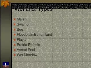
Wetland Definition • Used by the US Army Corps of Engineers and Environmental Protection Agency • Those areas that are inundated or saturated by surface or groundwater at a frequency and duration sufficient to support, and that under normal circumstances do support, a prevalence of vegetation typically adapted for life in saturated soil conditions. Wetlands generally include swamps, marshes, bogs, and similar areas. (EPA,40 CFR 230.3 and CE, 33 CFR 328.3)
Wetland Definition • Used by U.S. Fish and Wildlife Service, National Wetland Inventory Program • Wetlands are lands transitional between terrestrial and aquatic systems where the water table is usually at or near the surface or the land is covered by shallow water. …wetlands must have one or more of the following three attributes: 1) at least periodically, the land supports predominantly hydrophytes, 2) the substrate is predominantly undrained hydric soil, and 3) the substrate is nonsoil and is saturated with water or covered by shallow water at some time during the growing season of each year.
Cowardin Wetland and Deepwater Classification System • Marine • The Marine System consists of the open ocean overlying the continental shelf and its associated high-energy coastline. • Estuarine • The Estuarine System consists of deepwater tidal habitats and adjacent tidal wetlands that are usually semi-enclosed by land but have open, partly obstructed, or sporadic access to the open ocean, and in which ocean water is at least occasionally diluted by freshwater runoff from the land.
Cowardin Wetland and Deepwater Classification System • Riverine • The Riverine System includes all wetlands and deepwater habitats contained within a channel, with two exceptions: (1) wetlands dominated by trees, shrubs, persistent emergents, emergent mosses, or lichens, and (2) habitats with water containing ocean-derived salts in excess of 0.5%. • Lacustrine • The Lacustrine System includes wetlands and deepwater habitats with all of the following characteristics: (1) situated in a topographic depression or a dammed river channel; (2) lacking trees, shrubs, persistent emergents, emergent mosses or lichens with greater than 30% areal coverage; and (3) total area exceeds 8 ha (20 acres).
Cowardin Wetland and Deepwater Classification System • Palustrine • The Palustrine System includes all non-tidal wetlands dominated by trees, shrubs, persistent emergents, emergent mosses or lichens, and all such wetlands that occur in tidal areas where salinity due to ocean-derived salts is below 0.5%. It also includes wetlands lacking such vegetation, but with all of the following four characteristics: (1) area less than 8 ha (20 acres); (2) active wave-formed or bedrock shoreline features lacking; (3) water depth in the deepest part of basin less than 2 m at low water; and (4) salinity due to ocean-derived salts less than 0.5%.
Wetland Characteristics • Hydric soils • Hydrology • Hydrophytic vegetation
Hydric Soils • A hydric soil is a soil that formed under conditions of saturation, flooding, or ponding long enough during the growing season to develop anaerobic conditions in the upper part • Chemical and biological oxygen demand (COD and BOD) rapidly exhaust oxygen in the soil • The USDA has defined soil types, including hydric soils
Hydric Soils • All Histosols are considered hydric (except for folists) • Soils in Aquic suborders and subgroups are considered hydric • Soils somewhat poorly drained with the water table <0.5 feet from the surface • Poorly or very poorly drained soils with frequent flooding or poor permeability
Field Indicators of Hydric Soils • Histosols • Histic epipedon • H2S in mineral soils • Aquic moisture regime • Reducing soil conditions • Gleyed soils immediately below A horizon • Bright mottles immediately below A horizon • Iron (reddish brown) and or manganese (black) concretions
Hydrology • Wetlands require permanent or periodic inundation or soil saturation at the surface of a week or more during the growing season • These conditions create an anaerobic environment
Field Indicators of Wetland Hydrology • Inundation • Soil saturation at 12 inches or less • Watermarks • Deposition of water-borne debris • Deposits of water-borne sediment • Drainage patterns within wetland • Water stained leaves • Morphological adaptations of plants
Hydrophytic Vegetation • 50% of the composition of the dominant plants must be obligate wetland species, facultative wetland species, and/or facultative species • Obligate and facultative wetland species are the most reliable indicators of the presence of a wetland
Hydrophytic Vegetation • Plant classification • Obligate Wetland (OBL) • Facultative Wetland (FACW) • Facultative (FAC) • Facultative Upland (FACU) • U.S. Fish and Wildlife Service has listing of wetland plant species
Wetland Loss and Degradation • Hydrological alteration • Urbanization • Marinas and boat use • Industry • Agriculture • Silviculture • Mining • Atmospheric deposition
Wetland Mitigation • U.S. Army Corps of Engineers is obligated to require mitigation for any unavoidable impact on a wetland as a condition of permit approval • Avoidance of mitigation is best course • Costly and controversial • Creates long-term liability for owner • Serious exercise which must result in maintaining similar functions of wetlands • Mitigation banking
Measures of Mitigation Success • Looks like a wetland • Hydroperiod mimics natural systems • Wetland plants colonize or volunteer • Soils, physically and chemically, mimic natural wetlands • Diversity, density, and biomass of animals is the same as natural systems