Download
1 / 11
110 likes | 303 Views
Lecture 8b Land Use Project Assignment. LAND USE PROJECT - FALL 2012 – 20% of course grade GENERAL DIRECTIONS: Choose a county for your project. All paper copy of surveys are on a first come first served basis.

E N D
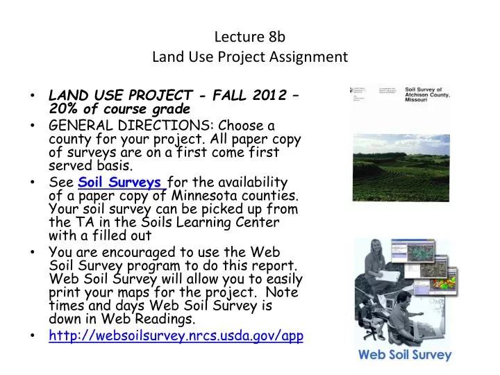
Lecture 8bLand Use Project Assignment • LAND USE PROJECT - FALL 2012 – 20% of course grade • GENERAL DIRECTIONS: Choose a county for your project. All paper copy of surveys are on a first come first served basis. • See Soil Surveys for the availability of a paper copy of Minnesota counties. Your soil survey can be picked up from the TA in the Soils Learning Center with a filled out • You are encouraged to use the Web Soil Survey program to do this report. Web Soil Survey will allow you to easily print your maps for the project. Note times and days Web Soil Survey is down in Web Readings. • http://websoilsurvey.nrcs.usda.gov/app
You should read over the entire directions for this project before choosing a county or section, since your decision on which land use plan to choose, may influence your choice of section or county. • The section you choose must have at least FIVE different soil series. For Example, • Webster 113 • Clarion 102B • Nicollet 130 • Okoboji, 134 • Cordova 109 • In most cases your section will have many more than five soil series. • However, your project grade is not determined by which section you choose (there is no perfect section). • Chose a county that you are interested in or that you have visited or would like to visit. It does not have to be in Minnesota.
All decisions about land use should be made according to the soil properties, landscape, and geographical features of this section. • The project is divided into two sections The first section will require that you write an introductory about the area you have selected to use for your project. This is a more general description of the soils on the section and the location. • The second section will be to describe in detail how the soils on the section are suitable for the specific land use. • While it is not required that you use only one section (For example: Section 3 of T3NR5E), it is required that you provide a legal land description for the area you have chosen. Choosing a section makes that process easier. All projects must have 640 acres and at least 500 acres must be land (140 can be water).
Section One This section is to provide an overview to client about the area. Address your report to the company who hired you to investigate the soil suitability for the parcel in a cover letter. They have asked you to investigate the purchase of 640 acres of land in the county you have chosen. Please follow the directions. In your report you need to describe to the company the following: • A) Section Location (Include: legal land description, location in the township, county, and state, driving directions from the nearest town and the Twin Cities. (10 pts) • B)General description of Soils (10 pts) • Describe all the soil series of your section. The section you choose must have at least five different soil series. Describe all of the soil series in a table. If a soil series has more than one map unit due to slope, you only need to describe the soil series, not all the different slope map units. Describe the soils of your section by including the following information in the table: • a) Information about the parent material for the soil, b) soil horizons c) surface soil texture and subsoil texture • d) The Suborder of the series (i.e.. Udoll, Udalf, Udept, Aquoll etc.)Using WEB Soil Survey will require you to go to http://ortho.ftw.nrcs.usda.gov/cgi-bin/osd/osdname.cgi for the official series description for each soil to find Suborder, PM, horizons, & landforms. • e) Write a general statement that summarizes the soils on this section. If I were to only read this section of the report I would have a general idea about the soils of the section.
C) Maps: (10 pts) • 1) soil map of your section including a scale, north arrow and legend for the soil mapping units WEB Soil Survey will do this for you. You must include the soil mapping units (ie. Map symbol 344 = Lester Loam – 0-6% slopes), to make the map useful and correct. Web Soil Survey prints a map, a soil map unit legend and a map symbol legend. Include all three in your report. • 2) Soil Suborder map for the section (note you will have to make this map after you look up the Suborders for the soil series) WEB Soil Survey will not do this for you. You must use the following color schemes:(from Soil Suborder Map) • Aqualfs – light green, Udalf-green, Udolls-brown, Ustolls-purple, Aquolls – dark brown, Aquepts – gray, Udepts- orange, Aquents – white, Orthents- green/blue, Psamments – yellow, Orthods – red, Hemists – black, Saprists – dark gray, Fibrists – pink, Aquerts – dark red/purple • 3) map showing location of the section in the county. • All maps need: title, a north arrow, scale, and legend. NOTE: I do not expect professionally made maps, but they must be neat (no hand printing). It is OK to copy maps from the paper copy or to transfer maps from the CD into your word processor for the project. You do not need to use a GIS program, but it is OK to do so.
Section Two • This section is a more specific report on the suitability of the soils on the 640 acre parcel for the desired land use. It is possible to use combinations from each land use plan or to create your own. Please get approval if you do not exactly follow one of the land use plans. • Your report will be graded on the following: • A) An explanation of relationship between your soils and land use required by the project. This should fully explain why each land use is suited for the soil types involved or how mitigation of problems with the soil will be handled. Be specific for the use, for example if the soil is suitable for crops indicated the kind of yields that would be expected as evidence it is a productive soil. (30 pts.); • B) Identification of wetlands (for purposes of this project potential wetlands are all soils in the aquic Suborders (Aqualfs, Aquolls, Aquents, Aquepts) and all Histosols). Explain your wetland protection plan. Without the proper permits the conversion of wetlands to non-wetland uses is prohibited. If your wet soils are currently used for agriculture you may leave them in agriculture. (5 pts) • C) Protection of erosion prone areas. Indicate which areas are susceptible to soil erosion from wind or water and explain your protection measures. Indicate the erosion prone areas on a map. For this project, water erosion is considered a problem when slopes are steeper than 4 % and wind erosion is a problem on all soils that have loamy sand or sand surface textures. (5 pts). • D) Land Use Map. Prepare maps to identify and explain the location of all land uses, wetlands and erosion prone areas. All land areas need a use. If an area is left without a use, it will be assumed it was not considered for a use and will deduct from your grade. If land is left as “wild or vacant”, indicate that on your land use map. All parts of your land use map should be labeled with a use. ON ALL MAPS YOU MUST HAVE: 1) A NORTH ARROW, 2) SCALE of Map, and 3) LEGEND for whatever you show on the map. Also turn in the Soil Map from Part I. (20 pts) • E) Neatness, originality, grammar, etc. (10 pts).
Possible Land Uses for Land Use Project. • 1) Green Spaces Inc.GSI is looking for an area to house professionals who are moving to the state. The planning of this nontraditional development evolved from community interaction and the design team's commitment to create a sustainable environment that respects the area's unique nature. Density transfer enabled the clustering of a greater number of houses on smaller than typical lots, thus maximizing the amount of preserved open land. The 75 (on one acre lots) custom built homes reflect the tradition of the homes built in the area at the turn of the century by using white exteriors, metal roofs, porches, and picket fences. This team is deeply committed to creating a new model for residential community that equally respects the heritage of a region and its environment. Geothermal heating and cooling and other sustainable technologies are being implemented. Communal constructed wetlands (5 acres per 10 homes) , which remove up to 95 percent of pollutants from wastewater before it enters the infiltration area, are used in place of conventional individual septic systems. Storm water runoff is reduced through narrower road widths, shorter driveways, and mown rather than paved pedestrian surfaces. In order to enhance the existing natural surroundings, the only plantings allowed at private residences are native trees, shrubs and herbaceous plants. Without curbs and gutters along the streets, grass swales and the natural depressions of the development have been used to capture storm water runoff and allow it to percolate slowly back into the soil. This method captures rainfall and keeps it on-site where it is filtered through natural vegetation before soaking back into the ground. Storm water detention wetlands aid in the infiltration process and 5 acres per 10 homes are required. Also include a recreational facility to entice individuals to locate here. Indicate the location of the roads, walking paths, horse trails, running trails, a five acre parcel for organic garden plots, a soccer/softball field complex, and other items you think may be important to entice homeowners to this area.
2) Organic Foods for All. OFFA is looking for a parcel to use for their organic produce production facility. Their philosophy of organic farming is "to grow the fertilizer," in the form of plant residues, animal manure, or compost. They are a certified organic farm consisting of 640 acres of which 320 are tillable acres (used for growing food). The rest is native woodland, native prairie, and pasture. They grow corn, soybeans, sunflowers, wheat, barley, & alfalfa. and vegetables for their local store. They raise beef cattle, sheep, & chickens. This land use will include a small retail store on 5-10 acres and a 80 to 100 acre plot for growing organic produce for the grocery store. The OFFA would also like a small day park for picnics. The complex will need a sewage treatment facility (sewage pond/treatment facility (5 acres) or a constructed wetlands waste water treatment facility (25 acres). Areas are also needed for annual flowers, a small greenhouse for some off season production, and processing sheds. Other items can be added as you deem necessary.
3) FootPrints on the Land. FPOTL wants your help in planning a back to nature camp for children from 12 to 17. The tracking of animals, conservation, outdoor awareness, safety, interest in fishing, bird watching, and hunting for young people are major concerns for FPOTL. The conservation of Minnesota's natural resources and traditions are in the hands of this generation. They have many interests to promote including Native American cultures and other cultures. They need at least 640 acres that has a lake, wetland, native prairie and forest. They believe your parcel can be a very interesting place to teach students about preserving nature and the importance of having a sustainable environment. This will require two camp grounds. The first campground will be a 10 acre modern group camp, headquarters building, (shower/restroom buildings) which requires a 10 acre septic tank field /toilet-shower building or 25 acre constructed wetland water treatment facility. The second campground will be four, five acre primitive camps, accessible by hiking. The main camp will require classrooms and a day park with some type of trail complex, and other interesting camp facilities for the children to use. Be sure to indicate the kind and diversity of vegetation, soils, wetlands, etc. that will be available for the students. They will want to study all aspects of nature including, vegetation, soils, wildlife, water, and weather.
4) Green Hunting for Minnesota.GHFM wants to purchase 640 acres for a skeet range, target range, bow hunting camp, and small game hunting camp. The HFHOM needs 640-1280 acres of private hunting land, including 100 acres of land in a set aside program like RIM or CRP, 40 acres of alfalfa, 40 acres of treed waterways, 80 acres of cropland and around 300 acres of grassland and or forest land. The birds and small game will also need natural sources for both water and food. They desire a quality hunting camp. To meet their needs they need 10 modern campsites, 10 primitive (tent) campsites and 5 small winter lodges. They also want a camp headquarter/store and maintenance facility for trails that will be used summer and winter. Restroom facilities are needed for all campgrounds and lodges. The main campground will provide shower/restroom buildings (10 acre septic tank field per toilet-shower building or 25 acre constructed wetland), 1 main ORV trail, hiking trails, ski trails, and the ranges and hunting blinds for deer and small game. Other items can be added as you deem necessary.
5) County Campground and Park. CCAP is looking for a 640 acre site. The park contains a wide variety of landscapes and wildlife habitats. These are managed to conserve wildlife and to let you enjoy quiet recreation with a quiet stroll along beautifully laid out woodland walks. About one third of this “Back to Nature Country Park” is woodland and the remainder of the site consists of grassland, scrub and farmland. The park would require parking lots (10 acres), restroom facilities, (15 acre lagoon or 30 acre constructed wetland), picnic grounds, primitive group camping (40 acres), and walking trails. Also planned are Scandinavian self-catering lodges for cross country skiing or summer hiking (10 acres for lodges, septic tank, etc.). These lodges are built of solid timber, are cool and airy in the summer and in the spring, autumn, or winter they are warm and cozy. Other facilities on the Park include an all-weather tennis court, nine-hole disc golf and an exciting adventure playground for the children. Other needs can be added as anticipated by you and the developer. • 6) Make your own use plan with instructor approval or a combination of the above. • The Land Use Project is due on or before Friday December 7, at 10:30 A.M. • Late reports are subject to a 10% penalty each day they are late.