Download
1 / 14
140 likes | 206 Views
Flight Planning Smoke Outlook SEAC4RS 2013. 08/02/2013 1800 hours PDT, 01:00Z (updated 0900 PDT 8/3) Forecast period: Saturday (8/3) - Tuesday (8/6) David Peterson Marine Meteorology Division Naval Research Lab - Monterey, CA. Bottom Line Upfront. Fire Observations:

E N D
Flight Planning Smoke OutlookSEAC4RS 2013 08/02/2013 1800 hours PDT, 01:00Z (updated 0900 PDT 8/3) Forecast period: Saturday (8/3) - Tuesday (8/6) David Peterson Marine Meteorology Division Naval Research Lab - Monterey, CA
Bottom Line Upfront Fire Observations: • 7-8 fires in SW Oregon and Northern California • Several new fires in northern CA! • Aspen fire is still burning in the Sierra (Fresno County) Key Forecasting Points (Tuesday 8/6): • Oregon/California fire activity is expected to persist, but some fires may be contained • Slight potential for off-shore smoke transport • Low clouds likely present over land in SW Oregon in the morning hours • Developing cutoff upper-level low and associated shortwaves may allow marine stratus deck to break early, especially along the CA coast. • Best time to sample Oregon fires is 10AM-5PM PDT (17Z-00Z), when fire activity is building, but broken cloud cover is still present. Earlier is better for smoke over clouds, later is better for a well defined plume. Smoke Predictions (Saturday 8/3 - Tuesday 8/6): • SW Oregon/N California: low concentrations before ~18Z, increasing throughout the afternoon hours each day. • Sierra Nevada: Aspen fire smoke output will slowly decrease through the period
Fire Trends (Past 24 hrs) Aqua MODIS: ~1430 PDT Thurs. Cloud cover impacting fire observations in OR Terra MODIS: ~1130 PDT Fri. As expected, Oregon clouds broke earlier on Friday and marine layer mixed out Smoke was near the coast! Similar setup today! Smoke
Fire Trends (Past 24 hrs) • Unfavorable fire weather conditions resulted in slow (if any) fire spread on Thursday. • Fires grew again on Friday! Conditions improved! • At least 3 of the fires were started by lightning in remote regions • Two of the fires are now partially contained
Fire Trends (Past 24 hrs) • Aspen Fire continues to burn, but is partially contained • Expect steady or decreasing smoke output • Dance fire in northern CA is largely contained • The newer Butler and Salmon River fires are producing smoke!
Synoptic Pattern 8/2/13, 1800Z • A Rex Blocking Pattern (high over low) is currently in place! • The trough will eventually become stretched (or sheared) during the forecast period. • Several models show the low becoming a cutoff and retrograding to the SW, off the coast of OR/CA. Primary forecast issues: • Occasional shortwaves moving through the broad synoptic trough • Lifting from upper level low can yield a higher but uniform deck, but more likely will lift perhaps too high for the 6th. • Higher winds also forecast along the CA coast. • Reduced/broken marine stratusresulting from less large-scale subsidence. • Possibility of occasional higher clouds traversing the region • Possible erratic upper-level winds near the end of the forecast period H L
Surface Conditions 8/2/13, 22:21Z Oregon and Northern California Fires: • Cloud cover is typical over in the morning hours. • Unlike Thursday, clouds burned off on Friday. Fire weather conditions were more favorable (lower RH/dew points), but still not as favorable as earlier in the week. • The potential for dry lightning has diminished across the region, at least for now. Saturday (8/3) –Tuesday (8/6)… • Cloudy in the mornings, then clearing, warming, and drying in the afternoon • SW flow is likely to develop by Monday due to the potential upper-level cutoff low located offshore • Some monsoonal moisture many be advected into the area • Potential for convection and dry lightning increases again on Monday/Tuesday!
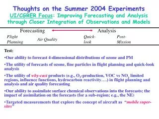
Fire Weather Conditions • Overall, low to moderate fire danger in SW Oregon and Northern CA on Friday • Fire danger consistently moderate to high in the Sierra Saturday (8/3) –Tuesday (8/6)… • Expect the fire danger to generally increase during the afternoon hours in SW Oregon and North CA! • Persistence is probably a good forecast, at least early in the period. • The big issue is the potential impacts from a cutoff low (located offshore) later in the period! • More favorable dry lightning conditions? • Increased instability/CAPE? Haines Index 1-2: low fire danger 3-4: moderate fire danger 5-6: high fire danger High-Elevation Haines Mid-Elevation Haines
Weather Forecast: Surface Monday 0000 – Tuesday 2300 PDT, near Grants Pass, OR Fire weather conditions are generally favorable for some fire growth in the afternoon hours each day. Inland highs persist in the 80s and 90s. • Low RH in the afternoon, wind speed will vary with terrain • Persistent northerly wind direction!
NAVGEM 500 mb heights/vorticity, Tuesday 18Z Weather Forecast: Upper Air Tuesday (8/6): • Most models show an upper-level low (cutoff) near the cost of CA/OR. • The low reaches down to ~700 mb • Some monsoonal moisture appears to reach Oregon via southerly flow • Enhanced rising motion is present by evening • There is a slight chance for elevated convection and dry lightning! It will be isolated. NAVGEM 700 mb heights/RH, Weds. 00Z
Weather Forecast: Upper Air COAMPS 850 mb, Tues. 18Z Tuesday (8/6): • Broad anticyclone is forecast under the upper-level low • General northerly flow will push smoke to the south • There is a slight chance of off-shore smoke transport near the CA/OR border • Large-scale off-shore transport seems unlikely at this time. But surface advection has been observed despite the model predictions
Winds and Stratus Tuesday (8/6): • Coastal winds are expected to increase significantly. • This could mix out coastal stratus. • Broken clouds on the north coast, with stratocumulus hugging the coast upstream of points • NAVGEM and GFS have decreasing winds on Tuesday, which could be good for stratus…
NAAPS Smoke/Aerosol Forecast View slideshow for loop!!! • Smoke increases from late morning to evening in SW Oregon/North CA each day! • Smoke concentrations generally persist near the Aspen Fire (CA). • While this seems to indicate smoke will be present through Tuesday, other factors may impact the forecast… • Containment of older fires • Potential for new ignitions • Major changes in weather conditions, which seems unlikely at this time
Summary • Fires and smoke will generally persist through Tuesday. • Steady fire growth is likely during the afternoon hours, but explosive growth is not expected. • Low cloud cover will be present in SW Oregon during the morning hours each day, but may break earlier than usual due to reduced stability • Surface and 850 mb winds will generally be from the North. • Large scale smoke transport over open ocean seems unlikely at this time! However, a small chance still exists if winds turn to the NNE. • Chance for convection increases through the forecast period