Download

1 / 26
280 likes | 448 Views
WRF Basics Weather Research and Forecasting. What is it? State of the art numerical weather forecasting model Useful from many km scale down to 100s of m Geographical dataset accounts for orography, land use, vegetation type, albedo, etc.

E N D
WRF Basics Weather Research and Forecasting This is the footer
What is it? • State of the art numerical weather forecasting model • Useful from many km scale down to 100s of m • Geographical dataset accounts for orography, land use, vegetation type, albedo, etc. • Full range of sophisticated boundary layer schemes, microphysical schemes, Cumulus schemes, turbulence, soil moisture, ... etc • International user base; well supported • Run from linux/unix using paralell processors • Free!!
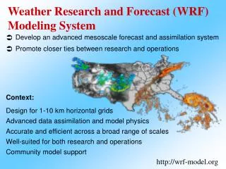
WRF: Overview Stages in running WRF Decide upon which domain you wish to use Acquire some met. data for the dates you are interested in Run the WPS WRF Preprocessing System Run WRF
Stages in running WRF Decide upon which domain you wish to use Acquire some met. data for the dates you are interested in Run the WPS Run WRF
Determining your domain WRF “Domain Wizard”
Outer domain: 9km resolution 100x126 gridpoints Intermediate domain: 3km resolution 55x76 gridpoints Inner domain: 1km resolution 31x40 gridpoints
WRF code • ~ 160,000 lines of code (Fortran90/C/Perl) • But, you don’t need to edit any of it! • To run WRF you only need to edit two ascii files
Stages in running WRF Decide upon which domain you wish to use* Acquire some met. data for the dates you are interested in Run the WPS Run WRF
Acquire some met data (forecast files) GFS data is online Usually the 06Z forecast cycle data is available in the UK mid-afternoon Online: April 21st 2007 – present Offline: Feb 15th 2005 – April 20th 2007
Stages in running WRF Decide upon which domain you wish to use* Acquire some met. data for the dates you are interested in Run the WPS Run WRF
WPS: Pre-processing Edit the “namelist.wps” file This file contains information about: Start and end times Grid definition Location of the ancillary files (land use, orography, etc
WPS: Pre-processing WRF Pre-processing system (WPS) 1) Design the grid formulation for your run 2) Extract the met. data from your input files 3) Interpolate the met. data onto your grid (defined above)
WRF Pre-processing system (WPS) Computes the grid formulation for your run geogrid.exe ungrib.exe metgrid.exe Extracts the met. data from your input files Interpolates the met. data onto your grid (defined above)
Stages in running WRF Decide upon which domain you wish to use* Acquire some met. data for the dates you are interested in Run the WPS Run WRF wrf.exe
For the Arran fieldcourse WRF runs: geogrid.exe ungrib.exe metgrid.exe qsub real_exe.sh qsub wrf_exe.sh
Stages in running WRF Decide upon which domain you wish to use* Acquire some met. data for the dates you are interested in Run the WPS Run WRF Examine the output
Examining the output WRF output files are enormous (WRF UK output data ~60Gb) One output file per nest; netCDF format Post processing and looking at the output: IDV – Interactive Data Viewer RIP and RIP4 GrADS Vis5D Matlab wrfpost ... generic netCDF viewers
23/02/08: 12Z T+60
23/02/08: 12Z T+60 Cloud water mixing ratio = 0.1g / Kg
23/02/08: 12Z (T+60)
Estimated that a third of the world’s population receive their weather forecast via WRF. Adopted by China, India, Korea, etc etc.