Download
1 / 11
110 likes | 184 Views
LiDAR Data Collection Status Northwest Florida Water Management District. The National Map Seamless Server. http://seamless.usgs.gov/website/seamless/viewer.htm. http://www.csc.noaa.gov/crs/rs_apps/sensors/lidar.htm. Projections Geographic UTM State Plane 1983 State Plane 127.

E N D
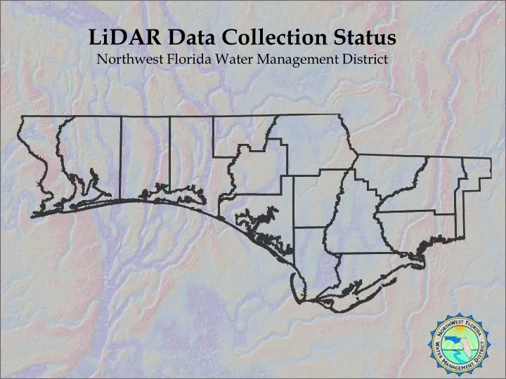
LiDAR Data Collection Status Northwest Florida Water Management District
The National Map Seamless Server http://seamless.usgs.gov/website/seamless/viewer.htm
http://www.csc.noaa.gov/crs/rs_apps/sensors/lidar.htm Projections Geographic UTM State Plane 1983 State Plane 127 Vertical Units Feet Meters Horizontal Datum ITRF-94 NAD83 NAD27 Vertical Datum NGVD29 NAVD88 Ellipsoid GRS80 LiDAR Returns All First Last Data Classes Ground Any Non Ground File Format x, y, z points LAS 1.1 file Binary raster (.flt) Geo TIFF DEM Pretty Picture DEM Contour shapefile Contour DXF file ASCII grid file Raster data sets—you select the cell size and units
Escambia County Light Detection and Ranging Data Extent of data for County Flight Extent of DEM Enhancement