Download
1 / 22
220 likes | 285 Views
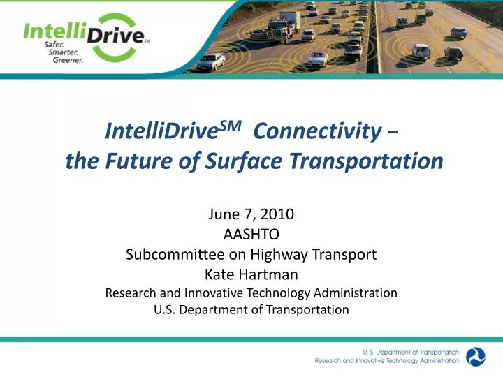
IntelliDrive SM Connectivity − the Future of Surface Transportation. June 7, 2010 AASHTO Subcommittee on Highway Transport Kate Hartman Research and Innovative Technology Administration U.S. Department of Transportation. Safety 37,000 highway deaths/year 5.8 million crashes/year

E N D
IntelliDriveSMConnectivity − the Future of Surface Transportation June 7, 2010 AASHTO Subcommittee on Highway Transport Kate Hartman Research and Innovative Technology Administration U.S. Department of Transportation
Safety • 37,000 highway deaths/year • 5.8 million crashes/year • Leading cause of death for ages 4 to 34 Mobility • 4.2 billion hours of travel delay • $87.2 billion cost of urban congestion Environment • 2.8 billion gallons of wasted fuel • ↓Emissions ↓Greenhouse Gases ↓ Particulates Why IntelliDriveSM?
IntelliDrive BenefitsDramatically Reduced Fatalities and Injuries • Greater situational awareness • Your vehicle can “see” nearby vehicles and knows roadway conditions you can’t see. • Reduce or even eliminate crashes through • Driver Advisories; • Driver Warnings; • Vehicle Control. Intersection Colision Avoidance IntelliDrive has the potential to address 82% of the vehicle crash scenarios involving unimpaired drivers.
IntelliDrive SM BenefitsIncreased Mobility and Environmental Stewardship • Information-rich environment benefits users and operators of all travel modes. • Travelers have real-time information on rerouting or “modal shift” options. • System operators have real-time data to enable better system operations for optimal performance. • Planners can use data to address system-wide issues. • Environmental benefits • Reduced stopping/starting at traffic signals which consumes 3-5 times more fuel than constant driving. • Nav systems with real time information can reduce fuel consumption by 10.5% over systems without real time traffic data.
Latency vs. Communications Technologies For IntelliDrive Two-Way Satellite (60+ secs) 60 40 20 Terrestrial Digital Radio & Satellite Digital Audio Radio (10 - 20 secs) 10 5.0 WiFi 802.11 (3 - 5 secs) 4.0 Bluetooth (3 - 4 secs) 3.0 Latency (in seconds) Cellular (1.5 - 3.5 secs) WiMax (1.5 - 3.5 secs) 2.0 Least stringent latency requirement for Active Safety ( 1 sec) 1.0 Most Stringent latency requirement for Active Safety (.02 sec) .02 .01 5.9 GHz DSRC (.0002 secs) Communications Technologies Note: Y-axis not to scale for illustration purposes Data source: Vehicle Safety Communications Project – Final Report
IntelliDrive TaxonomyLevel 1 vs Level 2 Level 1 Non-Vehicle-Based Data Level 2 Vehicle-Based Data 9
IntelliDrive TaxonomyTime-Criticalvs Non-Time-Critical Level 1 Non-Vehicle-Based Data Level 2 Vehicle-Based Data Level 1.ANon-Time-Critical Level 1.BTime-Critical Level 2.A Non-Time-Critical Non-Proprietary Vehicle Data Level 2.C Time-Critical Proprietary Vehicle Data Level 2.B Non-Time-Critical Proprietary Vehicle Data 10
IntelliDrive TaxonomyLevel 1.A Level 1 Non-Vehicle-Based Data Level 2 Vehicle-Based Data Level 1.BTime-Critical Level 2.A Non-Time-Critical Non-Proprietary Vehicle Data Level 2.B Non-Time-Critical Proprietary Vehicle Data Level 2.C Time-Critical Proprietary Vehicle Data Level 1.ANon-Time-Critical Level 2.A Non-Time-Critical Non-Proprietary Vehicle Data • Scenario: • -Today’s probe data and applications: traffic, transit/ fleet management, e-tolling • Applications that require only position and speed • Federal role/interest • Promote and demonstrate benefits (SafeTrip-21) • Data exchange standards 11
Level 1.BTime Sensitive • Scenario: • Integration of DSRC technology into nomadic devices • “Here I Am” message” supports safety and mobility applications • Federal role/interest • Promote industry data & communications (DSRC) standards • Accelerate deployment & benefits IntelliDrive TaxonomyLevel 1.B Level 1 Non-Vehicle-Based Data Level 2 Vehicle-Based Data Level 1.BTime Sensitive Level 2.A Non-Time Critical Non-Proprietary Vehicle Data Level 2.B Non-Time-Critical Proprietary Vehicle Data Level 2.C Time-Critical Proprietary Vehicle Data Level 1.ANon-Time Critical
IntelliDrive TaxonomyLevel 2.A Level 2.A Non-Time-Critical Non-Proprietary Vehicle Data Scenario: -Leveraging of non-proprietary data from vehicle data port via aftermarket products -Various communication capability including DSRC • Federal role/interest • Promote industry data & communications standards • Opportunity for obtaining vehicle based data for mobility and road weather applications • Accelerate deployment & benefits Level 1 Non-Vehicle-Based Data Level 2 Vehicle-Based Data Level 1.BTime-Critical Level 2.B Non-Time-Critical Proprietary Vehicle Data Level 2.C Time-Critical Proprietary Vehicle Data Level 1.ANon-Time-Critical 13
IntelliDrive TaxonomyLevel 2.B Level 2.B Non-Time-Critical Proprietary Vehicle Data • Scenario: • Private services • Various communication media • Federal role/interest • Promote industry data standards • Opportunity for obtaining richer set of vehicle based data for mobility and road weather applications Level 2 Vehicle-Based Data Level 1 Non-Vehicle-Based Data Level 1.BTime Sensitive Level 2.A Non-Time Sensitive Non-Proprietary Vehicle Data Level 2.C Time-Critical Proprietary Vehicle Data Level 1.ANon-Time Sensitive 14
IntelliDrive TaxonomyLevel 2.C Level 2.C Time -Critical Proprietary Vehicle Data • Scenario: • DSRC centric primary goal of safety • Supports mobility and environmental goals • Requires infrastructure for mobility, environmental, and some safety applications • Federal role/interest • Promote industry data and communications standards • Rulemaking for safety technology and applications • Explore retrofit opportunities for accelerated benefits • Deployment models • Governance framework Level 1 Non-Vehicle-Based Data Level 2 Vehicle-Based Data Level 1.BTime-Critical Level 2.A Non-Time-Critical Non-Proprietary Vehicle Data Level 2.B Non-Time-Critical Proprietary Vehicle Data Level 1.ANon-Time-Critical 15
ITS Strategic Plan – Vision A national, multi-modal surface transportation system that features a connected transportation environment among vehicles, the infrastructure, and portable devices to serve the public good by leveraging technology to maximize safety, mobility and environmental performance Achieved Through …and a suite of targeted research and development initiatives that support cross-modal ITS solutions
ITS Strategic Plan – IntelliDrive Research Framework Applications(Includes Field Tests and Demonstrations) Technology Underpinning Vision Policy & Non-Technical
Are applications available and benefits validated? What is the minimum infrastructure needed for the greatest benefit? How much, where, when and what type? What is the degree of market penetration required for effectiveness? Is technology stable, reliable, secure, and interoperable? Are international standards available to ensure interoperability? What policies/governance/funding are required for sustainability? How to address public concerns for privacy and ensure that applications do not cause driver distraction? Critical Research Questions 77% Applications Technology 18% 5% Policy ALL MUST BE ANSWERED TO BE DEPLOYABLE
ITS Strategic Plan – IntelliDrive Research Safety • Vehicle to Vehicle (V2V) Communications for Safety • Vehicle to Infrastructure (V2I) Communications for Safety • Human Factors Mobility • Real-Time Data Capture and Management • Dynamic Mobility Applications • Road Weather Management Environment • Applications for the Environment: Real-Time Information Synthesis (AERIS) Technology Underpinning • IntelliDrive Test Environment • Harmonization of International Standards and Architecture • IntelliDrive Certification • IntelliDrive Systems Engineering • Data and Communications Security Policy & Non-Technical • Deployment scenarios • Financing • Legal and Institutional Issues
Technology Systems engineering Remaining technical challenges: security, positioning, scalability Standards Testbeds Policy & Non-Technical Deployment strategy Financing Governance Certification Legal, liability, privacy issues Data ownership and rights Applications May be subdivided based on taxonomy Includes data capture methods to support applications V2V safety V2I safety SPAT and signal (I2V) Weather Environmental Other mobility and public sector management applications Tolling Aftermarket Interest Groups: Research Area Focus
Existing: OEMs (light vehicle manufacturers) AASHTO (state gov’t.) ITE, NACO (local gov’t. & system implementers) Traveler information community (511 Coalition) Weather community Transit community Needed: Aftermarket community (device makers, data collectors, aggregators, users) Freight Telecom Financial industry Toll Environment Interest Groups: Stakeholder Focused
For More Information… http://www.intellidrive.org/