Download
1 / 17
170 likes | 284 Views
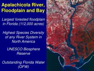
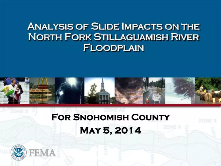
Analysis of Slide Impacts on the North Fork Stillaguamish River Floodplain. For Snohomish County May 5, 2014. Agenda. Initial River Floodplain Concerns Initial River Analysis Efforts Results and Impacts Determined from this effort

E N D
Analysis of Slide Impacts on the North Fork Stillaguamish River Floodplain For Snohomish County May 5, 2014
Agenda • Initial River Floodplain Concerns • Initial River Analysis Efforts • Results and Impacts Determined from this effort • Initial Discussions on What Longer Term Solutions Might Look Like • Impacted Structures and Hazus Risk Assessment • NFIP Assessment • HMA Assessment
Initial River Analysis Efforts • What flows could we see in the short-term (April-May) • What flows could we see in the longer-term (next flood season starts in October) • What information do we have to determine the baseline flooding condition prior to slide • What do we need to do to appropriately model how the river will act through the slide
Hydrology – River Flows Short-Term Derived Maximum Peak Flows by month for NF Stillaguamish nr Arlington Gage in CFS Long-Term (Flood Frequency Analysis)
Existing Flood Insurance Study Comparison From FIS (NF Stillaguamish River Last updated in 1981): From USGS Gage nr Arlington Conclusion: New Analysis shows 100-year flow at 48,700 cfs, which is 56% higher.
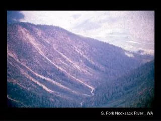
Updated River Model • A pre-slide hydraulic model was created using the 2013 LiDARtopography • LiDAR did not capture under water part but flow at time of LiDAR was fairly low • Mimicked the effective model profile for channel characteristics
River Model with Added Slide Impact • A post-slide hydraulic model was created by adding the April 6, 2014 LiDAR for the slide area to the existing 2013 LiDARmodel • Largest unknown was at what elevation the channel bottom was through the slide area • USGS has deployed gages in the lake area that this model was calibrated to • Channel was dropped by approximately 2.5 to 4.5 feet through the slide below the water line to match what was observed • This model was done prior to the pilot channel being improved • Upstream bathymetry is not a part of the model and it is not likely to affect the larger flood events
Initial Discussions on What Longer Term Solutions Might Look Like
Impacted Structures and Hazus Assessment • Detailed building/parcel data from Snohomish County • Hazus runs to be revised with building data
NFIP Policies • Impact area • 10 properties with 11 policies • Fringe area • 2 properties • Claims filed • 11 filed as of May 5, 2014 • Public inquiries at Disaster Recovery Center • 38 as of May 6, 2014
NFIP Strategy • Provide floodplain Management and Flood Insurance Technical Assistance • 209 Repetitive Loss Properties • Field verification • National Flood Mitigation Data Collection Tool • Provide to State and Snohomish County to assist in analysis and development for planning and grants • Insurance Agent Briefing