Download
1 / 11
120 likes | 301 Views
IGOS Geohazards Workshop. Science working group report. Moderator: Rosalind Helz Rapporteurs: Alik Ismail-Zadeh, Simeon Kostyanev, Pierre Briole WG members: Pascale Ultré-Guérard, Peter Collins, Valério Tramutoli, François Schindélé. Issues in earthquakes.

E N D
IGOS Geohazards Workshop Science working group report Moderator: Rosalind Helz Rapporteurs: Alik Ismail-Zadeh, Simeon Kostyanev, Pierre Briole WG members: Pascale Ultré-Guérard, Peter Collins, Valério Tramutoli, François Schindélé
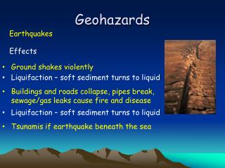
Issues in earthquakes • Location and size of the active faults (including blind faults) and the history of earthquakes on each. • Is the seismic cycle model realistic or not ? • Balance between seismic and aseismic deformation • Mapping and interpretation of strain changes produced by an earthquake and the implication for seismic hazard • Detection of precursors and understanding the physical processed that generated them inside Earth
Issues in volcanoes • To know the structure of the magmatic plumbing system. • To distinguish between signal indicating an unrest that will lead to an eruption and “noise” (like changes in the geothermal system). • Will precursors in long dormant volcanoes be similar to those in more active volcanoes ? Will precursors for “super-volcano” eruptions be similar ? • To predict the characteristics of an eruption once it has been forecast (including size) • To predict the evolution of an eruption once it has started
Issues in ground instabilities • Landslides • To detect unknown landslides, to develop landslides inventories • To be able to detect small motions before accelerations • To establish threshold conditions for triggering landslides from rainfall • Subsidence • To detect unknown subsiding areas • To be able to detect changes in subsidence rate
Compound geohazards • Triggering of landslides by earthquakes or volcanic eruptions • Triggering of a volcanic eruption by an earthquake • Occurrence of lahars after large explosive eruptions • Generation of tsunamis
Issues in tsunamis • To determine quickly the critical parameters of an earthquake with tsunamigenic potential: • Depth of the upper edge of the fault below the sea bottom • Length of the rupture • Slip distribution on the fault • To be able to directly detect a tsunami • To forecast amplitude and time of arrival of the waves reaching the coast
Social issues for the geohazards • We need to learn how to maintain awareness in the exposed population between rare events. • We need to learn more about the behaviour of populations in areas exposed to geological risk • We need to understand better the behaviour of populations after major disasters. • We need cost/benefit analysis for the different geohazards
Additional issues discussed by the group but out of scope of IGOS-G • Impact of very large eruptions on global weather • Impact of long term (>0.1Myr) climate change, sea level change, ice sheets evolution on the evolution of hazard
Development/validation of new techniques • IGOS encourages further development and expansion of quantitative deformation measurement techniques • Continuity of InSAR missions is crucial • Combination of GPS and InSAR • Need better tropospheric correction • IGOS encourages development of ground based radars and lidars • IGOS encourages a critical evaluation of the DEMETER mission that is aimed to detect electro-magnetic signals associated with earthquakes. In particular GPS derived ionospheric anomalies should be used in this evaluation. • IGOS encourages more research on techniques to evaluate the location and movement of fluids in the crust • IGOS encourages the development of cross validation methods to combine ground and space based data
Partnership and networking • IGOS recognizes that good research requires strong partnership among: • Observatories and operational agencies • Research scientists • Space agencies • Industry building ground and space sensors • Emergency authorities • IGOS recognises that networking activities are especially important to support near real time analysis and modelling of data
Some specific recommendations to help science for geohazards • Data bases • IGOS recommends that volcano observatories participate in the development of “WOVOdat” project. • IGOS recognizes the need for improved historical archives for all geohazards (comparable to the Global Volcanism Project). • IGOS encourages co-location of sensors (example seismic and GPS data acquired at the same location) • IGOS encourages the development of facilities to feed science community with InSAR and PS-InSAR interferograms produced on a routine basis