Download
1 / 46
460 likes | 641 Views
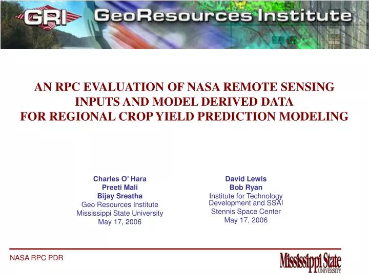
AN RPC EVALUATION OF NASA REMOTE SENSING INPUTS AND MODEL DERIVED DATA FOR REGIONAL CROP YIELD PREDICTION MODELING. Charles O’ Hara Preeti Mali Bijay Srestha Geo Resources Institute Mississippi State University May 17, 2006. David Lewis Bob Ryan

E N D
AN RPC EVALUATION OF NASA REMOTE SENSING INPUTS AND MODEL DERIVED DATAFOR REGIONAL CROP YIELD PREDICTION MODELING Charles O’ Hara Preeti Mali Bijay Srestha Geo Resources Institute Mississippi State University May 17, 2006 David Lewis Bob Ryan Institute for Technology Development and SSAI Stennis Space Center May 17, 2006
GENERAL OVERVIEW RPC Evaluation of Soybean Yield Modeling Regional Level Prediction Integration of Remote Sensing Advantages, Disadvantages and Tradeoffs Best Possible Solution
CROP YIELD MODELS Crop (Soybean) Yield Prediction Crop models have been used for predicting crop yield before harvest. These pre-harvest crop yield estimations also help in regional and global crop prices and trade policies. Integration of Remote Sensing Data to Crop Yield Remote Sensing based methods have been used to provide inputs to a number of crop prediction models.
RPC: INTEGRATING BASELINE & FUTURE SENSORS DATA FOR CROP YIELD PREDICTION Sensors in Current Use Moderate Resolution Imaging Spectro-radiometer (MODIS) Advanced Very High Resolution Radiometer (AVHRR) Both have large Swath Width and High Temporal Resolution RPC Evaluation: Implement a baseline configuration of the Sinclair Model for selected soybean production areas in Brazil with current remote sensing data streams and compare results against results derived from model outputs using synthetic VIIRS and modeled LIS as data inputs. Include a well-devised ground data collection campaign, collaboration with USDA FAS for data sharing and exchange, participation of Dr. Tom Sinclair as the model owner, programmers to integrate the model, and researchers who will conduct tests and evaluations of results.
CROP MODEL SUITABILITY FOR REGIONAL YIELD PREDICTION • Regression based empirical methods • Montieth based models • Mechanistic or agro-meteorological based methods The agro-meteorological based crop yield prediction method provides a good scope in regional yield predictions using remote sensing. The variables in these methods are mostly obtained from meteorological stations, derived from remote sensing data sources, or computed by models; thus, they provide global or regional coverage and enhanced regional model applicability.
STUDY AREA DETAILS: ARGENTINA Study Area Details: MODIS 10 x 10 tiles are shown for areasto be considered. Field areas are shownfrom previous NASA/ ITD/USDA FAS workas well as the fieldsselected by Dr. LouisSalado and Dr. TomSinclair for field data campaign.
COMPLETED NASA RESEARCH IN STUDY AREA FOR USDA FAS Can NASA Research contribute to the foreign crop type assessment performed by the USDA Foreign Agriculture Service (FAS) Crop Assessment Estimates Crop Condition Data Retrieval and Evaluation (CADRE)?
CROP TYPES IN PROJECT Crop # Samples_______________________________ Corn 140 Forest 40 Pasture (Cultivated) 100 Pasture (Natural) 100 Soybeans 150 Urban 40 Water 40 Wetland 40 Wheat 150 Sorghum <30 Peanuts <30 _________________________________ Total ~800 = total samples to be collected
FIELD DATA COLLECTION METHODOLOGY Example of ground truth equipment and digital sampling forms created for this study
QC • NIR • RED • Clip to Bounds • Set Bad Pixels to -2 • Apply Median Filter • Make QC Mask • Create NDVI • Set Background to 0 • Make Buffer Mask • Save as ESRI Grid • Apply Masks • Make Look Angle Mask • Import to Imagine DATA PRE-PROCESSING FLOW Creation of daily NDVI datasets to be used for the hypertemporal composite
Download MOD09 HDF Resample Export to GeoTIF Generate Daily NDVI Composite NDVI STEPS FOR GENERATION OF A MODIS-BASED NDVI
Sep Oct Nov Dec | Jan Feb Mar April 2004 2005 HYPERTEMPORAL NDVI PLOTS FOR 4 MAIN CROPS
CONCLUSIONS • Moving window compositing produced dataset for good classification results • Masks and filters applied significantly reduced anomalous and noisy pixels • The NDVI profiles of the hypertemporal dataset were separable for the corn, soybean, wheat, forest, other ag, and non-agriculture classes. • Best classification method from those tested was Minimum Distance classifier • The overall accuracy was improved using this classifier by separating the soybean class into two classes for single and double-cropped soybeans • An overall classification accuracy of 69% was achieved
FUTURE WORK • Investigate a classification system that combines the Growing Degree Days and Minimum Distance into a rules-based classifier (or decision tree classification system) in order to raise the overall accuracy achieved. • Develop a weighting rule for the data layers in a decision tree classification scheme • Use more sample sites in order to separate the pasture and other-agriculture classes • Identify sample sizes by crop distribution and acreage • To reduce noise, expanding the buffer mask to include a two and possibly three pixel buffer away from identified cloud or ‘bad’ pixels. • Refine methods for integrating results with crop yield prediction models.
SINCLAIR MODEL SINCLAIR MODEL Semi-mechanistic model Named after Thomas Sinclair (University of Florida) Used by USDA/FAS PECAD for regional soybean estimations Basic model inputs are based on the following relationships (Speath & Sinclair, 1987): Leaf emergence as a function of temperature Leaf area index as a function of leaf number and plant population Interception of solar radiation as a function of leaf area Biomass accumulation proportional to intercepted radiation Seed yield proportional to biomass
INPUTS TO THE MODEL Leaf Area Index Temperature Precipitation Soil Moisture Planting Date Solar Radiation Photoperiod
MODEL INPUTS Planting Date DIPI (Daily Increase in Plastochron index) PLA (Plant Leaf Area) LAI = PLA * Plant Population Temperature Soil Water LEAF AREA INDEX Sinclair Model simulation BASELINE SPATIAL SUBSTITUTE NOAA-AVHRR (NOAA-Advanced Very High Resolution Radiometer) MODIS (Moderate Resolution Imaging Spectro-radiometer) NASA LIS – Temperature & Soil Moisture (NASA Model) Visible/Infrared Imager/Radiometer Suite (VIIRS) – Synthetic RPC EVALUATION
BASELINE MODEL INPUTS REMOTE SENSING BASED LAI AVHRR (1km): NDVI ~ LAI relationship MODIS (250m): EVI ~ LAI relationship MODIS LAI ( MOD 15 LAI : 1km)
MODEL INPUTS METEOROLOGICAL DATA
INTEGRATED DATA SOURCES MODEL INPUTS
MODEL INPUTS OTHER INPUTS Day length: Calculated based on Latitude and Day of year Planting date: Important variable usually estimated from local knowledge and crop reports
MODEL INPUTS Zonal function Temporal NDVI Phenology curve PLANTING DATE ESTIMATION Improved through remote sensing Detect onset of greenness Temporal NDVI cube Develop refined estimation of crop planting date
* Critical RPC Items RPC CHALLENGES
NPOESS VIIRS • In 2008, the National Polar-orbiting Operational Environmental Satellite System (NPOESS) Visible Infrared Imager Radiometer Suite (VIIRS) instrument will be launched into 1330, 1730, and 2130 local-time ascending-node sun-synchronous polar orbits. • VIIRS will replace three different currently operating sensors: • The Defense Meteorological Satellite Program (DMSP) Operational Line-scan System (OLS), • The NOAA Polar-orbiting Operational Environmental Satellite (POES) Advanced Very High Resolution Radiometer (AVHRR), and • The NASA Earth Observing System (EOS Terra and Aqua) Moderate Resolution Imaging Spectroradiometer (MODIS).
VIIRS SIMULATION • VIIRS will have a ground sample distance (GSD) ranging from 371 m by 387 m at nadir to 800 m by 800 m at the edge of the scan • Since the MODIS red-band and NIR-band reflectances have a GSD of 250 m at nadir, simulations of the types of NDVI images to be expected from the VIIRS sensor can be created from MODIS data • Temporal VIIRS simulations, such as near-daily NDVI time series plots and temporally-processed image videos, can be created using the TSPT.
Synthetic VIIRS for RPC Evaluation – Bob Ryan • MODIS data will be collected for the study area for the period from 2005 to 2007. • VIIRS data will be simulated for specific desired time intervals • IRS ResourceSat 1 AWiFS image data are in active use by the USDA FAS for crop monitoring and acreage estimation. • AWiFS image data provides an opportunity to create simulated products for comparison to actual MODIS products as well as to the synthetic VIIRS products to perform preliminary validation and uncertainty quantification of the synthetic products.
Scale Issues, Synthetic ProductValidation, and Uncertainty Analysis Selecting large fields as study sites with areas that include semi-continuous features enables crop characteristics to be measured by a plurality of image pixels by operational sensors. Synthetic image products with reduced spatial resolution will be produced that provide pixels that still remain within the boundaries of the selected study sites. A set of images with significantly higher spatial resolution and similar spectral characteristics will be employed to test the results of the data simulation and develop preliminary quantification of uncertainty.
PRELIMINARY VIIRS NDVI SIMULATION SHEELY FARM CROP FIELDS MODIS 250 m GSD NDVI VIIRS 400 m GSD NDVI
PRELIMINARY VIIRS NDVI SIMULATION SHEELY FARM COTTON FIELD, 2003 MODIS NDVI Time Series VIIRS NDVI Time Series
PRELIMINARY VIIRS NDVI SIMULATION SHEELY FARM GARLIC FIELD, 2003 MODIS NDVI Time Series VIIRS NDVI Time Series
VIIRS PIXEL AGGREGATION • VIIRS uses a pixel aggregation technique whereby three pixels are aggregated in-scan from nadir to a sensor zenith angle (SZA) of 31.71°, two pixels are aggregated in-scan at SZA’s from 31.71° to 47.87°, and no aggregation occurs beyond an SZA of 47.87°. • Due to this technique, although VIIRS has a larger GSD than MODIS at nadir, it has a smaller in-scan GSD at large SZA.
RESOLUTION VS SCAN ANGLE Source: Dr. Robert E Murphy, NPP Project Scientist, NASA GSFC
Synthetic VIIRS Data Product ValidationIRS (Indian Remote Sensing) RESOURCESAT-1 RESOURCESAT-1 Orbit and Coverage DetailsRESOURCESAT-1 was launched into a sun-synchronous orbit at an altitude of 817 km following the current IRS 1C ground track. The RESOURCESAT-1 satellite was launched October 17, 2003 with a design life of 5 years.
Synthetic VIIRS Data Product Validation AWiFS Characteristics Advanced Wide Field Sensor (AWiFS) The Advanced Wide Field Sensor (AWiFS) with twin cameras has a 56 meter NADIR resolution with a 700 km combined swath and a five day revisit time. To cover such a wide swath,the AWiFS camera is split into two separate electro-optic modules (AWiFS-A and AWiFS-B) tilted by 11.94 degrees with respect to each other. AWiFS specifications IGFOV 56m (nadir) 70m (at field edge) Spectral Bands B2: 0.52-0.59 B3: 0.62-0.68 B4: 0.77-0.86 B5: 1.55-1.70 Swath 370 km each head 740 km (combined) Integration time 9.96 msec Quantization10 bits No. of gains1
NASA AWiFS Characterize/Validation Activities Some additional input may be provided here by NASA about their efforts to characterize and validate calibrate reflectance products from AWiFS data sources.
CONCEPTUAL REPRESENTATION Compile MODIS data for area of interest and temporal range defined. Create synthetic VIIRS data to match the area and temporal range of the MODIS data. Desired Event Based Product for Critical Phenological Development Running NDVI for Daily Model Runs
X Y Y Image n Z Image 1 Time X RPC IMPLEMENTATION OF PARALLEL TEMPORAL MAP ALGEBRA FOR RAPID DATA PRODUCT DEVELOPMENT TMA is the temporal extension to conventional map algebra. Treats time series of imagery as three dimensional data set. XY plane represent Earth’s surface. Z dimension represents time.
TMA PARALLEL PROCESSINGBijay Srestha – MS Thesis • Global or regional coverage requires large volume of satellite data. • Need for intensive computing to integrate and process large datasets. • Parallel processing is the decomposition of a large problem into smaller problems that can be solved simultaneously to provide faster execution time. • Many spatial programs are inherently parallel. • Parallel processing can provide leap in performance.
TMA Parallel Processing Temporal Cube • Block Distribution & Processing 1 n 2 …………………………………… Temporal Composite
MODIS or Synthetic VIIRS Pre-processing Surface reflectance day 1 NDVI day 1 NDVI cube Surface reflectance day 2 NDVI day 2 … … Surface reflectance day N NDVI day N QMask day 1 Surf.Refl. Quality day 1 Input to Compositing Algorithm Surf. Refl. Quality day 2 QMask day 2 Quality Mask cube … … Surf. Refl. Quality day N QMask day N Geolocation Angles day 1 view zenith angle day 1 Geolocation Angles day 1 view zenith angle day 2 View zenith angle cube … … Geolocation Angles day N view zenith angle day N
Masking TMA Compositing NDVI Cube View Angle Cube Surface reflectance Quality Cube Model based constraints to create masked NDVI Masked NDVI Cube TMA Operations NDVI Composite
Experimental Results Implementation of parallel TMA abilitiesin the RPC will enablethe rapid generation ofcustom temporal composites of real andsimulated data sourcesand enable rapid use ofdesired products in evaluations! High quality temporalcomposites may be efficiently created forcustom products anddesired temporal andgeographic ranges of interest!
CONCLUSIONS More research is needed for validating LAI-based inputs from remote sensing for agricultural modeling purposes. A single sensor does not provide sufficient information to meet the needs for modeling regional agricultural systems, therefore integrated systems such as NASA-LIS are necessary to address spatial, temporal and adaptability issues. NASA–LIS provides up to 1km resolution, enhancing compatibility with other inputs of comparable resolution. Employing a set of synthetic VIIRS data products will enable the evaluation to consider the sensitivity of the model to the characteristics of the data streams from the future NASA sensor. Agricultural yield prediction requires multi-temporal analysis and implementation of solutions such as temporal map algebra offers opportunity to implement robust solutions.
PDR Questions and Discussion Items RPC Experimental Design: Baseline and Future Data Assimilation Plan: Strength of RPC Team: Adequacy of Field Data Campaign and Local Knowledge Expertise: Identification of Pathway to ISS: