Download
1 / 20
200 likes | 274 Views
Developing a Web-based GIS Viewer using MapObjects Java to Reduce Operating Costs. Outline. Introduction Why the need? Alternatives Our Solution Challenges Application Functionality. Introduction. ISA serves 16 Agencies, 5 Departments Approximately 500 ArcView 3.x licenses

E N D
Developing a Web-based GIS Viewer using MapObjects Java to Reduce Operating Costs
Outline • Introduction • Why the need? • Alternatives • Our Solution • Challenges • Application Functionality
Introduction • ISA serves 16 Agencies, 5 Departments • Approximately 500 ArcView 3.x licenses • Upgraded to 175 ArcView 8.x licenses • Further refined to 31 single use and 48 floating licenses as IDV was developed • A large majority are casual users who: • View data • Add local data • Print • Find addresses • Save projects
Why the Need? • License maintenance costs • For a majority of our users, ArcView was too robust. • What are the alternatives to ArcView (2003)?
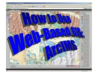
Our Initial Solution • Initial solution was to use ArcIMS Java Custom Viewer • Limitations encountered during development • Very limited object model • Not very flexible • Is based on MapObjects Java 1.0 • Limitations in selection capabilities. • Couldn’t view attribute table • No printing capabilities
Our Second Try • Discovered that ArcIMS Custom Java Viewer applets were built on MapObjects Java…therefore we decided to build our own applets on MapObjects Java • Switched to MapObjects Java 2.0+ • Access to more base objects • Much more flexibility
Challenges • Silent installation – 3 different vendors to work with (ESRI, Sun, Microsoft) • Rewriting/reinventing the wheel • Encountering intrinsic bugs due to the scale of this project
Benefits • Reduce license costs!!! • No desktop installations • All installations are silent behind the scenes over the Intranet • All ArcIMS Java Custom Viewer limitations were overcome • The wheel is now our own wheel to fix and extend
Key IDV functionality • Adding Data • Favorites folder • Geography Network • View metadata
More Functionality • Attributes Dialog
Functionality… Summarize Attributes
Functionality… Single geocoding Batch geocoding:
Functionality… • Manual Label/Annotation
Functionality… Custom Printing
Functionality… View Metadata
Functionality Context Sensitive Help Tutorials FAQ Known Bugs List