Download
1 / 22
220 likes | 223 Views
Explore the uses of maps in forestry, the transition to digital methods, and the benefits of using blogs and online maps with students in forest technology courses. Learn how to utilize GPS data and create embeddable maps with Google Earth and Google Maps.

E N D
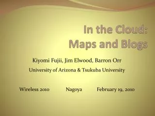
Communicating with Blogs and Online Maps Peter LinehanAssociate Professor of Forestry Penn State Mont Alto Teaching and Learning with Technology Symposium University Park, PA March 29,2008
What is Forest Technology? • A.S. degree program • Stresses practical applications and field work in forestry • Student outcomes • About half the students get employment in forestry and natural resources, private and public sectors • About half complete a B.S. degree, usually in forestry at Penn State School of Forest Resources
Uses of maps in forestry • Forest inventory plots • Trail layout • Timber harvest planning • Forest stand mapping • Wildlife management • Outdoor recreation
Trends in Mapping in Forestry • Previously map-based using compasses • Transition to digital methods: GPS, digital data recorders, GIS • In education need to maintain the fundamental skills and introduce the new technologies • Job market driving the change • Need to communicate geographically oriented data in many ways
Online Mapping • Large number of providers: Yahoo!, Local Live (Microsoft), Google, etc. • Increased resources: maps, data, tools • New tools to create personal maps that can be used in multiple areas • Increased linkage between Google maps and Google Earth
Google Mapping Resources • Google Earth • Excellent coverage for PA • Editing tools (points, lines, areas, labels, photos, hook other data) • Available in Penn State computer labs • Kml format for data exchange • Google Maps • Reads kml files • My Maps option • Editing tools similar to Google Earth • Share, link, or embed maps • Map, terrain, or imagery options
Why use Blogs with students? • Easier than creating stand-alone web pages • Very flexible, easy to update • Can range from basic text to very technically sophisticated • Fun in their own right! • Choice of • outside hosts such as Blogger, Word Press, etc. • Penn State Movable Type blogs linked to PASS account
Forest Technology Courses Using Blogs and Maps • FORT 120 – Forestry computer applications: introduction to IT. Concentrates on Windows, Office (Word, Excel, PowerPoint) and some forestry-specific tools. • FORT 130 – Forest mapping systems: Use of topographic maps, compass, GPS, and computerized mapping • Will be carried into other courses such as Forest Management Practices and Aerial Photo Interpretation
Getting data from the field to Google Earth and Google maps • GPS receiver in the field (Garmin models): waypoints, routes, and tracks • Minnesota DNR Garmin (free data conversion utility) creates kml files • Google Earth and/or • Google maps
Map a State Park -- Identify a favorite park near your home -- Mark the park with a point -- Create embeddable map -- Transfer to blog and write description
Landforms Field Trip -- Field trip to compare contour lines with actual landscape in a hilly part of the Michaux State Forest near campus -- Collect GPS waypoints during field trip -- Convert waypoints to Google Earth -- Import to Google Maps -- Make embeddable map -- Embed in blog and write trip report
Mapping the Waynesboro Reservoir Trail -- Hike around Waynesboro Reservoir to map recreational trail -- Collect GPS waypoints during field trip -- Convert waypoints to Google Earth -- Import to Google Maps -- Make embeddable map -- Embed in blog and write trip report
Mapping Part of the Appalachian Trail -- Get coordinates from Iron Springs topographic map -- Enter points and trail in Google Earth -- Import to Google Maps -- Make embeddable map -- Embed in blog and write description
To Blog and Map or Not Advantages Concerns Takes time and patience. Must be willing to deal with student problems Some students resent the extra work Not a “traditional” report format Technology will change each year. Must be ready to adapt • Combines multiple data sources • Rewards creativity • Product visible to everyone • Can easily track a class with RSS reader • Can serve as introduction to more complicated GIS tools and be used • Good way to illustrate reports
Links • Linehan web page with blog links • Google Maps • Google Earth • Minnesota DNR Garmin • Student Blogs • Coby Cutchall → Oak • Eric Monger → MTBikes • Penn State Mont Alto Forest Technology Program