Download
1 / 19
190 likes | 201 Views
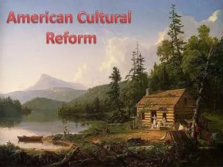
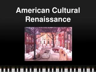
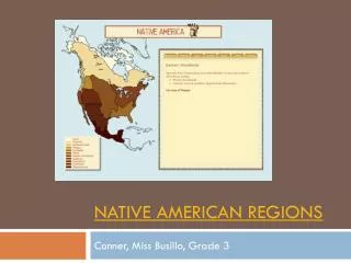
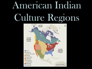
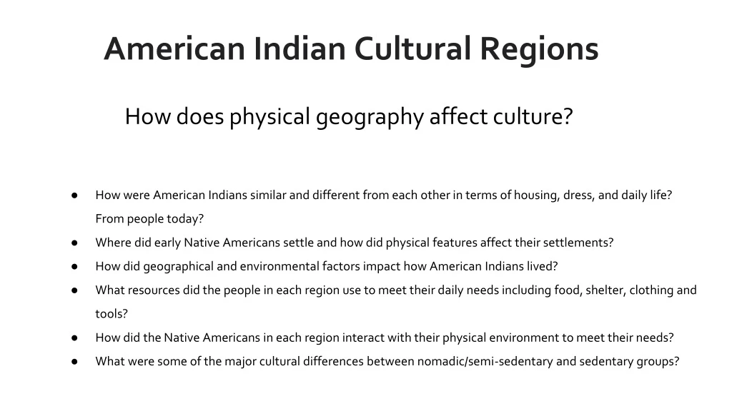
American Indian Cultural Regions. How does physical geography affect culture?. How were American Indians similar and different from each other in terms of housing, dress, and daily life? From people today?

E N D
American Indian Cultural Regions How does physical geography affect culture? • How were American Indians similar and different from each other in terms of housing, dress, and daily life? From people today? • Where did early Native Americans settle and how did physical features affect their settlements? • How did geographical and environmental factors impact how American Indians lived? • What resources did the people in each region use to meet their daily needs including food, shelter, clothing and tools? • How did the Native Americans in each region interact with their physical environment to meet their needs? • What were some of the major cultural differences between nomadic/semi-sedentary and sedentary groups?
QUESTIONS: •Describe the objects you see on the side of the rock wall. •How do you think people over time created this rock art? Why? •What questions do you have about Newspaper Rock? •What can this source tell you about the culture of the people who created the rock art? Petroglyphs at Utah’s Newspaper Rock
Describe the objects you see on the side of the rock wall. • How do you think people over time created this rock art? Why? • What questions do you have about Newspaper Rock? • What can this source tell you about the culture of the people who created the rock art? Highsmith, Carol M, photographer. Petroglyphs at Utah’s Newspaper Rock. United States Utah Utah, None. [Between 1980 and 2006] Photograph.
What do you notice about the language of the map? • Why do you think the map was drawn? • Could an explorer use this map? Is this map accurate? • What type of physical geography and landforms does this map show in the Americas? How would these landforms affect the way people lived? Hondius, Jodocus, and Pietro Todeschi. America Noviter Delineata. [Bologna, Italy: Pietro Todeschi, 167-?, 1670] Map. https://www.loc.gov/item/96686659/.
What elements of physical geography do you see in this drawing? • What can you learn about the lifestyle of the American Indians in this drawing? • How have the American Indians in this drawing adapted to their environment? • Are the Algonquins in this drawing nomadic or sedentary? How do you know? De Bry, Theodor. Americae pars decima. Oppenheimii: Typis H. Galleri, 1619. Library of Congress Rare Book and Special Collections Division.
What types of physical geography and natural resources do you see in this photograph? • How did the Indians at Oklanah, near Lake Superior, adapt to their physical environment? • What questions do you have about this engraving? “Birch-bark Indian Wigwams.” Illustration in Harper’s Weekly, August 5, 1871. Library of Congress Prints and Photographs Division.
Analyze the landscape, what do you notice? Analyze the structure of the nomadic dwellings, how are they similar to settled Indian dwellings? What do you wonder about … who? what? when? where? Why? List one or two things the source tells you about life in this time period in this part of the country. Curtis, Edward S, photographer. Camp at Stony Lake. Ontario Stony Lake, ca. 1905. January 6. Photograph. Library of Congress Prints and Photographs Division.
Timothy O’Sullivan, “A Street — Pueblo of Zuni.” 1873. U.S. Geographical Surveys West of 100th Meridian. Library of Congress Prints and Photographs Division. • What landform do you see in this photograph? • How is this style house adapted to the physical environment of the Southwest? • What are the major differences between Zuni buildings and those of other Indian groups? • What questions does this photograph raise in your mind?
Cayuse Woman and Child
What type of clothing do you see in this photograph? What might it be made out of? In what type of climate might it be worn? • Why do you think the small child is bundled on a cradleboard? • How are the woman and small child similar to and different from women and their children today? Curtis, Edward S, photographer. Cayuse Mother and Child. , ca. 1910. Library of Congress Prints and Photographs Division.
What does this hide painting tell you about what was important in the artist’s culture? • What conclusions can you draw about the physical geography of this group based on the painting? • What questions do you have about this source? Al Momaday, Elk Hide Painting, undated [20th century]. J.W. Wiggins Native American Art Collection. Sequoyah National Research Center, UA Little Rock.
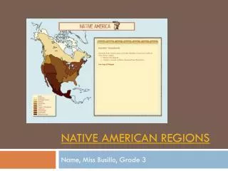
QUESTIONS: Answer the following questions for objects 1-6 using this map to help learn more about each of the other primary sources in this set. Which region did the Native Americans in this primary source live? How would you describe the physical geography in each region? What landforms, bodies of water and natural resources does each region contain? • Answer the following questions for objects 1-6 using this map to help learn more about each of the other primary sources in this set. • Which region did the Native Americans in this primary source live? • How would you describe the physical geography in each region? What landforms, bodies of water and natural resources does each region contain? Sturtevant, William C, and U.S Geological Survey. National atlas. Indian tribes, cultures & languages: United States. Reston, Va.: Interior, Geological Survey, 1967. Map. Library of Congress.