Download
1 / 60
600 likes | 711 Views
Understanding Our Sky:. Clouds. What Clouds Are Made of. Clouds are made of tiny bits of water and ice that would be invisible if they were viewed individually (they are 100 times smaller than a raindrop)

E N D
Understanding Our Sky: Clouds
What Clouds Are Made of • Clouds are made of tiny bits of water and ice that would be invisible if they were viewed individually (they are 100 times smaller than a raindrop) • How many particles actually form together is what determines the size of the cloud and therefore the TYPE of the cloud as well
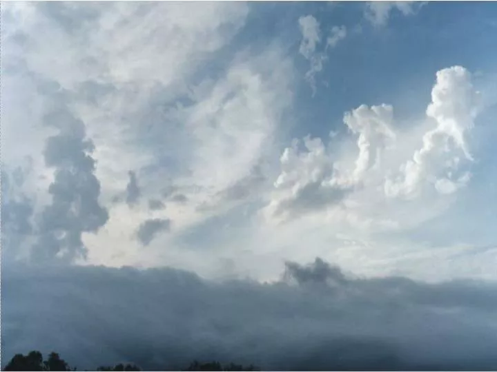
How do Clouds Form • Clouds form when the air cools and water vapor condenses into a liquid • Clouds are formed when the air moves in a VERTICAL direction (which would be if they were moving like a train does, across a service, not up or down)
Clouds form at three different levels Clouds are made in different shapes and size but are always the color white even though sometimes they appear to us to be in different colors (their shade and the level of the sun effect the color we see in clouds) Each type of Cloud is specific to a height level Clouds usually occur within the TROPOSHPERE which is an area of the atmosphere way above earth CLOUD FORMATION
Clouds can be sorted into three types: Low-level Clouds (strato) Mid-level clouds (alto) High Clouds (Cirro) ~ A British Pharmacist was the first man to give cloud types names. The names that he created which are still used today are terms Types of Clouds (Luke Howard) Latin
Cloud shapes Clouds can be classified by their shape and height Flat, spread out clouds Stratus Fluffy, lumpy, heap clouds Cumulus Wispy, curly, feathery clouds Cirrus
Low-level Clouds CUMULUS - large piles of white clouds that can billow high in the sky; they appear during fair weather gray layers of cumulus clouds that may cover the whole sky; they do not usually bring rain dark towering clouds; they are known as thunderclouds because they bring thunderstorms thick, low sheet-like clouds that cover the sky and are a sign of rainy weather sheets of gray, dark clouds that bring falling rain or snow STRATOCUMULUS - CUMULONIMBUS - STRATUS - NIMBOSTRATUS -
Low-level Clouds Low clouds are of mostly composed of water droplets since their bases generally lie below 6,500 feet. However, when temperatures are cold enough, these clouds may also contain ice particles and snow.
cumulus Fair weather cumulus clouds are fueled by buoyant bubbles of air that rise upward from the earth's surface. As they rise, the water vapor within cools and condenses forming cloud droplets. Evaporation along the cloud edges cools the surrounding air, making it heavier and producing sinking motion or outside the cloud. Without a continued supply of rising air, the cloud begins to erode and eventually disappears.
Cumulus Cumulus clouds are usually very isolated with large areas of blue sky in between the clouds. Most cumulus clouds form below 6,000 feet and associated with fair weather. However, when the atmosphere becomes unstable and very strong, upward air currents form, cumulus clouds can grow into towering cumulus. If the atmosphere is unstable enough, cumulonimbus clouds form, (better known as thunderstorms). Cumulonimbus clouds can tower from below 6,000 feet to greater than 50,000 feet.
Cumulus Clouds ~ puffy cotton balls floating in the sky Fair weather cumulus have the appearance of floating cotton and have a lifetime of 5-40 minutes. Known for their flat bases and distinct outlines, fair weather cumulus exhibit only slight vertical growth, with the cloud tops designating the limit of the rising air. Given suitable conditions, however, harmless fair weather cumulus can later develop into towering cumulonimbus clouds associated with powerful thunderstorms.
Stratocumulus Clouds ~ low, lumpy layer of clouds Stratocumulus clouds generally appear as a low, lumpy layer of clouds that is sometimes accompanied by weak intensity precipitation. Stratocumulus vary in color from dark gray to light gray and may appear as rounded masses, rolls, etc., with breaks of clear sky in between.
Stratus clouds Stratus clouds are uniform grayish clouds that often cover the entire sky. They resemble fog that does not reach the ground. Usually no precipitation falls from stratus clouds, but sometimes they may drizzle.
stratus When a thick fog "lifts," the resulting clouds are low stratus.
Nimbostratus Nimbostratus clouds form a dark gray, "wet" looking cloudy layer associated with continuously falling rain or snow. They often produce precipitation that is usually light to moderate.
Mid Level Clouds rounded heaps of white or grayish clouds that look fleecy; they may bring rain grayish-white sheet of clouds that often makes the sky look watery; usually no rain or snow falls ALTOCUMULUS - ALTOSTRATUS -
Mid-Level Clouds "Alto" Clouds Clouds with the prefix "alto" are middle level clouds that have bases between 6500 to 23,000 ft. Because of their lower altitudes, they are composed primarily of water droplets, however, they can also be composed of ice crystals when temperatures are cold enough.
altocumulus Since the individual elements of stratocumulus are larger than those of altocumulus, one can easily decipher between the two cloud types by extending your arm toward the sky. Altocumulus elements are about the size of a thumb nail while stratocumulus are about the size of a fist.
Altocumulus clouds Altocumulus clouds are composed primarily of water droplets and are located between 6,500 and 20,000 feet above the ground.
Altostratus Altostratus clouds are gray or blue-gray middle level clouds composed of ice crystals and water droplets. These clouds usually cover the entire sky. Altostratus clouds often form ahead of storms that will produce continuous precipitation.
HIgh CLoudS thin, wispy white clouds made of ice crystals; they can be seen when the weather will change rippling rows of white fleecy clouds; they can be a sign that a storm is approaching “see-through” white clouds that may cover the whole sky; they can be a sign of a storm coming CIRRUS - CIRROCUMULUS - CIRROSTRATUS -
High-Level Clouds High-level clouds form above 20,000 feet and since the temperatures are so cold at such high elevations, these clouds are primarily composed of ice crystals. High-level clouds are typically thin and white in appearance, but can appear in a magnificent array of colors when the sun is low on the horizon.
~ thin and wispy The most common form of high-level clouds are thin and often wispy cirrus clouds. Typically found at heights greater than 20,000 feet. Cirrus clouds are composed of ice crystals that originate from the freezing of supercooled water droplets. Cirrus generally occur in fair weather and point in the direction of air movement at their elevation. Cirrus Clouds
Cirrus Cirrus clouds are thin, wispy clouds blown by high winds into long streamers. Cirrus clouds usually move across the sky from west to east.
Cirrocumulus • Cirrocumulus clouds appear as small, rounded white puffs. • The small ripples in the cirrocumulus sometimes resemble the scales of a fish. A sky with cirrocumulus clouds is sometimes referred to as a "mackerel sky."
Cirrostratus Cirrostratus Clouds ~ sheet-like and nearly transparent Cirrostratus are sheet-like, high-level clouds composed of ice crystals. Though cirrostratus can cover the entire sky and be up to several thousand feet thick, they are relatively transparent, as the sun or the moon can easily be seen through them.
Wow Look at that Cloud! • Clouds have a lot to do with the weather that we experience on earth. • The sun makes earth warmer and when there are many clouds the sun is blocked which cools the earth. • Clouds bring rain, snow, hail and other sorts of PRECIPITATION.
Clouds can Tell Us what TYPE of Weather to Expect • When you see a STRATUS cloud you can expect drizzle or light rain • A STRATOCUMULUS cloud means snow or drizzle are on their way • ALTOCUMULUS clouds can tell us that the weather may change within the next few days but do not indicate an immediate weather condition • CUMULONIMBUS clouds often bring thunderstorms
Name that Cloud
Low and flat ….. Stratus
Middle level, fluffy ….. Alto -Cumulus
High level, wispy ….. Cirrus
Rain bearing, storm clouds. Cumulo-Nimbus
Clouds with two names