Download
1 / 63
630 likes | 752 Views
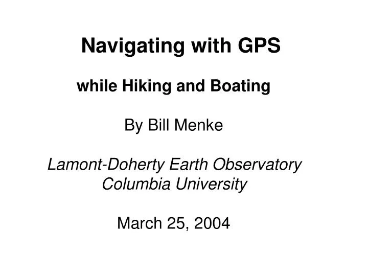
Navigating with GPS. while Hiking and Boating By Bill Menke Lamont-Doherty Earth Observatory Columbia University March 25, 2004. Navigation questions. I ask when I’m outdoors. Where am I ?. Or maybe I really want to ask that dreaded question …. Am I lost ?. or more optimistically ….

E N D
Navigating with GPS while Hiking and BoatingBy Bill MenkeLamont-Doherty Earth ObservatoryColumbia UniversityMarch 25, 2004
Navigation questions I ask when I’m outdoors
Where am I ? Or maybe I really want to ask that dreaded question …
Am I lost ? or more optimistically …
How far did I go today ? How far did I come ? or alternatively …
How far do I have to go ? Or even better …
on the right trail ? Am I really ? ? ? ? ? or finally …
What GPS Gets You Your precise location … … but only if you can see the sky Your elevation … … but not especially accurately Your direction and speed of motion … but only if your moving!
How GPS Works satellites (about 24) in orbit around the earth broadcast (at 1575 MHz): a precisely-timed “ping” their own precise positions
GPS Receivers Receive the satellite broadcasts, and determine the distance to each satellite by the time it takes the ping to travel from the satellite to the receiver determine the position of the receiver by triangulating the known position of at least four (but better 6 to 12) satellites determine the velocity and direction of motion of the receiver by differencing successive receiver positions
Many Models of Receivers Price anywhere from $100 to $1000+
Receivers all equally good at determining your position but differ in added features: Water resistance Power consumption Built in map database Ability to communicate with PC Amount of Memory Display size Built in barometer Built in magnetic compass WAAS-capability HIGH Importance (in my opinion) LOW
Water Resistance In my opinion … a GPS receiver that is not 100% waterproof is 100% worthless I never have a problem keeping my GPS receiver dry !
Power Consumption What kind of batteries does it take ? I prefer units that use AA’s, since AA’s are cheap and readily available How long does it last ? Iprefer units that last at least 12 hours on 2 AA’s (I leave them on all day and change the batteries every morning). Beware: Some GPS watches often use expensive batteries that last just a few hours !
Map Database Digital map quality is getting better every year, but in my opinion is not yet as good as the quality of printed maps. On the other hand, the ability to automatically overlay your desired and actual route on a map is very neat and useful. And in some applications (e.g. hazard avoidance) continuous plotting of position is vital
Typical Digital Maps Source: Garmin Mapsource
Communicate with PC In order to save waypoints that you’ve collected … I do this professionally, when I make geophysical measurements. But I’ve never seen the need to do it hiking. download new maps … keep in mind that the maps are not free. Figure on at least $100. download waypoints and routes that you’ve designed on your PC … again, the software is not free. Figure on roughly $25.
Amount of Memory Maps are memory hogs!
Display Size The bigger the display The easier it is to see a map but receivers with the largest displays are bigger and heavier than receivers with small displays
Built in barometer GPS ability to determine elevation is poor 150 feet vertical compared to 30 feet horizontal measurements of air pressure can improve elevation accuracy On the other hand, how vital are precise elevation measurements ?
Built In Magnetic Compass GPS can only determine your direction of motion. It give directions like a compass, but only when You’re moving. So if you’re stopped (e.g. to compare the map to the terrain), you get no direction. A built in magnetic compass solves this problem. … but, at least with the receiver I use, you have to hold the receiver horizontally in order for the compass to work. You can’t dangle it from the combing of your kayak!
WAAS capability The 30 foot error in GPS locations is mainly due to fluctuations high in the earth’s atmosphere. But these fluctuations are the same everywhere over a wide area. A WAAS base-station measures the fluctuations and transmits correction factors to receivers by normal radio. Thus reducing the error to about 5 feet. In my opinion, WAAS is great for landing a plane on a narrow runway in fog, but it not relevant to hiking or recreational hiking or boating.
GPS Coordinates Latitude North pole: 90°N Equator: 0° South pole: 90°S Longitude Furthest west: 180°W Greenwich, UK: 0° Furthest East: 180°E
1 Degrees = 60 minutes Less than 69 miles 48°N 48°45’N 48°30’N 69 miles 48°15’N 47°N 85°W 84°30’W 84°W
1 Minute = 1 Nautical Mile A minute of latitude, or “nautical mile” is 1.15 miles or 1.85 kilometers So If my map marked off in minutes Its easy to gauge (rough) distances
Navigation with GPS In my opinion, GPS does not replace a printed map and compass. I always carry map and compass, too. Safety is one reason. I allow for the possibility that the GPS receiver fails or runs out of power But also …
Each Tool Has Advantages Compass fast to access if worn around the neck works under dense trees that can block GPS Printed Map Can give you the “big picture” May show features not on digital maps May be more up-to-date
Example Map N 39° 30’ W 1 minute 79° 20’ W
Plotting GPS on Map my GPS screen 39° 28.41 N 79° 22.71 W 30’ 29’ 28’ 27’ 25’ 24’ 23’ 22’ 21’ 20’ 19’ 18’ I’ve just “eyeballed” the distance between the minute marks
But my map has no lat/lon No problem! Navigate by waypoint
Waypoint method, Step 1 Record a waypoint Where you park your car I always name this waypoint “car” For easy reference car
Waypoint method, Step 2 Set your GPS receiver to display distance and heading to this waypoint Set the distance units to whatever is used on the map (feet in this case) car
Waypoint method, Step 3 As you walk, use the heading “I’m walking north” And distance “I’ve come 300 feet from the car” To navigate I’ve come 300 feet North, so I must be here car
Waypoint method, Step 4 As you continue walking add more waypoints when you arrive at easily identifiable places bridges, streams Train intersections summits, lakes, etc. mark them on your map display distance & heading to them intersection 1 bridge 3 bridge 2 bridge 1 car
Waypoint method, Step 5 intersection 2 On the way back use each waypoint in succession Switching to the Next when the distance To the current one gets close to zero intersection 1 bridge 3 bridge 2 bridge 1 car
Avoiding the Hazard You must know its coordinates or at least the coordinates of a safe route You must have adequate time to avoid it and not be distracted doing other things You must allow leeway for errors including both GPS errors and human errors
Hazard Avoidance Why can’t I see the hazard? its night* the weather is horrible* the hazard is invisible underwater obstacle a political boundary *Sure, GPS can help. But maybe you should wait until you can see that hazard? View from cliff edge in dense fog
Following the Channel GPS works well to help guide small craft through navigation channels and past hazards such as shallow water, submerged obstacles, surf, rocks, etc. but …
Following the Channel, continued It needs to be used in conjunction with an accurate navigation chart – preferably with a route set in the receiver and with the receiver displaying both the desired route and your actual track on a map
Map showing route actual route desired route with waypoint
strong currents and winds can force you near a hazard you’re doing your best to avoid But beware I was trying … to head to shore !
Out of my way, beast! But remember, not all hazards are stationary …
Emergency Situations Knowing where you are is only one small element of dealing with an emergency situation … … but it can help … … rescuers find you … … if you can communicate with them … you plan for a “hike out” … … though that is not always the wisest course of action
Communicating your location How much confidence do you have that a 911-operator can properly route an emergency call if all you give for your location is a latitude and longitude ?
Hello 911 I’m at latitude 48° 51.72’ N, longitude 120° 31.92’ W