Download
1 / 21
220 likes | 340 Views
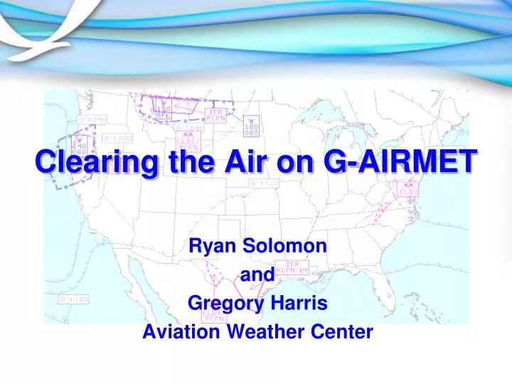
Clearing the Air on G-AIRMET. Ryan Solomon and Gregory Harris Aviation Weather Center. Introduction. The G raphical Air man’s Met eorological Advisory (G-AIRMET) has been operationally produced as a “ supplementary ” product since October 2008.

E N D
Clearing the Air on G-AIRMET Ryan Solomon and Gregory Harris Aviation Weather Center
Introduction • The Graphical Airman’s Meteorological Advisory (G-AIRMET) has been operationally produced as a “supplementary” product since October 2008 • In March 2010 the G-AIRMET became a “Primary” Operational Weather Product • The FAA designation allows pilots and weather briefers to use G-AIRMETs as a primary decision making tool for anticipating and avoiding weather hazardous to safe flight operations
Topics • How it began • Evolution • Safety • Definition • Depiction • Difference from text AIRMET • Available formats • Where to get it
How it began • Text-based forecasts made logical sense 20 or more years ago, when teletype and facsimile were the primary methods of transmitting weather to pilots • A “call” began to be heard from the users of the National Airspace System for higher resolution weather hazard information • G-AIRMET is the collective response from the Federal Aviation Administration (FAA) and the National Weather Service to answer that call
Evolution • Idea to change to a graphical forecast process was born in 2000 • First software prototype released to forecasters in 2003 • Operational production of the G-AIRMET as a supplementary product began in 2008 • G-AIRMET becomes a primary product in 2010
Safety • G-AIRMET thoroughly scrutinized by a FAA Safety Risk Management Assessment Team (including controllers, dispatchers, pilots, and meteorologists) • Team identified potential risks and implemented mitigation measures • Removal of the AIRMET VOR Plot on websites (had potential to confuse users)
Definition The Graphical AIRMET is: • A graphical forecast of en-route weather hazards • A series of snapshots at 3 hour intervals valid for up to 12 hours • 00 hour represents the initial conditions • the subsequent 3-hourly graphics depict the area affected by the particular hazard at that valid time • Routinely issued every 6 hours • Updated as needed
Depiction G-AIRMETs depict the following en-route aviation weather hazards: • Instrument flight rule conditions (IFR) • Mountain Obscuration • Turbulence • Low Level Wind Shear (LLWS) • Strong Sustained Surface Winds • Icing • Freezing Level
F00 F03 F06 F00 F03 F06 Differences from Text AIRMET Aerial Coverage Depth G-AIRMET Snapshots Area of Text AIRMET F00 + F03 + F06 = 6HR Smear
Differences from Text AIRMET WAUS45 KKCI 081445 SLCZ WA 081445 AIRMET ZULU UPDT 3 FOR ICE AND FRZLVL VALID UNTIL 082100 AIRMET ICE...ID MT UT WA OR FROM 80ESE YDC TO 60NW GGW TO 40WSW LWT TO 20S MLD TO 20ESE REO TO 80ESE YDC MOD ICE BLW FL180. • This example shows a 00hr through 06hr G-AIRMET icing forecast for the Western U.S. • The G-AIRMET detail provides greater aerial and depth detail vs. the final Legacy AIRMET • The western edge of the G-AIRMET depicts a shallower icing layer depth, this detail is not correlated in the Text.
G-AIRMET Formats • BUFR “Binary Universal Form for the Representation of Meteorological Data” • Allows users to customize displays • GIF “Graphics Interchangeable Format (GIF)” images • JAVA display • Allows looping, overlaying, and zooming • Coming Soon ... GIS based products
G-AIRMET on the Web AviationWeather.gov • Advisories • SIGMET/AIRMET • Java Tool • US (CONUS) • AWC Oceanic • Graphical AIRMET
Graphical AIRMET Interactive G-AIRMET page allows the user to select: - Individual or multiple hazards - Display the time of interest - Loop the entire set - View Static G-AIRMET Images - View (CONUS) Text AIRMETs
Text AIRMETs • Previously we clicked the • Text AIRMET link. To • view the Text AIRMETs: • Click on the type of hazard. • Click on the area desired. • Click on the Retrieve button. 4. The Text AIRMET will be retrieved in that same window. 5. Click link on top of the page to select another Text AIRMET
G-AIRMET (Interactive and Static Displays, AIR/SIGMET Java Tool & Oceanic SIGMET Displays Currently Active SIGMETs with individual links to each possible SIGMET category Text AIRMETs / SIGMETs AWC US(CONUS) Page Provides “one-stop” shop for: http://aviationweather.gov/adds/
G-AIRMET Summary • No change to text AIRMET • Improves temporal and spatial forecast resolution • Provided in three formats – BUFR, Java, GIF • Allows pilots to maintain high safety margins while flying more efficient routes