Download
1 / 23
250 likes | 459 Views
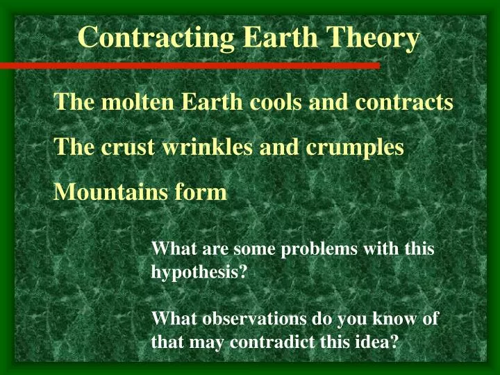
Contracting Earth Theory. The molten Earth cools and contracts The crust wrinkles and crumples Mountains form. What are some problems with this hypothesis? What observations do you know of that may contradict this idea?. The Expanding Earth. 20 th century - radioactive decay

E N D
Contracting Earth Theory The molten Earth cools and contracts The crust wrinkles and crumples Mountains form What are some problems with this hypothesis? What observations do you know of that may contradict this idea?
The Expanding Earth 20th century - radioactive decay Land masses are ripped apart Explains the continents What are some problems with this hypothesis? What observations do you know of that may contradict this idea?
Discussion Questions 1. How did Wegner’s Hypothesis challenge the “contracting Earth model”? 2. How does the distribution of ages of the ocean floor support “Continental Drift” and challenge the “expanding Earth model”?
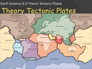
Continental Drift • Proposed by Alfred Wegner in 1915 • Continents are a giant jigsaw puzzle • Put together get Pangea (“all land”) a supercontinent
Evidence for Continental Drift • Jigsaw Pattern Fit • Using the Continental Shelves continents fit nicely • Continents began breakup 200 million years ago
Evidence Cont. • Fossils • Mesosaurus • Fresh waterreptile • Could swim, but not an ocean • Found in South America and Africa
Evidence Cont. • Fossils • Lystrosaurus • Land dwelling reptile • Could not swim • Found in Africa, India, and Antarctica • Cynognathus • Land dwelling reptile • Could not swim • Found in Africa, South America.
Evidence Cont. • Fossils • Glossopteris • Fern • Habitation area dictated by ability of plant to spread. • Seeds to big to be transported by wind. • Found in Africa, India, South America, Australia, and Antarctica.
Evidence Cont. • Rocks • Similar composition, age, and geologic structures on both sides of the Atlantic • When continents are together have continuous pattern
Evidence Cont. • Mountains • See continuation of mountains on both sides of Atlantic Ocean • North America and Europe together have a continuous mountain chain, rock is similar composition and age
Evidence Cont. • Paleoclimatic Data • Evidence of Tropical Climates in non tropical areas. • Evidence of Low-latitude deserts in non desert areas. • Evidence of Glaciers in areas of tropical climates today.
Glacial Deposits Striations Glaciated Areas
Question for Wegner • What is the mechanism of the movement? • Wegner proposed that the tidal influence of the moon was strong enough to move continents. • Continents plowed through ocean crust.
Refining a Hypothesis • Paleomagnetism • Earth has a magnetic field creating a north and south pole – similar to a small magnet. • Magnetic Field has reversed over Earth’s history.
Magnetic Signature • Iron-rich (ferromagnesium) minerals become weakly magnetized in the direction parallel to the existing magnetic field as they cool below 580 oC. • The rock retains the signature unless heated up past 580 oC. • If the rock moves or if the magnetic pole changes, the rock retains the original magnetic signature.
Polar Wandering • Study of lava flows showed that magnetic signature of lava flows of different ages varied widely.
Magnetic signatures indicate that the magnetic poles have moved. • Taken separately with no continental movement, the data indicate different pathways for the pole movement. • If continental movement is incorporated, the polar wandering for the different continents are identical.
Magnetic Reversals and Ocean Floor Data • Earth’s Magnetic field has reversed • In addition to magnetic signature, polarity is recorded in rocks [either normal (present day) or reversed]. • At mid-ocean ridges, new oceanic crust (basalt – mafic composition) is generated and records the magnetic signature and polarity.