Download
1 / 37
370 likes | 375 Views
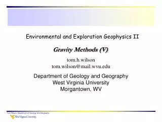
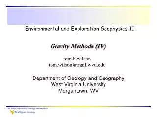
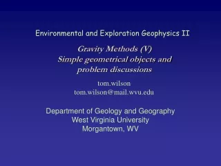
Environmental and Exploration Geophysics II. Gravity Methods (VI). tom.h.wilson tom.wilson@mail.wvu.edu. Department of Geology and Geography West Virginia University Morgantown, WV. Greer 2008 GEM2 Survey. X. z. r. Sphere with radius R and density .

E N D
Environmental and Exploration Geophysics II Gravity Methods (VI) tom.h.wilson tom.wilson@mail.wvu.edu Department of Geology and Geography West Virginia University Morgantown, WV Tom Wilson, Department of Geology and Geography
Greer 2008 GEM2 Survey Tom Wilson, Department of Geology and Geography
X z r Sphere with radius R and density Simple Geometrical Objects - the Sphere Tom Wilson, Department of Geology and Geography
X z r Sphere with radius R and density Anomaly Shape gvert Tom Wilson, Department of Geology and Geography
The Shape Term This term defines the shape of the anomaly produced by any spherically shaped object Where Tom Wilson, Department of Geology and Geography
The Diagnostic Position ½ is referred to as the diagnostic position, z/x is referred to as the depth index multiplier Solve for x/z We found that x/z = 0.766 Tom Wilson, Department of Geology and Geography
That ratio can be solved for at any point on the curve to provide a diagnostic position. 3/4 1/2 1/4 Tom Wilson, Department of Geology and Geography
A table of diagnostic positions and depth index multipliers for the Sphere (see your handout). Note that regardless of which diagnostic position you use, you should get the same value of Z. Each depth index multiplier converts a specific reference X location distance to depth. Tom Wilson, Department of Geology and Geography
Solve for R or These constants (i.e. 0.02793 or 0.00852) assume that depths and radii are in the specified units (feet or meters), and that density is always in gm/cm3. Tom Wilson, Department of Geology and Geography
What is Z if you are given X1/3? … Z = 0.96X1/3 In general you will get as many estimates of Z as you have diagnostic positions. This allows you to estimate Z as a statistical average of several values. Using the above table, we could make 5 separate estimates of Z. This allows the interpreter to evaluate how closely the object approximates the shape of a sphere. Tom Wilson, Department of Geology and Geography
0.56 1.79 0.77 1.31 1.04 0.96 1.24 0.81 You could measure of the values of the depth index multipliers yourself from this plot of the normalized curve that describes the shape of the gravity anomaly associated with a sphere. 0.46 2.17 Tom Wilson, Department of Geology and Geography
Test Review Using the depth index multiplier of 1.305, Z has to be 13.05 km Given that X3/4=z/2.17, then X3/4 =6km Tom Wilson, Department of Geology and Geography
Another Test gmax=0.35 g1/2=0.175 g3/4=0.26 Based on the x1/2 distance and depth index multiplier of 1.305 what is z? Based on the value of x3/4 and the depth index multiplier of 2.17, What is z? Tom Wilson, Department of Geology and Geography
Horizontal Cylinder Vertical Cylinder or or Vertical Dike Sphere Offset Half Plates Half Plate or i. e. a fault Tom Wilson, Department of Geology and Geography
Non-Uniqueness Do you believe it? Tom Wilson, Department of Geology and Geography
At least two possibilities One large thrust sheet vs. two smaller ones - Tom Wilson, Department of Geology and Geography
The large scale geometry of these density contrasts does not vary significantly with the introduction of additional faults Tom Wilson, Department of Geology and Geography
The differences in calculated gravity are too small to distinguish between these two models Tom Wilson, Department of Geology and Geography
Estimate landfill thickness Shallow environmental applications Roberts, 1990 Tom Wilson, Department of Geology and Geography
Crustal Scale Tectonic Problems http://pubs.usgs.gov/imap/i-2364-h/right.pdf Tom Wilson, Department of Geology and Geography
The influence of near surface (upper 4 miles) does not explain the variations in gravitational field observed across WV The paleozoic sedimentary cover Morgan 1996 Tom Wilson, Department of Geology and Geography
The sedimentary cover plus variations in crustal thickness explain the major features we see in the terrain corrected Bouguer anomaly across WV Morgan 1996 Tom Wilson, Department of Geology and Geography
In this model we incorporate a crust consisting of two layers: a largely granitic upper crust and a heavier more basaltic crust overlying the mantle Morgan 1996 Tom Wilson, Department of Geology and Geography
Gravity model studies help us estimate the possible configuration of the continental crust across the region Derived from Gravity Model Studies Tom Wilson, Department of Geology and Geography
It could even help you find your swimming pool Ghatge, 1993 Tom Wilson, Department of Geology and Geography
Gravity Problems - Part 2 Pb. 3 What is the radius of the smallest equidimensional void (such as a chamber in a cave - think of it more simply as an isolated spherical void) that can be detected by a gravity survey for which the Bouguer gravity values have an accuracy of 0.05 mG? Assume the voids are in limestone and are air-filled (i.e. density contrast, , = 2.7gm/cm3) and that the void centers are never closer to the surface than 100m. i.e. z ≥ 100m Tom Wilson, Department of Geology and Geography
Let gmax = 0.1 Recall the formula developed for the sphere. Tom Wilson, Department of Geology and Geography
Pb. 4: The curve in the following diagram represents a traverse across the center of a roughly equidimensional ore body. The anomaly due to the ore body is obscured by a strong regional anomaly. Remove the regional anomaly and then evaluate the anomaly due to the ore body (i.e. estimate it’s depth and approximate radius) given that the object has a relative density contrast of 0.75g/cm3 Tom Wilson, Department of Geology and Geography
residual Regional You could plot the data on a sheet of graph paper. Draw a line through the end points (regional trend) and measure the (vertical) difference between the actual observation and the regional (the residual). You could also use EXCEL to fit a line to the two end points and compute the difference between the fitted line (regional) and the observations. Tom Wilson, Department of Geology and Geography
A. B. C. In problem 5 your given three anomalies. These anomalies are assumed to be associated with three buried spheres. Determine their depths using the diagnostic positions and depth index multipliers we discussed in class today. Carefully consider where the anomaly drops to one-half of its maximum value. Assume a minimum value of 0. Tom Wilson, Department of Geology and Geography
Gravity Lab Write up Follow the standard reporting format. Include the following or similar subdivisions: Abstract: a brief description of what you did and the results you obtained (~200 words). Background: Provide some background on the data we’re analyzing. All of this would come from Stewart’s paper. Explain his approach and answer question 1 below in this section to illustrate his approach. Results: Describe how you tested the model proposed by Stewart along XX’. Include answers to questions 2 through 4 below in this discussion. Conclusions: Summarize the highlights of results obtained in the forgoing modeling process. Tom Wilson, Department of Geology and Geography
Replace questions in the lab manual with the ones listed below. The differences are minor but simplify discussions of edge effects. In your write-up answer the following questions and refer to them by number for identification. 1. The residual gravity plotted in Figure 5 of Stewart's paper (also see illustrations in this lab exercise) has both positive and negative values. Assume that an anomaly extends from +2milligals to -2 milligals. Use the plate approximation (i.e. Stewart’s formula) and estimate the depth to bedrock? What do you need to do to get a useful result? Residuals of any kind usually fluctuate about zero mean value. Remember our discussions of the residual and the densities used in Stewart’s model. What would you guess Stewart must have done to the residual values before he computed bedrock depth? Tom Wilson, Department of Geology and Geography
Note how values are shifted into the negative to bring anomaly variations into consistency with the model densities. Shift to negative Tom Wilson, Department of Geology and Geography
gravity lab questions continued 2. At the beginning of the lab you made a copy of GMSYS window showing some disagreement between the observations (dots) and calculations (solid line) across Stewart's model (section XX' Figure 7). As we did in class and in the lab manual, note a couple areas along the profile where this disagreement is most pronounced, label these areas in your figure for reference, and offer an explanation for the cause of these differences? Assume that the differences are of geological origin and not related to errors in the data. Tom Wilson, Department of Geology and Geography
gravity lab questions continued 3. With a combination of inversion and manual adjustments of points defining the till/bedrock interface, you were able to eliminate the significant differences between observed and calculated gravity. Although you have good agreement between the observations and calculations, do you think the model could still be in error? Recall discussions of how the model oversimplifies the geology. Consider the influence of edge effects along the section. These edge effects were illustrated and computed on several occasions in class. Just repeat those arguments and show your own calculations. Also refer to Stewart’s gravity anomaly map. Tom Wilson, Department of Geology and Geography
gravity lab questions continued 4. After inversion, i.e. after you obtained a good match between the observations and calculations, does the plate approximation (expressed in Stewart's formula t = 130g) work any better as an estimate of bedrock depth in this area? Illustrate by conducting the test at two points along the gravity profile. Note the X location, the anomaly value (after shifting to the negative), actual valley depth in the model, and the calculated result using t = 130 g. Include the above observations in your discussion of Stewart's paper. Use figures you've generated in GMSYS to illustrate your point. All figures should be numbered, labeled and captioned. Tom Wilson, Department of Geology and Geography
Due Dates • Turn in Part 1 (problems 1 & 2) of gravity problem set 3 today. • Turn in gravity lab this Thursday, Nov. 13th . • Turn in Part 2 (problems 3-5) of gravity problem set 3, Tuesday, November 18th. Tom Wilson, Department of Geology and Geography