Download
1 / 16
160 likes | 295 Views
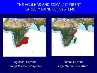
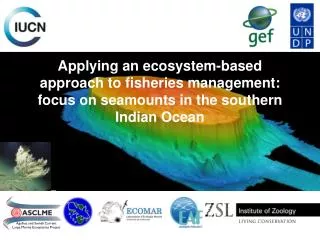
Greta Leber Rosenstiel School of Marine and Atmospheric Science Student Seminar Presentation: December 1, 2010 Advisor: Dr. Lisa Beal. Hydrographic survey of a solitary meander in the agulhas current. BACKGROUND: The Agulhas System. Image Courtesy Dr. Lisa Beal.

E N D
Greta Leber Rosenstiel School of Marine and Atmospheric Science Student Seminar Presentation: December 1, 2010 Advisor: Dr. Lisa Beal Hydrographic survey of a solitary meander in the agulhas current
BACKGROUND: The Agulhas System Image Courtesy Dr. Lisa Beal
BACKGROUND: Description of the ACT Project Line 1: LADCP + CTD During Deployment: Less Synoptic: April 7-15 Line 2: LADCP + CTD More Synoptic: April 17-19 Steamed back for a continuous underway shipboard ADCP section Image Courtesy Dr. Lisa Beal Lowered Acoustic Doppler Current Profiler (LADCP) with Conductivity-Temperature-Depth (CTD) Average Vertical Spacing: 2m Average Horizontal Spacing: 23km
BACKGROUND: Non-meander Phase Agulhas Undercurrent Experiment East London line February-March 2003 Images Courtesy Dr. Lisa Beal
BACKGROUND: Solitary Meander Phase • Solitary Meander Characteristics (de Ruijter et al, 1999): • Downstream velocity ranges from 5 (North) to 20 (South) km day-1, • Diameter ranges from 30-200 km • Period between 50 and 150 days. Marine Remote Sensing Unit; http://www.afro-sea.org.za/mrsu/flags.php
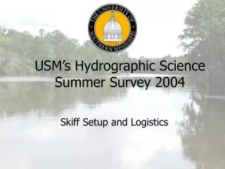
BACKGROUND: Solitary Meander during ACT April 12 April 7 Line 1 Line 2 April 15 April 19 April 17 April 18 Diameter: ~100km Velocity: ~15 km day-1 downstream SSALTO/ Data Unification and Altimeter Combination System (DUACS) Real-Time AVISO MADT Product
ANALYSIS: Direct Velocities (LADCP) Line 1 Line 2
ANALYSIS: Calculating Geostrophic Flow Need a ZVS… commonly: But, we know that the ZVS is V-shaped, so use ZVS from LADCP data: Still no Northeastward (Barotropic Feature)!
ANALYSIS: Calculating Geostrophic Flow • SOLUTION: • Demean the Geostrophic Velocity and add Geostrophic Barotropic component from LADCP.
ANALYSIS: Ageostrophic Flow Line 1 Line 2
SUMMARY AND FUTURE WORK • During the passage of a Solitary Meander, the northward flow strengthens and extends to the surface as a barotropic feature. • Geostrophic velocity is highly sensitive to the choice of a ZVS, with comparison to LADCP barotropic component giving the best results. • Ageostrophic flows in the Agulhas are concentrated in the surface layer. • Next Steps (with the hydrographic data): • Investigate structure of ageostrophic flow (Cylostrophic? Ekman? Data artifact?). • Continue evaluating meander properties (vorticity, mixing, etc.).
ACKNOWLEDGEMENTS THANK YOU! • My advisor, Dr. Lisa Beal. • The crew of the R.V. Knorr • Funded by NSF
BACKGROUND: Description of the ACT Project Images Courtesy Dr. Lisa Beal
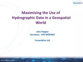
MOTIVATION: Why Study the Agulhas? • Largest WBC in the world (Bryden and Beal, 2005) Large heat and salt transports. • Important inter-ocean link in the Thermohaline Circulation as the so- called ‘warm-water route’ first described by Gordon, 1986. • Upstream dynamics have been linked to frequency of ring-shedding events (Lutjeharms and van Ballegooyen, 1988; van Leeuwen et al, 2000). Zahn, 2009
SSALTO/ Data Unification and Altimeter Combination System (DUACS) Real-Time AVISO MADT Product