Download
1 / 14
140 likes | 246 Views
Haiti Earthquake (12.01.2010, M7.0) surface shift estimation using TerraSAR-X data Christian Minet (1) , Michael Eineder (1) , Nestor Yague-Martinez (2) (1) German Aerospace Center (DLR), Remote Sensing Technology Institute (2) Starlab Living Science, Barcelona, Spain. The Earthquake.

E N D
Haiti Earthquake (12.01.2010, M7.0) surface shift estimation using TerraSAR-X dataChristian Minet(1), Michael Eineder(1), Nestor Yague-Martinez(2)(1) German Aerospace Center (DLR), Remote Sensing Technology Institute(2) Starlab Living Science, Barcelona, Spain
The Earthquake • January 12, 2010 at 21:53:10 UTC • 18.443°N, 72.571°W, 13km depth • ~25 km wsw of Port-au-Prince • left-lateral strike slip faulting and compression between the Caribbean and North American Plate • Septentrional fault system • Enriquillo-Plantain Garden fault system source: USGS
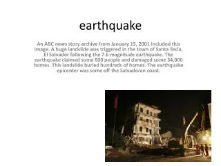
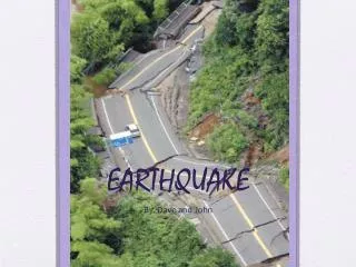
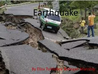
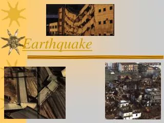
The effects of the earthquake • > 300,000 casualties • > 1.5 m homeless • > 5 bn € of economic loss • collapse of thousands of buildings • large-scale destruction of infrastructure • triggering of landslides • “change” of topography
Available Data • TerraSAR-X Stripmap data (~3m resolution, 30 km swath) • 39.1° & 40.9° incident angle • Data acquisition thanks to DLR’s Center for satellite Based crisis Information (ZK) and the activation of the “International Charter Space and Major Disasters”
TerraSAR-X interferograms • Interferogram formation at remote Sensing Technology Institute, using DLR’s system GENESIS • compensation of topography using SRTM 3” Digital Elevation Model • multilooking of 20x20 pre co post 59 m154 days 20 m330 days 94 m11 days
Incoherent Cross-Correlation • Estimation of shift caused by parallax effects • satellite orbit state vectors (<5 cm accuracy) • SRTM 3” DEM • geometric shift estimation as a-priori information • 128x128 px regular grid(270 m x 238 m) => signal shifts • displacement = signal shifts – geometric shifts
Applied Correctionsexamples for ascending co-seismic datatakes • Location accuracy of TerraSAR-X in the magnitude of a few centimeters • Corrections necessary for: • Solid Earth Tides – numbers from simulation • Zenith path delays – Permanent GPS Station • SET [m] at Port-au-Prince (North, East, Up) 18.02.2009 0.012818, 0.025078, 0.088032 14.01.2010 0.006799, 0.015156, -0.140888 • Zenith path delays from SCUB • 18.02.2009 2439.3 mm • 14.01.2010 2534.0 mm • near Satiago de Cuba, > 300 km distance => ~22 cm => ~9.5 cm
Correlation results • pre-, co- and post seismic LOS deformation retrieved from incoherent cross correlation • colors and arrows indicate size and directions of LOS displacement • combination of estimated range and azimuth displacements pre co post
3D inversion pixel by pixel basis leas squares solution maximum likelihood estimator • y observed displacement vector • Cεε covariance matrix of the measurement error • K transformation matrix • estimated 3D-displacement vector
3D Results • maximum uplift near Léogâne (~0.7 m) • Maximum shiftsup to 0.5 m • general direction at EPGF can be retrieved
Verification • concordant with the general tectonic regimeleft-lateral strike-slip • deformation matches Antony Sladens (Caltech) predictionderived from waveform inversion • uplift matches in-situ observations (Hayes et al, 2010) • uplift of microatolls near Léogane: 0.64 ± 0.11m, patch reef bleeching • change of coastline due to the uplift • ALOS & SPOT 5 data yield corresponding results G. P. Hayes et al “Complex rupture during the 12 January 2010 Haiti earthquake,” NATURE GEOSCIENCE, Vol. 3, Macmillan Publishers Limited, pp. 800-805, November 2010.
Outlook • include more than 2 cross-correlation inputs • include and combine different sources • unwrapped interferogramsof all available sensors • permanent GPS stations • implementation of full error propagation • refinement of path delay • verification of weather models using Corner reflectors • experiments on location accuracy continue, using corner reflectors
Sendai • unfortunately no crossing orbits available • ~3m LOS displacementcould be retrieved byincoh. cross-correlation • deformation map showing wide spread effects bycombination of several pairs=> FRINGE 2011
Thank You! Thank you to the Supersites Initiative and all contributors!