Download
1 / 19
190 likes | 370 Views
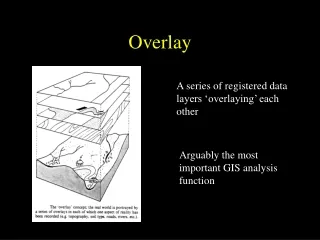
The FalconView Geodata Overlay. FalconView TM. Diverse Map Types Threat / Intel Feed Illumination GPS Moving Map Tactical Graphics Overlay Etc…. Summary of GIS Technologies. OGC Simple Features Standard – A standard way of addressing feature (vector) geometries.

E N D
FalconViewTM • Diverse Map Types • Threat / Intel Feed • Illumination • GPS Moving Map • Tactical Graphics Overlay • Etc…
Summary of GIS Technologies • OGC Simple Features Standard – A standard way of addressing feature (vector) geometries. • GDAL / OGR – Open source library to read and write many popular vector and raster formats. • GeoServer – Open source technology to publish to web services (WMS, WFS, etc.) • PostGIS – Geodatabase technology built on PostgreSQL.
Diagram of Some Major GIS Technologies Standards OGC Software SFA OSGeo WFS QGIS ESRI GTRI ArcGIS GRASS WMS FalconView Google GDAL/OGR GML Google Earth RefractionsResearch GEOS KML PostGIS TOPP GeoTools ESRI GeoServer uDig MapServer Shapefile
Demonstrate Interoperability With • Popular file formats such as PostGIS, KML, .e00 files, and other formats enabled by GDAL/OGR. • Web services such as WMS and WFS. • Interoperability means reading and publishing. • An interoperability framework will make it relatively easy to add support for other formats.
Currently Supported Data Formats • KML – Supports Vector and Raster Formats. File or Web Server based • GML Simple Features – XML standard returned by most Web Feature Servers • Shapefile – Lowest Common Denominator for most Mapping Applications • PostGIS & SQL Server – Simple Features SQL database (DAFIF) • GeoRSS, S-57, FalconView Points and Drawings, WMS, etc.
Building a Common Data Architecture Access the Data though Open Standards based Interfaces Simple Features COM • Using standard interfaces, promote programmatic interoperability • FOSS libraries leverage other development efforts and promotes adherence to standards • Reading and writing open data standards promotes interoperability with other programs Leverage Open Source Libraries LIBKML / GDAL / OGR Read Open Standard Data Formats KML / WFS / SF-SQL
Interfaces • IFvDataSource • Provides a single way to retrieve geospatial data from various data sources • Serves features using OGC’s Simple Features COM Standard • Allows access to FalconView Data • Drawing Files, (Local) Points, Possibly DAFIF or Tactical Graphics
Data Source Data Source Data Sources Data Sets Raster Data Sets Raster Data Sets Data Sets Feature Data Sets Features Features Interfaces
Libraries • GDAL / OGR – OGR is a Open Source C++ Library for reading a variety of vector data formants and serving them out as Simple Features Geometry • LibKML - Google's C++ library for use with applications that want to parse, generate and operate on KML. It is an implementation of the OGC KML 2.2 standard.
Data Architecture KML IFVDataSource IFVDataSource IFVRenderer IFVDataSource IFVDataSource IFVRenderer IFVDataSource (optional) IFVRenderer IFVRenderer IFVDataSource .e00 PostGIS Memory KML Renderer WMS / WFS UniversalVector Renderer FalconViewPlugin Overlays UniversalRaster Renderer Other Renderers ObjectRegistry Geodata (KML) Overlay
Drawing Styles Using Styled Layer Descriptors “A Styled Layer Descriptor (SLD) is an XML schema specified by the Open Geospatial Consortium (OGC) for describing the appearance of map layers. It is capable of describing the rendering of vector and raster data. A typical use of SLDs is to instruct a Web Map Service (WMS) of how to render a specific layer.” - Wikipedia
Placemarks (Polygons, Points, etc.) Google Earth FalconView
Consuming Web Services (WMS) Tree Control Shows Layers Available for Viewing (Generic for all Geodata)
Screen Overlays HTML Text
Ground Overlays / Network Links FalconView Google Earth
The End • Geodata Overlay technical contact: • Joel Odomjoel.odom@gtri.gatech.edu • http://www.falconview.org/ • http://giscoder.blogspot.com/