Download
1 / 66
660 likes | 793 Views
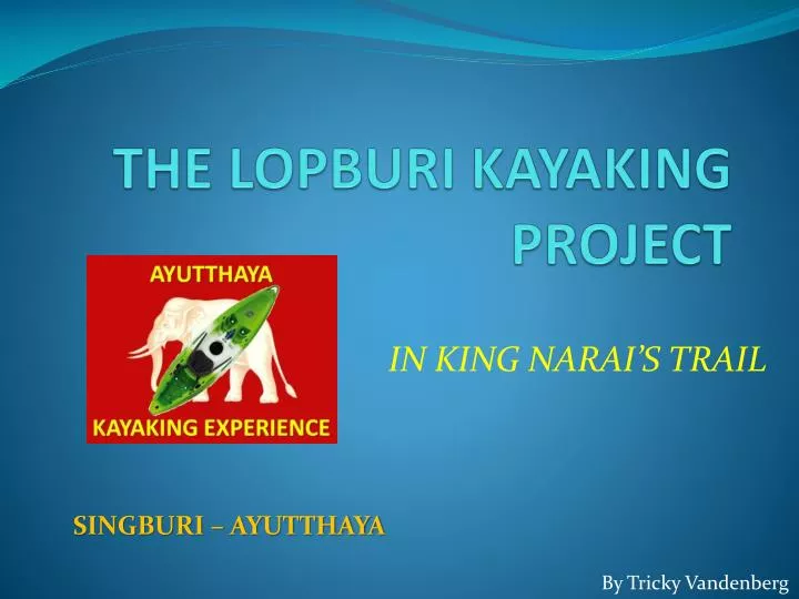
THE LOPBURI KAYAKING PROJECT. IN KING NARAI’S TRAIL. SINGBURI – AYUTTHAYA. By Tricky Vandenberg. THE LOPBURI KAYAKING PROJECT.

E N D
THE LOPBURI KAYAKING PROJECT IN KING NARAI’S TRAIL SINGBURI – AYUTTHAYA By Tricky Vandenberg
THE LOPBURI KAYAKING PROJECT King Narai (r. 1656-1688) used the Lopburi River for his boat travels between the Grand Palace in Ayutthaya and the palace in Lopburi. The latter was built during the years 1665 - 1677 and once served as the King's residence and administrative center during his regular annual stay.
THE LOPBURI KAYAKING PROJECT The King boarded at the Wasukri landing in front of the Grand Palace in Ayutthaya, turned into Khlong Sra Bua, to join the Lopburi in the north. He disembarked at the old royal harbor at the back of the Lopburi palace and entered the Lady's Court through the western gate "YatraKasattri" after climbing a flight of stairs, called "the fifty-one steps". We will follow in King Narai's steps...
THE LOPBURI KAYAKING PROJECT OBJECTIVES • Sport event - Kayak the whole stretch from the mouth of the Lopburi River in Singburi till the confluence with the Pa Sak River in Ayutthaya. • Cultural event - Experience the importance of waterways in the Ayutthayan era - the veins of life of the former Kingdom. • Ecological event - Water = life. Make people aware that the river - a heaven for birds, animals and fish and a source of sweet water - should not be used as an open sewer and garbage collector.
THE LOPBURI KAYAKING PROJECT BANG PHUTSA – PHO KAO TON DAY I
THE LOPBURI KAYAKING PROJECT • Recce Track Bang Phutsa - Pho Kao Ton (1/3) executed on 12 Feb 10. • 30 Km – long route goes west of the City of Lopburi. • Conclusion • Mouth of the river is obstructed for about 100 m. • Descend of the river possible from WatTukRacha onwards. • No water hyacinth blocking passages. • River is fairly open. • Sufficient water level.
THE LOPBURI KAYAKING PROJECT • Minor obstacles: • Fishing nets on 2 places near Asian Highway Bridge. • Floating bridge near Tha Wung Yellow Bridge • Major obstacles • Two dams • Ton Pho Dam • Pho Kao Ton Dam
Mouth of Lopburi River Asian Highway WatTukRacha Ton Pho Dam WatPhra Prang Muni Fishing nets Fishing nets DAY I – TRACK I
Mouth of the Lopburi River (confluence with the Chao Phraya River) near Bang Phutsa. • Photo taken 12 Feb 10.
View near Wat Tuk Racha. • Photo taken 12 Feb 10.
View of Ton Pho Dam. • Kayaks to be taken out of the water prior • arriving at the dam. Ropes needed to • ascend and descend the sloops. • Photo taken 12 Feb 10.
Muang Mu – Fishing net obstacle. • Photo taken 12 Feb 10.
View under the Asian Highway Bridge – Fishing net obstacle. • Photo taken 12 Feb 10.
View from Wat Phra Prang Muni Bridge. • Photo taken 12 Feb 10.
View South of Wat Phra Prang Muni. • Photo taken 12 Feb 10.
Wat Pak Nam Bridge WatPhromBuri Bridge R&R Point 1 Wat Pho Sri WatRampharam Bridge DAY I – TRACK I/II
View from Wat Pak Nam Bridge. • Photo taken 12 Feb 10.
View from Wat Phrom Buri Bridge • Photo taken 12 Feb 10.
Rest & Recuperation Point 1 • View from Wat Pho Sri Bridge. • Photo taken 12 Feb 10.
View from Wat Rampharam Bridge. • Photo taken 12 Feb 10.
WatKet Bridge ThaWung Yellow Bridge WatPinyoSamoson Bridge WatTha Rat Bridge WatSua Bridge R& R Point 2 Wat Pak Khlong Bridge DAY I – TRACK II
View from Wat Ket Bridge. • Photo taken 12 Feb 10.
View from Wat Pinyo Samoson Bridge. • Photo taken 12 Feb 10.
View from Tha Wung – Yellow Bridge. • Photo taken 12 Feb 10.
View from Wat Tha Rat Bridge. • Photo taken 12 Feb 10.
View from Wat Sua Bridge. • Photo taken 12 Feb 10.
View from Wat Pak Khlong Bridge. • Location: Bang Khu. • Photo taken 12 Feb 10. Rest & Recuperation Point 2
Pho TalatKaew Crossing WatSanamChai Bridge DAY I – TRACK III
View from Pho Talad Kaew Road crossing. • Photo taken 12 Feb 10.
View from Wat Sanam Chai Bridge. • Photo taken 12 Feb 10.
Wat Thong Thaeng Bridge Wat Pho Rahat Bridge WatAmphowan Bridge WatThepKhankhon Bridge WatPhromMat Bridge Narai Palace Lopburi Wat Pho Ngam Bridge Wat Klang Bridge Overnight Pho Kao Ton Dam DAY I – TRACK III
View from Wat Thong Thaeng Bridge. • Photo taken 12 Feb 10.
View from Wat Pho Rahat Bridge. • Photo taken 12 Feb 10.
View from Wat Klang Bridge • Photo taken 12 Feb 10.
View of Wat Amphowan Bridge. • Photo taken 12 Feb 10.
View of Wat Thep Khankhon Bridge. • Photo taken 12 Feb 10.
View from Wat Prom Mat Bridge. • Confluence with Chonlaprathan (canal) at Lopburi City. • Photo taken 12 Feb 10.
View of Wat Pho Ngam Bridge • Photo taken 12 Feb 10.
View from Pho Kaw Ton Dam • Photo taken 12 Feb 10. • Night stop
THE LOPBURI KAYAKING PROJECT PHO KAO TON – MAHA RAT DAY II
THE LOPBURI KAYAKING PROJECT • Recce Track Pho Kao Ton – Maha Rat (2/3) executed on 20 Feb 10. • 30 Km – long route goes south of the City of Lopburi. • Conclusions: • No water hyacinth blocking passages. • River is fairly open. • Sufficient water level. • No obstacles. • Proposed Rest & Recuperation points: (later)
WatThammikawat Bridge WatBua WatLuangSuwanaram Bridge WatKhok Pho Kun Chon Bridge DAY II – TRACK IV
View from Wat Bua. • Photo taken 20 Feb 10.
View from Wat Thammikawat Bridge. • Photo taken 20 Feb 10.
View from Wat Suwanaram Bridge. • Photo taken 20 Feb 10.
View from Wat Khok Pho Kun Chon Bridge. • Photo taken 20 Feb 10.
WatKrajiaw Bridge Wat Pho Loi Bridge Wat Ban Dab Bridge WatTako Bridge Wat Yan Sen Bridge WatBot Bridge WatThaoUthong Bridge WatLuangPhorKiauw Bridge DAY II – TRACK IV/V
View from Wat Krajiaw Bridge. • Photo taken 20 Feb 10.
View from Wat Pho Loi Bridge. • Photo taken 20 Feb 10.
View of Wat Ban Dab Bridge. • Photo taken 20 Feb 10.