Download
1 / 55
550 likes | 718 Views
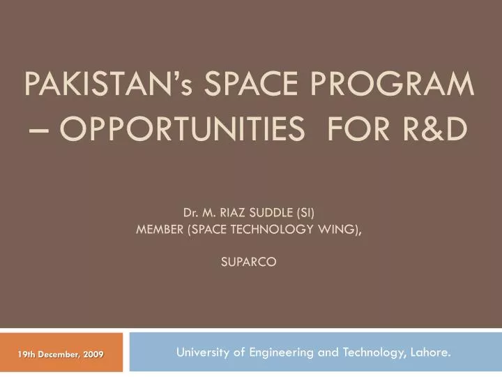
PAKISTAN’ s SPACE PROGRAM – OPPORTUNITIES FOR R&D D r . M. Riaz suddle (SI) member (space technology wing), suparco. University of Engineering and Technology, Lahore. 19th December, 2009. Outline. Introduction Pakistan’s Space Program Current Space Projects

E N D
PAKISTAN’s SPACE PROGRAM – OPPORTUNITIES FOR R&DDr. M. Riaz suddle (SI)member (space technology wing), suparco University of Engineering and Technology, Lahore. 19th December, 2009
Outline • Introduction • Pakistan’s Space Program • Current Space Projects • Satellite related R&D infrastructure • Human Resource Development • Trends in Satellite Communications • Possible Research Directions • Concluding Remarks
Background Pakistan Space and Upper Atmosphere Research Commission (SUPARCO), the National Space Agency is mandated to conduct R&D in space science, Space Technology, and their peaceful applications in Pakistan. It works towards developing indigenous capabilities in space technology and promoting space applications for socio-economic uplift of the country.
Organizational Structure • Chairman • Member (Space Technology) • Member (Space Electronics) • Member (Space Application Research) • Member (Range and Instrumentation) • Member (Finance) • Secretary
Location of Facilities • Karachi • Headquarters • Space Applications & Research Center • Remote Sensing Applications Directorate • Space & Atmospheric Research Directorate • Space Science Section • Karachi Ionospheric Station • Geomagnetic Observatory • Astronomy • National Center for Remote Sensing and Geoinformatics (NCRG) • Satellite Research & Development • Center for Remote Sensing Satellite • Multan • Space & Atmospheric Research Station • Lahore • Satellite Research & Development Center • for Communication Satellite • Telemetry, Tracking and Command (TT&C) station • Space Application & Research Cell • Islamabad • Satellite Ground Station • Ionospheric Research Station • Geomagnetic Observatory • Peshawar • Space Application & Research Center
Major Milestones Achieved • 1961: Established as a Committee • 1962: Launched Rehbar-I and Rehbar-II (two-stage rockets) • 1981: Acquired the status of a Commission • 1989: Established SPOT/NOAA/Landsat Satellites Receiving Station near Islamabad • 1990: Launched its 1st experimental satellite BADR-1 • 1994: Established VHF/UHF/S-Band satellite TT&C station in Lahore • 2001: Launched its 2nd experimental satellite BADR-B • 2002: Leased HGS-3 satellite and relocated it as Paksat-1 • 2008: Initiated implementation of Paksat-1R satellite
Badr-1 Launched on 16 July 1990 from a Chinese launcher (LM-2E) • Project Objectives • To acquire know-how for indigenous development of satellites and to create infrastructure for future satellite development activities • To test the performance of indigenously developed satellite hardware in the space Environment • To demonstrate Store-and-Forward type message communications • To educate the country's academic and scientific community in the tracking and use of low-earth-orbiting satellites • Broad Design Parameters • Size: ~482 mm (sphere) • Mass: ~50 Kg • Life time: 06 months (approx) • Payload: Store and Forward Experiment (SAFE)
Badr-B Launched on 10 Dec 2001 from a Russian launcher (Zenit) • Project Objectives • Development of low cost satellites and creating necessary infrastructure for future satellite development activities • Development of know-how and capability in the field of satellite attitude control and stabilization • Acquire know-how and technology for earth imaging using CCD sensors • Broad Design Parameters • Size: 510mm x 510mm x 465mm (approx) • Mass: ~70kg • Lifetime: 2 years (approx) • Payloads: CCD cameras, Compact Dosimeter, End of Charge Detector, Store & • Forward Experiment (SAFE) • Launched on 10 Dec 2001 from a Russian launcher (Zenit)
Elements of Pakistan’s Space Program • Satellite Development Program • Remote Sensing & GIS Applications • Space Science • Core Technologies Development • International Cooperation • Infrastructure Development
Satellite Development Program • GEO Satellites – Paksat Series • Paksat-1 (Extension) • Paksat-1R • Paksat-MM1 • Paksat-MM2 • Paksat-2
Satellite Development Program • LEO Satellites • PRSS-O1 • PRSS-S1 • PRSS-O2 • PRSS-S2 • PRSS-O3 • PRSS-S3
Current Space Projects • Paksat-1 • Pakistan Communication Satellite System (Paksat-1R) • Remote Sensing Satellite System (RSSS) • Assembly Integration and Test Centre (AITC)
Paksat-1 • Leased from Hughes (USA) in Dec 2002 • Has 34 transponders (24 Standard C, 6 Extended C and 4 Ku) • Current usage about 22.93 TPE (36MHz) • Communication Signal Monitoring and Technical Support from SRDC Lhr • Customers in Pakistan and across Middle East, Africa, East South Asia and Europe
Paksat-1R Satellite • Platform: • CAST DFH-4 • 3-axis stabilized • ≈ 7 KW Power • 15 years service life • Payload: • 12 C-band Transponders • 18 Ku-band Transponders • Coverage/ Footprints: • C-Band: Pakistan, Afghanistan, India, Iran, parts of Middle East, eastern coastal countries of African continent and parts of Europe • Ku-Band: Pakistan, Afghanistan, India, Sri Lanka, Nepal, Bangladesh, UAE, Oman, Parts of Iran and Turkmenistan, Tajikistan, Parts of China
RSSS • Approved in principle by the GoP • Feasibility and System Definition Study conducted in 2007, recommending launch of one Optical and one Synthetic Aperture Radar (SAR) Satellite • Launch of Optical Satellite in the 1st step, having ~2m PAN and ~4m MS resolution and 5-7 yrs life • Implementation will start after the funds are made available
Assembly Integration and Test Centre (AITC) • To facilitate indigenous assembly, integration and testing of various types of satellites of our national needs, including: • Telecommunication • Optical Imaging • Synthetic Aperture Radar (SAR) • Weather • Navigation • Early Warning • Currently in planning phase
Design and Development Labs • Power System Lab • On-Board Computer Lab • Diplexer and Multiplexer Lab • Amplifiers and Filters Lab • Communication System Integration Lab • Telemetry and Telecommand Lab • Electronics Lab • Digital Signal Processing Lab • Attitude Orbit & Control System Lab • Onboard Data Handling Lab • Digital System Lab • RF System Lab • Imaging Payload Lab • Spectrum Engineering Lab
Design and Development Labs (cont’d) • Channel Coding Lab • Source Coding Lab • Embedded Systems Lab • Spacecraft Power Systems Lab • Mechanisms & MEMS Lab • AOC Sensors Lab • AOC Actuators Lab • Satellite Structures Lab • Thermal Control Lab • Attitude & Orbit Control System Lab • TCR Link Security Lab • Spacecraft Propulsion & Pyro Techniques Lab
Design and Development Labs (cont’d) • Satellite Systems Engineering Lab • Satellite Communications Lab • Concurrent Engineering Lab • Mission Planning and Design Lab • ASIC & FPGA Lab • TCR Lab • Solar Array Lab • BCR & BDR Lab • PC&D Lab • System Integration Lab • Transponder Lab • Antenna Lab
R&D Facilities • Satellite Assembly Integration and Test (SAINT) Facility • Environmental Validation Testing (EVT) Facility • Compact Antenna Test Range (CATR) Facility • SAINT Support Workshop (SSW) • Remote Sensing Data Transmission (RSDT) Facility • Satellite Bus Development (SBD) Facility • Satellite Dynamic System Test (SDST) Facility • Attitude and Orbital Control System (AOCS) Center
Indigenous Capability Development (cont’d) • Industry approach: • Prototype/Engineering Model (EM) • Engineering Qualification Model (EQM) • Qualification Model (QM) • Flight Model (FM)/ Proto-Flight Model (PFM)
Indigenous Capability Development (cont’d) • Prototype Paksat-1R • The project was aimed to enhance the know-how of young scientists and engineers about communication satellite engineering. Commercial components were used to keep the cost low since the satellite will only be a functional lab model • Prototype Paksat-1R is a communication satellite, which has three C-band Transponders as the communication payload • All the subsystems have been designed and developed indigenously • Integration and testing have also been performed • The project was completed in three years time
Indigenous Capability Development(cont’d) • Prototype Paksat-1R bus comprised the following subsystem: • Computer (based on Intel 80188EB microprocessor) • Power subsystem • Telemetry subsystem • Telecommandsubsystem • Attitude and Orbit Determination and Control subsystem • S-band RF communication subsystem • Thermal Control subsystem • Satellite Structure • Mechanisms for: • Antenna Deployment • Solar Array Deployment
Indigenous Capability Development Prototype Paksat-1R
Indigenous Capability Development • EQM Paksat-1R: • Already developed sub-systems/units: • On-Board Computer (OBC) • Telemetry Subsystem (TM) • TelecommandSubsystem (TC) • C-band Transponder • S-band Communication Subsystem
Indigenous Capability Development • Customer furnished Instruments (CFIs) • To design, develop / manufacture and integrate into Paksat-1R satellite the following 04 electronic equipment, as an experimental / auxiliary payload for validating their designs and technology: • Telemetry (TM) • Tele-command (TC) • On-Board Data Handling (OBDH) • Power Conditioning & Distribution (PCD) • Mass: ≈ 50 Kg • Volume: ≈ 36”(L) X 30” (W) X 15”(H) • Power Dissipation ≈ 300 Watt
Human Resource Development (HRD) • To meet the huge requirements of the NSDP an ambitious and rigorous HRD programme is being undertaken • Main elements of the HRD program: • MS/PhD (local & abroad) • Short Trainings (local & abroad) • Conferences, Seminar & Workshops • On the Job Trainings (local & abroad) • Hands on Trainings (in-house) • Comprehensive KHTT embedded in Paksat-1R program • Several hundred already trained and a very large number currently undergoing training
Composition of a Typical Satellite • Platform: • Structure Subsystem (SS) • Thermal Subsystem (TS) • Unified Propulsion Subsystem (UPS) • Attitude Orbit Control Subsystem (AOCS) • On-Board Data Handling (OBDH) Subsystem • Telemetry Command & Ranging (TC&R) Subsystem • Electrical Power Subsystem (EPS)
Composition of a Typical Satellite • Payload (either of the following): • Transponder • Optical Telescope/Camera • Synthetic Aperture Radar (SAR) • Infrared Telescope • Radiometer • Atomic Clock
Some Example Satellites SPOT-5 (imaging) Skynet 5 (mil satcom)
Some Example Satellites (Cont’d) Meteosat (weather) GPS (navigation)
Trends in Satellite Communications • Communication Satellite Technology • Modular and expandable subsystems/units/modules • On-board Digital Multiplexing - Skyplex • Flexible Payloads • Milsatcom Payloads • Satellite Communication Applications • Digital Video Broadcast to Handheld via Hybrid Satellite/Terrestrial Network • IP on the move for Aircraft, Trains and Boats • From 3G Mobile TV to Unlimited Mobile TV • Satellite Communication Terminals • Mobile Satellite Terminals • Mobile Digital Satellite News Gathering Systems (M-DSNG)
On-board Digital Multiplexing - Skyplex • Skyplex is a payload designed for onboard digital multiplexing. • The multiplexing facility provides much more flexibility and lower operating costs, because broadcasters can uplink services directly. • Skyplex can receive video, audio and data uplink signals from several different geographic locations, and multiplex them into a single DVB downlink signal. Skyplex Technology-based Communication System
On-board Digital Multiplexing - Skyplex SkyplexNet architecture – examples of two-way services
Flexible Payloads • Requirements: • Match bandwidth and power resource to time varying traffic demands • Trend towards systems with larger numbers of narrow beams • Requirement to support high level of frequency reuse within frequency planning constraints • Transparent digital processing offers a powerful solution which provides the following aspects of flexibility • Flexible channel to beam routing • Flexible frequency mapping • Flexibility in channel gain • Flexibility in channel beam properties • Flexible air interface – including carrier width • Transparent digital processing offers flexibility at a significantly finer granularity than analogue solutions
Milsatcom Payloads • Access to greater bandwidth – Ka band & frequency reuse • Flexibility – Coverage, Power and Bandwidth • Communication to handheld terminals via Higher power payloads • Leveraging Future Military Capability from Commercial Developments
Digital Video Broadcast to Handheld via Hybrid Satellite/Terrestrial Network content adaptation & aggregates TV programs into service bundles Geo-stationary satellites that amplify and convert the DVB-H based signals to the terminals in the targeted IMT2000 frequency band Contains features needed to receive & combine DVB-H based signals Terrestrial repeaters that broadcast the DVB-H based signal to the terminals in the targeted IMT2000 frequency band; hub that maps the service bundles to the satellite carrier resources
IP on the move for Aircraft, Trains and Boats • Satellite technology is used to backhaul a wireless (WiFi or GSM) local loop; it allows the end user to connect his own device (laptop, PDA or mobile phone) to the Internet while traveling the world. • Giving IP connectivity to trains, aircraft and vessels also creates a way for transport operators either to create a new revenue stream, or to use this facility for their own needs. • Such systems are typically based on a classical star topology as deployed for fixed broadband services, the space segment being used as transparent repeaters.
Mobile Digital Satellite News Gathering Systems (M-DSNG) • This system offers a true on-the-move communication for shoot and move applications, e.g. • Disaster • Military operations • M-DSNG enables • Crew to transmit and receive programming while the vehicle is in motion • Increase productivity • Access to cooperate LAN • Access film libraries • VIOP, data • Shoot, edit, transmit story while on the move
Technologies and Engineering Disciplines • Aerospace Engineering • Mechanical Engineering • Electrical/Electronics Engineering • Communication System Engineering • Chemical Engineering • Systems Engineering • Software Engineering • Metallergical Engineering
Relevant Specialist Fields & Technologies • Rechargeable Batteries • Solar Cells and Solar Power Generation • Microwave Systems • Imaging and Inertial Sensors • and Systems • Embedded Systems • Fault Telerant Computer Systems • Space Radiation • Space Structures and Mechanisms • Space Systems Engineering • Thermal Control • Antenna Systems • Composite Materials • Space Materials • Propellants • Polymers • Racket Propulsion • Remote Sensing and • GIS Technologies • Control Systems • Nanotechnology • DSP