Download
1 / 29
600 likes | 2.38k Views
FLUVIAL GEOMORPHOLOGY. Learning objectives Understand basic controls on flood generation and sediment delivery to rovers Define and measure the size and shape of river channels Explain how water and sediment moves in river channels

E N D
FLUVIAL GEOMORPHOLOGY • Learning objectives • Understand basic controls on flood generation and sediment delivery to rovers • Define and measure the size and shape of river channels • Explain how water and sediment moves in river channels • Show awareness that understanding river channel behavior can be used to manage rivers in a more sustainable way
Introduction • Rivers vary greatly from source to mouth and between rivers • Form and shape of river can be transformed overnight by a single large flood • Rivers are dynamic – adjust morphology spatially and temporally • Shape the landscape • Provide threat and resources to humans
Catchment processes: Runoff and river regimes • Catchment runoff is controlled by: • Regional climate • Catchment characteristics (soil, topography, land use, vegetation, geology) • River regime= seasonal variability in the water balance • 4 major river regimes identified: • Snow and ice melt dominated • Temperate oceanic environments • Tropical, non-equatorial river systems • Equatorial rivers • Distinct differences also occur at these regional scales • Flashy regimes • Subdued regimes
Catchment processes:Sediment sources and delivery • Variety of sources: • Hillslope erosion, gully erosion, landslides, floodplain erosion • Arrives in pulses rather than continuous • Temporary storage of sediment (slope bases and floodplains) • Global scale differences • Highest erosion – sparse vegetation or very high rainfall • Sediment yield per unit area is highest for small rivers • Calibre of sediment varies • Sediment yield effected by humans • Poor agricultural practices, construction, deforestation
Dominant discharge concept • Rivers erode and receive sediment input during flood events • flood that does the most geomorphological work = the dominant discharge • Large floods - have most potential to erode and transport • Medium sized flood occur more frequently • do more geomorphological work in the long-term • Small floods -cannot mobilise coarse sediment • In large rivers –most sediment transport by floods occurring between twice each year and every five years • Caution – very simplistic concept • Morphological change lags behind events • Very active rivers – change occurs more frequently
River channel morphology: measuring rivers Channel networks and slopes • Horton (1945) stream ordering; Strahler’s (1957) modification • Long profiles • Important variables • Main stream length • Total stream length • Drainage density • These reflect the combined effects of • topographic, geologic, pedologic and vegetation controls Channel planform • 3 broad types – braided, meandering, straight • Intermediate types – anastomising and wandering • Common measured variable - channel sinuousity
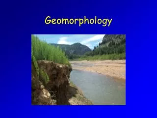
Figure 14.4 Source: Photo courtesy of Dominic Habron
Channel cross section • Requires straight section of river • Measure bank full channel dimensions • Flow resistance at minimum – high conveyance • Complicated by irregular channel sides merging into floodplain Channel boundary materials • Particle size analysis • Sediment mineralogy and roundness • Riverine sediment – well sorted but can be bi-modal • Particle imbrication • Tracers – movement of bed material • Sediment traps
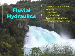
River channel processes:flow hydraulics • 2 principal forces: Gravity and frictional forces • Mean water velocity in an open channel is estimated using the Manning Equation where V is mean water velocity in m s-1 • S channel bed slope (gradient in m per m) • R hydraulic radius • Manning’s ‘n’ is a measure of channel roughness • Quantifying roughness is problematic • Indices of bed grain size are usually used V (m s-1) =
Hydraulic geometry The way in which water velocity, depth and width increase with a rise in water velocity • Expressed as power functions of discharge • Q is stream discharge in m3s-1, W is water width in metres, D is water depth in metres, V is water velocity in ms-1. Since wdv is equal to Q, the sum of the exponents b, f and m and intercept values a, c and k is equal to 1.
Stream power • One of the most important expression of channel flow • Determines the rate of erosion, sediment transport and instability Stream power (W m-1) = Q is stream discharge in m3s-1 S channel slope ρwater density
Channel flow characteristics • Isovels • Lines of constant velocity • Shows cross sectional velocity distribution • Mid-channel = greatest water velocities • Thalweg • Area of maximum flow • Heliciodal flow • Outward direction of flow at a meander • Outside of meander bends become super-elevated • Water flows inwards along the ned in return flow – corkscrew motion
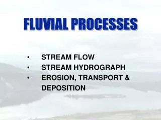
Sediment movement • Washload transport • Fine sediment in river flow (predominantly suspended sediment) • Requires threshold of critical velocity (shear stress) to be crossed • Bedload transport • Almost entirely function of flow volume, velocity and turbulence • Particles roll, slide and saltate at constant rate unless obstructed • Increase in flow strength causes entrainment • Dependent on channel slope, particle size, shape, fluid kinematic viscosity • Fall in velocity causes deposition and hydraulic sorting • Stream competence - max particle size a stream can carry • Stream capacity - max volume of debris a stream can carry • Sediment load is highly pulsed – dependent on sediment supply
River channels:linking processes and morphology • Different elements of a channel’s morphology have different susceptibilities to change and may change over different timescales • Negative feedback allows dynamic equilibrium • Flood events • Valley floor inundation (channel cannot adjust in time) • Relaxation time – time taken to return to original form • Long profile • Controlled by geology, inherited landscape, runoff variability
Channel cross sections • Relationship between downstream increase in discharge and channel morphology = ‘downstream hydraulic geometry’ (Leopold and Maddock, 1953) • Larger channels are more efficient • Boundary roughness decreases downstream – offsets reduced channel slope • Where wb, ab, vb are channel bankfull cross sectional width, depth and velocity values ONLY IN UNIFORM SEDIMENTS – BED AND BANK ERODIBILITY AND SEDIMENT LOAD ARE ALSO IMPORTANT – MORE COMPLEX
Channel planform • Studies have consistently demonstrated that channel slope and discharge are important variables • Threshold slope - channels meander • Higher threshold – channels braid • Critical threshold decreases with increasing discharge • Relationship between planform stream power is complex due to many local variables • Sediment calibre is important • Coarse sediment = mostly braided and wandering • Important to understand channel planform response to management
Channel bed morphology • Down stream fining of bed material particle size and rounding • Perturbations are caused by tributary inputs and bank collapse • Erosion and depositional bedforms: • Pool-riffle sequences • Dunes and anti-dunes • Pot-holes - caused by corrasion, cavitation and corrosion • Bars – variability in grain size • Armoured layer – coarse protective layer
Short-term river channel changes • Both slow and rapid channel changes • Autogenic or allogenic • Cross-sectional change • Planform change • Human induced change • Straightening and embanking • Reservoir construction, urbanisation, mining, land drainage, vegetation changes
River management As previously demonstrated – rivers are not static • ‘Hard engineering’ • Traditionally management strategies - civil engineers • Many dramatic failures • revetments and bridges collapse • return to natural dimensions after straightening and widening e.g. River Mississippi • habitat loss and local extinctions • ‘Soft engineering’ • Working with rather than against natural processes • Geomorphologists have greater role
River maintenance • Where human use of rivers does not allow natural processes • e.g. dams – water periodically released downstream • Glen Canyon Dam, Colorado • Building new river channels • Where natural channels effect urban development • Mirroring ‘natural’ channel behaviour is preferred • E.g. River Nith, Scotland – old natural channel lost to valley floor mining for coal • River restoration • Where human activity resulted in ecological devastation • Morphological diversity benefits ecological carrying capacity • Reinstatement of meanders and riffle-pool sequences • Need careful consideration of river regime equilibrium
Summary • Large variation in water and sediment carried by rivers • Channel size and shape are characterised by cross-section and planform • Channel water is subject to gravity and frictional forces • Velocity has a large impact on stream power • Threshold for sediment entrainment • Bed morphology varies depending on bed material • River channel changes can occur very rapidly causing problems for river management • Fluvial geomorphology plays a very important role in modern river management