Download
1 / 18
180 likes | 185 Views
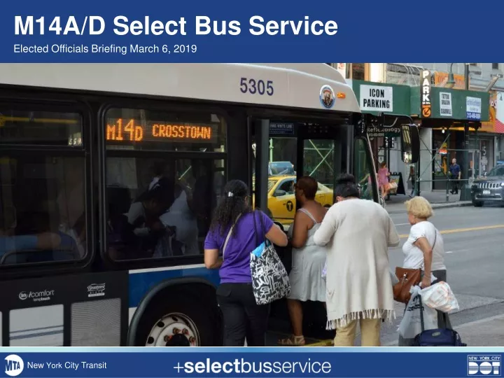
M14A/D Select Bus Service. Elected Officials Briefing March 6, 2019. New York City Transit. Background. M14 Select Bus Service. M14 identified as a critical future SBS corridor in past BRT studies as far back as 2011

E N D
M14A/D Select Bus Service Elected Officials Briefing March 6, 2019 New York City Transit
Background M14 Select Bus Service • M14 identified as a critical future SBS corridor in past BRT studies as far back as 2011 • M14A/D is second-busiest bus route in Manhattan (27,000 daily riders) and second-slowest in NYC • M14A and D connect to 18 subway lines and 16 other bus routes
Planning Process To Date • Extensive public outreach helped to refine the 14th St design in preparation for full tunnel closure • 14th Street markings were partially installed in Fall 2018 • 2018 design was intended for M14 SBS route from 10th Av to Stuyvesant Cove ferry, with local bus service on M14A and D branches M14 Select Bus Service
Moving Forward 14th Street M14 Select Bus Service Public Outreach A/D Branches 14th Street Planning & Analysis A/D Branches Fare Machine Installation SBS Launch 14th St Markings Installation • DOT/MTA are committed to launching M14A & M14D SBS in Spring 2019 • Accelerated public process intended to deliver SBS improvements to L train customers • 14th Street bus lanes could be implemented in time for SBS launch • Bus priority on the Lower East Side branches will be investigated for later implementation
SBS Elements • Toolkit of SBS elements includes: • Camera-enforced bus lanes • Off-board fare collection on M14A and M14D • Bus boarding curb extensions • Better stop spacing • Changes to parking/loading regulations • Signal timing adjustments • Real Time Passenger Information M14 Select Bus Service
M14A/D Performance PM Peak – May 2018 34% 32% 25% 25% 41% 43% M14A M14D • Average Speed • M14A: 4.2 mph • M14D: 4.6 mph • M14 routes spend almost 60% of their trip at bus stops or stopped in traffic
East Side Stop Spacing Improvements • Very close existing spacing on A and D branches means slow service • Proposal maintains approximately every other stop, focusing on higher ridership locations and transfer points • Customers will always be within two blocks of a stop
West Side M14A Adjustment • M14A loop through Abingdon Square requires tight turns and disruption to narrow streets • Proposal removes M14A from Abingdon Square and extends it to 10 Avenue, providing more service on the primary corridor of 14 Street.
14th Street: Vision Zero Corridor • 14th Street is a Vision Zero priority corridor with 7 priority intersections, more than any other Manhattan street • 7th Avenue • 6th Avenue • 5th Avenue • Union Sq West/University Pl • 3rd Avenue • 2nd Avenue • 1st Avenue • 16.8 pedestrians killed or severely injured per mile M14 Select Bus Service
14th Street Design Key Considerations M14 Select Bus Service • Busway markings have been installed • Busway parking regulations and traffic restrictions have not been installed • Changes to street design would require street resurfacing and installation of new markings • Markings cannot be installed until late April or early May at the earliest, due to temperature restrictions
14th Street Design Safety Improvements 2016 DOT Left Turn Study: pedestrians and bicyclists are killed or severely injured by left-turning vehicles at over three times the rate of right-turning vehicles New Restriction Existing Restriction • Proposed Turn Restrictions on 14th Street • Left from 14th St to 8th Av • Left from 14th St to 7th Av • Left from 14th St to 6th Av: DOT will explore exception for buses as part of SBS street design • Left from 14th St to 5th Av • Left from 14th St to University Pl • Right from 14th St to Broadway • Left from 4th Av to 14th St • Left from 14th St to 3rd Av • Other safety improvements to be explored on: • 14th Street: curb extensions, bus boarding space • A and D branches: Curb extensions, bus boarding space, left turn traffic calming, turn restrictions
14th Street Design Options Option 1: Retain Existing Markings M14 Select Bus Service • Designed for 85,000 daily riders during full shutdown • Complicated traffic pattern that may divert through traffic to other crosstown streets • Pedestrian space was designed for pedestrian surges under original tunnel reconstruction plan • Retains parking/loading space for private vehicles on both sides of every residential block • Minimal bus lane markings required in 2019 • Some electeds, advocates have called to retain busway • Traffic restrictions and parking changes would go into effect
14th Street Design Options Option 1: Retain Existing Markings
14th Street Design Options Option 2: Install standard bus lanes M14 Select Bus Service • Provides extensive bus priority outside of tunnel construction zone • Could incorporate pedestrian safety improvements at intersections • Would remove parking/loading on some block faces
14th Street Design Options Parking/Loading (could be on north or south block face) Option 2: Bus Lanes on a Typical Block Curbside bus lane (potential parking/loading at designated times) 1 general traffic lane in each direction SBS stop Manhattan Crosstown SBS examples 23rd Street 34th Street
Next Steps • Ongoing public outreach • West Side Open House: March 7 • East Side Open House: April 8 • Community Boards in March, April, May • Construction at bus stops for SBS fare payment starting March 11 • 14th St detailed design • Updated traffic analysis • Final bus stop and routing plan • Curb regulations development