Download
1 / 30
300 likes | 439 Views
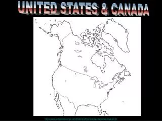
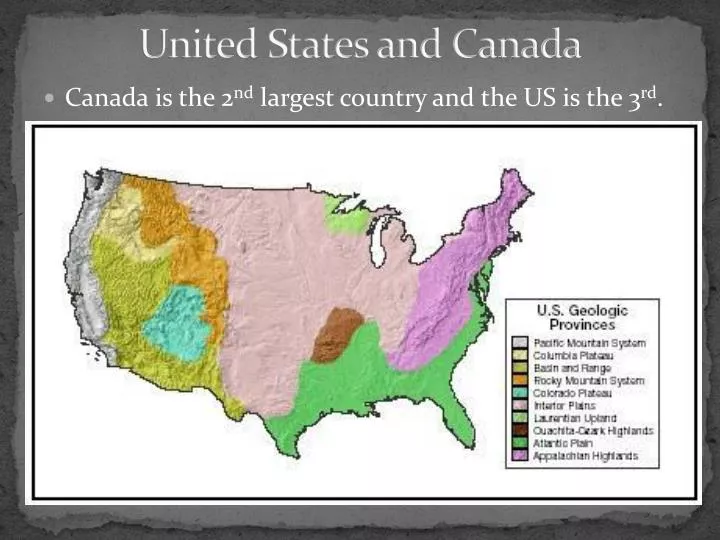
United States and Canada. Canada is the 2 nd largest country and the US is the 3 rd. Landforms. The U.S. and Canada have several major mountain ranges: The Rocky Mountains The Appalachian Mountains Pacific Coastal Ranges. The Rocky Mountains.

E N D
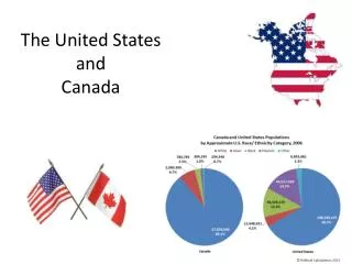
United States and Canada • Canada is the 2nd largest country and the US is the 3rd.
Landforms • The U.S. and Canada have several major mountain ranges: • The Rocky Mountains • The Appalachian Mountains • Pacific Coastal Ranges
The Rocky Mountains • The Rocky Mountains extend about 3,000 miles from Alaska south to New Mexico. They are younger and taller than the Appalachian Mountains. The Continental Divide is the line of highest points in the Rockies that marks the separation of rivers flowing eastward and westward.
The Appalachian Mountains • The Appalachian Mountains extend about 1,600 miles north to south from Newfoundland in Canada to Alabama.
Pacific Coastal Ranges A series of small mountain ranges stretch from southern California to Washington. These ranges are low in elevation and right on the coast. They make the coastline rugged and steep. This area is also on the Ring of Fire and has many active and dormant volcanoes. Earthquakes are common in this area.
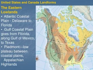
Other Landforms • The Canadian Shield • Interior Lowlands • Atlantic and Gulf Coastal Plains • Basin and Range • Great Plains • Grand Canyon
Canadian Shield • The Canadian Shield is a rocky, mainly flat area around Hudson Bay.
Interior Lowlands • An area that spreads from the Appalachian Mountains to the Rocky Mountains and includes the Great Plains, Interior Plains and part of the Canadian Shield.
Atlantic and Gulf Coastal Plains • These are flat areas that stretch along the Gulf of Mexico in the south and the Southeastern coast of the United States
Basin and Range • This area is mostly in Nevada and it consists of rocky outcroppings of rock and large depressions.
Great Plains • A largely treeless flat area that extends from Canada down to Mexico. The soil is very fertile and good for farming but the climate can be harsh with cold winters and hot summers. This area also gets many tornadoes.
Grand Canyon • The Grand Canyon was formed by water erosion from the Colorado River. The canyon is 277 miles long and ranges in width from 4 to 18 miles. Most of the canyon is in Grand Canyon National Park in Arizona. • See the Grand Canyon skywalk at youtube!
Rivers • Some major rivers in the United States are: • Mississippi • St. Lawrence • Colorado • Columbia • Rio Grande
Mississippi River • The Mississippi River is the second longest river in the United States with a length of 2,340 miles. The river is an important transportation route from the grain producing states of middle America to the Gulf of Mexico.
St. Lawrence River • The St. Lawrence River connects the Great Lakes to the Atlantic Ocean. The river has a system of locks that allow large ships to transport loads of minerals and goods. Part of the river serves as the boarder between Canada and the United States.
Colorado River • The Colorado River flows from Colorado to the Gulf of California. The river formed the Grand Canyon by erosion and it is an important source of fresh water in an arid region. The Hoover Dam on the river provides electricity for Los Angeles.
Columbia River • The Columbia River is the fourth largest river in the U.S. and the largest river in the Pacific Northwest. The river has many dams that are used to create hydroelectric power. The dams have impacted the local salmon industry.
Other Water Features • Some other important water features are: • Gulf of Mexico • Great Lakes • Arctic Ocean • Pacific Ocean • Atlantic Ocean • Hudson Bay