Download
1 / 26
260 likes | 393 Views
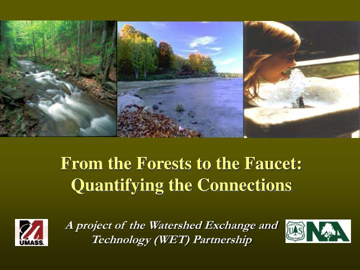
From the Forests to the Faucet: Quantifying the Connections. A project of the Watershed Exchange and Technology (WET) Partnership. Watershed Exchange and Technology (WET) Partnership. Partnership with UMass Focus on water supply watersheds

E N D
From the Forests to the Faucet: Quantifying the Connections A project of the Watershed Exchange and Technology (WET) Partnership
Watershed Exchange and Technology (WET) Partnership • Partnership with UMass • Focus on water supply watersheds • Transfer research results, information and analysis • Communicate importance of forests to water quality • Assist local communities with source water assessment and natural resource planning • Showcase techniques to protect water quality and improve water supply • Develop training in watershed forestry • Support practitioners through NEAFWM
Drinking Water Supply Assessment for the Northeastern Area Objectives • Compile a GIS database to help quantify forest, water, people connections in NA • Evaluate and rank current and future conditions to identify priority areas for conservation and stewardship • Develop one or more sustainability indicators • Guide future work of the WET Partnership • Highlight key areas for investment • Provide useful information for SAP and other regional analyses
Things to consider…. • Basic GIS Overlay Process – no modeling • Used only existing data – readily available with documented sources – EPA and FOTE • Results intended to guide both conservation and management programs
Three Step Analysis Process Step 1: Create a watershed index for clean water – biophysical conditions Step 2:Identify thedistribution of Surface Water Supplies - combine step 1 results with water consumer data (2a) and importance of private forest land (2b) Step 3: Predict future water supply threats from land conversion
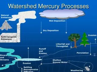
Step 1: Ability to produce clean water (APCW) • Index of water quality and watershed integrity • GIS overlay by 8-digit HUC’s in NA • Attributes rated very high to low on 30 meter grid • Summed by watershed % Forest landHigher % forest land ranked higher. % Agricultural landHigher % agric. land ranked lower. Road Density (% tile)Higher % road density ranked lower. % Riparian forest Higher % buffered ranked higher. Erodible SoilsHigher soil erodibility ranked lower. Housing Density Higher housing density ranked lower. Variables
Some thoughts... • Results dominated by land use • Could expand on ecological features • but suitable data sets were not readily • available across NA • Useful for Criterion 4 • Reasonable correlation with 303d data • but more validation may be needed
Step 2: Existing Conditions (1992) 2a: Prioritize the importance of 8-digit HUC watersheds in NA for water supply from surface water sources • Ability to Produce Clean Water (APCW) • Water Consumers per Unit Area 2b:Prioritize the importance private forests for water supply in 8-digit HUC watersheds in NA • Step 2a + % Unprotected Forest
b These are the surface water supply “workhorses” most dominated by unprotected private forest lands
Some thoughts... • Small to medium sized surface water supplies • dominate New England and Mid Atlantic • Midwest is a mix of surface and groundwater • supplies (run of the river/lake) • Results inform where to focus and acknowledge • stewardship activities as well as where to assist • large municipal water providers – tailoring • technical services • Data useful for finer scale analysis
Step 3: Future Conditions (2030) Prioritize the threats to drinking water supplies presented by development pressure on private forest lands • Ability to Produce Clean Water (APCW) • Water Consumers per Unit Area • % Unprotected Forest • 2000-2030 Housing Density Increase
Green to dark blue indicates high value drinking source water watersheds where development is likely to cause loss of private forest lands and impact the largest number of water consumers.
In an area of focus, the data could be reclassified using pixel-based scoring.
Parcel Evaluations* * From source water stewardship project – WET/TPL 2004
Value of Ecosystem Services:Less Forest Cover = Higher Treatment Costs A 10% decline in forest cover leads to an $8-12 increase in chemical costs per million gallons of water treated. E.g. 26 MGD ($10) = 228.8 (365) = $ 95,000/yr or stated another way… For every 10% decline in forest cover, there may be a 12-15% increase in chemical treatment costs.
Some thoughts... • Regional priorities for Legacy and other forest • conservation activities • Customize information and advice • Targeting assistance to communities and • water providers in threatened areas • Opportunity to quantify the magnitude of the • threat and the cost to society of forest loss
Next Steps… • Review results • Verify top scoring watersheds with field-level experts. • Interpret findings in terms of management • Finalize maps and report for NA, post results on NA & WET Partnership website, article for Journal of Forestry • Prepare data in state by state format • Make metadata available to others • Identify additional questions for analysis & areas for further assessment at 11-digit HUC watershed level.
“The water we drink may be our most important connection to the forest.”