Download
1 / 19
290 likes | 618 Views
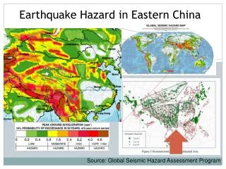
Earthquake Hazard. Session 1 Mr. James Daniell. Risk Analysis Earthquake Risk Analysis. Learning Objectives. Develop an understanding of basic earthquake processes From the source, via a path, to the site Explore seismic principles such as waves and other concepts in terms of hazard

E N D
Earthquake Hazard Session 1Mr. James Daniell Risk Analysis Earthquake Risk Analysis
Learning Objectives Develop an understanding of basic earthquake processes From the source, via a path, to the site Explore seismic principles such as waves and other concepts in terms of hazard Know about ground motion, site effects Know how seismic hazard is integrated into loss models Know the difference between probabilistic and deterministic models Apply hazard assessment to a real situation
Plate Tectonics Tectonic plates are moving relative to each other via a process called plate tectonics Plate Tectonics, mantle, crust, subduction 3
Most earthquakes occur on faults – areas of broken and displaced rocks. There are 3 main types of faults: Strike-Slip, Reverse (compression) and Normal (tension). Earthquakes occur in both oceanic and continental crust at varying depths. Seismic Hazards Strike-Slip Reverse Normal Faults, oceanic and continental crust, reverse, normal, strike-slip 4
How do earthquakes occur? Built up energy, stress and strain release on plate boundaries and faults, via deformed rock vibrating. Initial earthquake rupture occurs on the fault at the hypocentre (also known as focus). Movement (slip) occurs along the whole fault plane with rapid energy release in all directions. Hypocentre, epicentre, slip, fault plane, rupture, elastic rebound 5
What happens when the fault slips? This energy release sends seismic waves into the earth. These waves have a certain wavelength (called period) and a certain amplitude. From the source, the waves travel along the path, and arrive at the earth’s surface (i.e. at the site). The amplitude and period of these waves are measured and called the ground motion. This is measured by a seismometer. Seismic waves, period, amplitude, path, site, ground motion, seismometer 6
Seismic Waves There are 2 types of waves – body and surface. Body waves travel through the earth (primary waves=P waves with a push-pull action, and secondary waves=S waves with an up-down action). Surface waves have both horizontal and vertical motion, have a high amplitude and cause the most damage close to the epicenter. Waves are faster in rock and slower in loose soils. The amplitude of the wave is increased in loose soils. L. Braile, 2005. SDSU, 2009. Body waves, P and S waves, surface waves. 7
Duration and EQ Records The longer the duration of earthquake shaking, in general the greater the damage caused by an earthquake. Measurement can occur at seismic stations by printing out the movement (ground motion) at a certain location – called an earthquake record or an accelerogram. Duration, earthquake record, accelerogram. 8
Size and Distance of Earthquakes To measure an earthquake, we use magnitude or intensity. Intensity Magnitude • Measured from wave amplitude or energy release. • Logarithmic; for a 1.0 increase: 10x ground motion & 32x energy release. • Does not always correlate with damage and many different methods. • Measured from human damage reports. • Simple and easy measurement of earthquake effects. • Not good for physical size of earthquake – more useful for risk. • The distance away from an earthquake source reduces the ground motion/shaking called attenuation. • In areas where many earthquakes occur, this attenuation is stronger than in areas where few earthquakes occur. Magnitude, logarithm, intensity, attenuation 9
How do we measure ground motion? Ground motion is measured using accelerometers/seismometers (spectra-based) or as human impact indices (damage-based). Damage-based indices include MMI which is a 12 class system ranging from no damage to complete destruction based on qualitative measurement of people’s perception of damage at a location. Other similar scales include MSK (Russia), JMA (Japan), EMS (Europe) and Ross-Forel. damage-based scale, MMI, MSK, JMA, EMS, Ross-Forel. 10
How do we measure ground motion? Spectra-based indices include measurements of acceleration, velocity and displacement. PGA (Peak Ground Acceleration) is the maximum amplitude of ground acceleration (measured in m/s2) Spectral Acceleration (Sa) is the ground motion as measured at different periods to find the peaks in ground motion. Waves travel at both short and long periods. PGA, Spectral Acceleration 11
Some other effects on Ground Motion Site soil structure impacts on ground motion. For soft soils, clays etc., increase the shaking of the ground (ground motion amplification) during an earthquake. Topography also impacts on the ground motion; valleys with deep soil layers increase ground motions. Direction of fault rupture can also focus earthquake energy, resulting in greater shaking at a certain location (directivity). Shakemaps show differences in ground motion on maps. Amplification, topography, directivity, Shakemaps 12
Secondary Hazards There are 5 main sources of secondary hazard due to earthquakes: Fire Liquefaction Landslides Tsunami Fault Rupture 13
Earthquake Sequences An earthquake can be a single event or can contain a foreshock or aftershock sequences if the fault needs to release more energy. Note: tree is only to indicate ground level. NOT TO SCALE. • In geologic time (millions of years), earthquakes occur periodically on a fault to release energy. Some faults will have a major energy release every few hundred years on a certain rupture length, whereas some may have earthquakes every million years. Foreshock, mainshock, aftershock, sequence, geologic time. 14
Earthquake Catalogues Earthquakes appear to follow a pattern through time in terms of no. of earthquakes vs. magnitude. More smaller magnitude earthquakes occur than larger magnitude earthquakes worldwide. • At any location, predictive earthquake catalogues can be produced to give people an idea of how often a certain magnitude earthquake or ground motion will be exceeded (rate of exceedance). magnitude-frequency, earthquake catalogue, rate of exceedance 15
How is hazard shown in Building Codes? Generally, buildings should be designed for a certain additional earthquake loading based on this hazard catalogue. Under low probability events, the infrastructure should not collapse and under frequent events, minor damage. Zone V – 0.36g (Intensity IX) Zone IV – 0.24g (Int. VIII) Zone III – 0.16g (Int. VII) Zone II – 0.10g (Int. VI or less) Earthquake zone, building code 16
Ground Motion Prediction Equations (GMPEs) GMPEs or attenuation relations predict the ground motion at sites of interest for a scenario earthquake using existing or simulated earthquake data. A GMPE is of the following form: log[Sa(T)] = median fn(M,R,T,V) + uncertainties, where the spectral acceleration (Sa) can be calculated for given periods (T) • Many models exist around the world • When choosing a GMPE, check for: 1) Tectonic regime (stable or active) 2) Fault type (normal, subduction etc.) 3) Distance 4) Magnitude 5) Geology/Geotechnical Information 6) Location 7) Ground Motion Parameter. GMPE, attenuation relation, tectonic region, uncertainty 17
Deterministic Seismic Hazard Assessment (DSHA) A DSHA is undertaken to calculate the probability of ground motions for a single scenario earthquake, (historical, worst case or otherwise). Useful for emergency planning, seismic risk awareness, simple assessment or high-risk facilities. • There are three main steps: • Define all the possible sources to cause significant hazard at a site using historic data. • Choose a fixed distance, fixed magnitude earthquake and place it on the closest position to the site on each source. • Estimate ground motions via GMPEs to determine the ground motions at the site in terms of PGA, MMI, Sa or other measures. • Variability in ground motions can be modeled within a DSHA but not extensively. Deterministic Seismic Hazard Assessment 18
Probabilistic Seismic Hazard Assessment (PSHA) A PSHA calculates the probability of exceeding all levels of ground shaking at a certain location (all different earthquake scenarios) This is useful for reinsurance/insurance purposes (annual premiums), design code exceedance and government hazard. • It consists of the following steps: 1) Collect data on tectonics & geology 2) Compile an earthquake catalogue for the region 3) Define seismic sources zones 4) Determine magnitude-frequency relationships 5) Select an appropriate set of GMPEs 6) Calculate probability of each level of acceleration 7) Construct hazard curves and maps Probabilistic Seismic Hazard Assessment 19