Download
1 / 60
600 likes | 769 Views
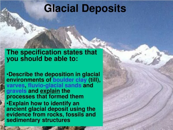
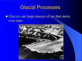
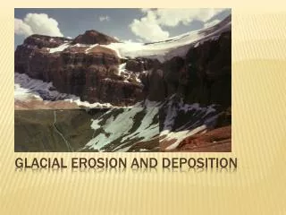
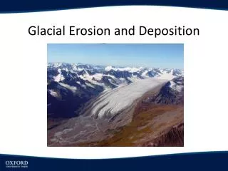
Glacial Erosion. The power of a glacier to move material is a function of its thickness and its speed. The rate of erosion is greatest near the margins of glaciers, and is greater in temperate glaciers than in polar glaciers. Cold-based glaciers, however, often have longer lifespans.

E N D
The power of a glacier to move material is a function of its thickness and its speed The rate of erosion is greatest near the margins of glaciers, and is greater in temperate glaciers than in polar glaciers. Cold-based glaciers, however, often have longer lifespans Erosional processes 1. Abrasion 2. Plucking and Quarrying 3. Moving meltwater: abrasion and dissolution
Abrasion Glacier ice cannot abrade most rock due to softness (even cold glaciers). Rock fragments act as abrasive elements Ice is simply a power source and the matrix within which rock abrades Where do the rocks come from ? Free rocks, subglacial freezing and thawing, quarrying or valley walls Significant abrasion may only occur when large clasts or a large number of particles exist at the base
Quarrying and Bulldozing Glaciers exert compressive forces on obstructing rock and tensile forces when parts of the glacier freeze to the bottom Glaciers are capable of removing fractured segments of rock Loose or fractured substrate can be bulldozed Thrust-faulting can move basal material to the surface Repeated advancing and retreating or changes in applied force load and unload the substrate, causing bending and fracturing. This is exacerbated by freeze-thaw weathering. Pressure melting point varies with snow accumulation, surface melting and crevassing (freeze-thaw zones change). If glacier is frozen to surface and rock is fractured, it may be plucked by the glacier above and incorporated into the ice.
Plucking Mechanism A. Glacier frozen to bed where PMP below surface B. Frozen bed may expand (eg. due to thinning) C. Glacier advances, plucking some of the substrate frozen to the ice D. After several cycles
Subglacial Meltwater Erosion Large amount of water generated at base of temperate glaciers Meltwater may flow through fractures, tunnels and thin sheets. Subglacial lakes form under thick polar glaciers. Sudden release generates powerful subglacial floods. Water flows abrade the substrate because they carry sediment. The water itself may dissolve carbonates.
Erosional features Small-scale features Large-scale features Striae Grooves P-forms Channels Potholes Roches moutonnées Crag and tail Drumlins Flutes Cirque Snow hollows Glaciated valley features
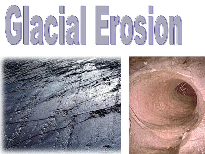
Striae Scratches produced by abrasion Preserved best in fine-grained, brittle rock (eg. limestone, quartzite) Form parallel to flow direction as rocks within the ice matrix abrade the underlying substrate The form of striae provide a clue to the size, concentration and hardness of clasts
A. Multiple sets (deeper ones survive) B. Wedge-shaped C. Nailhead D. Rat-tail E. Polished Surface
Simple striae: Scratches of various length Wedge-shaped Clasts abrade bedrock progressively deeply and nailhead striae: until they are retracted back into the ice (triangular or ellipsoidal) Rat tail striae: Ridges formed downstream from an obstruction due to abrasion Polished surfaces Moving mass of silt or sand finely abrades or fine scratches: underlying substrate Crescentic marks: Presence of moving clast under pressure causes tensional stresses upstream and compressional forces downstream. Gouges or fractures form if bedrock strength exceeded. Crescentic gouges: Semilunate scours, concave upstream formed after a rock fragment is removed from between fractures
Crescentic Gouges
Grooves Linear erosional features formed in solid bedrock: Less than 2m deep and about 50-100 m long. Striae are visible inside. Likely formation mechanism: Large boulders or bands of debris gouge the substrate. Followed by further abrasion by sediments in ice or subglacial water
Potholes: Round (often deep) bedrock scours formed when small cavities are enlarged and deepened by rock clasts caught in turbulent vortices. The original clast is often still in the (now dry) pothole.
Large-scale Erosional Features Formed by glacial plucking, often accompanied by abrasion and flowing water. Roche moutonnée Streamlined forms with a smooth, gentle upslope portion and a steep, jagged downslope portion. Formed by both ice sheets and valley glaciers
Formation of Roche Moutonnée 1. Pre-existing morphological irregularity of some sort (eg. small outcrop of relatively hard, especially igneous rock) 2. High stresses form upstream causing basal melting and the glacier slides 3. Embedded clasts abrade the bedrock upslope 4. Downslope, there is a pressure drop, so the pressure melting point rises. The glacier freezes to the base. 5. As glacier pulls away, tension causes quarrying or plucking of fragmented rocks downslope.
Roche moutonnée, Yosemite national Park Roche moutonnée, north of Ottawa, Ontario
Crag and tail Consists of a resistant bedrock knob and a streamlined remnant of bedrock or sediments on the tail (lee side). Crag and tail, Princess Mary Lake, Nunavut
Flutes Sub-parallel grooves with ridges of variable size They form in flat areas, parallel to the direction of glacier movement Form on bedrock or sediment-covered terrain. Mostly erosional, but also depositional as basal sediment is squeezed into fractures at the base of the glacier.
Fluted terrain, Peterborough, Ontario
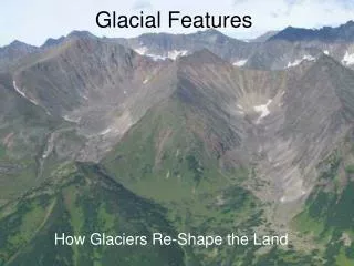
Cirque How are they formed ? Small, thin glaciers near the snowline respond to rapidly changing climatic conditions. Rotational mass movements of the glacier carry ice and sediments toward the lip of the hollow Erosion is efficient because of frequent freeze-thaw weathering Sculpts mountains into steep arêtes (ridges) and horns (pyramidal mountains). The same process may sculpt nunataks Nivation Hollows Small niches cut into the sides of mountains through freeze-thaw cycles that break up local rocks and the movement of the resulting sediment downslope
Pyramidal form (horn) caused by cirque erosion (Matterhorn, Swiss Alps)
Glaciated Valleys Scoured by streams, then modified by glaciers Traverse Shape:U-shape in cross section (glacial modification of V-shaped fluvial valley) How does it change to a U-shape ? 1. Velocity of glacier higher at mid-sections of V-shaped valley walls than at base or upper sections of wall 2. Velocity may reach zero at the base and upper sections of valley walls. A U-shape is most efficient for glacier flow.
Longitudinal Profile: Generally, glaciers help to straighten and deepen valleys. 1. Erodability usually varies along longitudinal profile as a result of lithological and structural characteristics: eg. shale eroded preferentially to granite. This leads to steps.
Hanging valleys form where small glaciers meet larger ones due to their weaker erosive capability Glaciated valleys can be carved and then flooded during and/or after ice retreat, resulting in fjords. Sognefjord, Norway
Glacial Transportation, and Depositional Landforms DRUMLIN FIELD TERMINAL MORAINE
Glacial Transportation Types of Glacial Drift Supraglacial Drift Subglacial (Basal) Drift Englacial Drift Sediment added to a glacier by (a) plucking and abrasion of the substrate (b) falling from side or head walls of valleys and nunataks (c) wind transportation of material onto glacier surface
Ice sheets get most of their sediment load from the surface Valley glaciers get their sediment from both the bed and side Sediments are transported (a) above the glacier (supraglacial drift) (b) within the glacier (englacial drift) (c) at the base (subglacial or basal drift) Particles tend to concentrate in patches called moraines (a) lateral moraines are derived from the valley walls (b) medial moraines form from the joining of lateral moraines (c) basal moraines form from the material eroded at the base (d) internal moraines form when sediments fall into crevasses, where lateral moraines coalesce at the confluence of glaciers or when basal drift is thrust upward at the terminus (thrust- faulting)
Subglacial drift - composed of material derived from the local substrate (some clasts may be added from other parts of the glacier or from previously-deposited glacial sediments) - subglacial drift, where there is basal melting, forms a water- saturated moving carpet, facilitating basal sliding - clasts abrade against bedrock and may also be crushed - fine powder or silt can also develop as a by-product of abrasion Supraglacial drift - Important in valley glaciers in which the confining walls provide the material (largely angular particles) - In ice sheets, from nunataks, upward thrusting of basal material and windblown sediment Glacial Deposition Till: Material deposited directly by a glacier
Glacial Landforms Formed by Glacial Sediments • Drumlin Shape: • Oval, streamlined, hills, shaped like inverted spoons or tear-drops (blunt, rounded heads and long, pointed tails along a straight axis). Lemniscate loop shape. Simple or composite • Generally 1-2 km long, 400 to 600 m wide and 15 to 30 m in height • (“rock drumlins” can be larger) • Vary in size and shape, especially in different fields • Often occur in staggered pattern associated with small end moraines, and eskers
Drumlin Composition: • Composed of till, sometimes • stratified • Drumlin Origin: • Erosional Hypotheses • Depositional Hypotheses • Meltwater Hypothesis
Erosional Hypotheses: • Some drumlins have stratified material, always draped by till • Pre-existing sediments get waterlogged and are reworked easily by advancing temperate glaciers • Drumlins form around points where little or no deformation occurs (possibly associated with stress patterns within the glacier) and are eventually overlain with till
Depositional Hypotheses: • Theory 1: • Some sediment at the base of the glacier is granular dilatant material • This material must expand to move but this is not possible until a limiting stress level is reached • Once this strength overcome it becomes thixotropic and can flow and plaster around nuclei of more resistant, drier or coarser sediment • Streamlined deposits occur which can eventually become drumlins unless effective glacier power is too high (everything eroded) • Drumlins form within a restricted range of pressure (perhaps the pressures that are encountered behind end moraines)
Theory 2: • Under a glacier, sediments with pressured, interstitial watersmove at different speeds in a “deformation carpet.” • Finer particles move faster in a pressurized slurry • Coarser materials are less easily moved, so static or slow moving obstructions develop and finer materials form streamlined mounds around these obstructions • Basal drift or previously-deposited material
Meltwater Hypothesis: • Drumlins form from catastrophic meltwater floods under temperate glaciers • During peak discharge, glaciers float: flood melts and abrades streamlined caverns in the glacierabove. • The flow is reduced within these caverns and deposits material within them. • The glacier then melts, draping the mound in till.
Esker: A sinuous low ridge composed of sand and gravel formed by deposition from meltwater running through a channel beneath or within glacier ice.
Moraines: • Accumulations of glacial sediment that form under moving parts of glaciers and under stagnant ice at glacier margins • 1. Ground Moraines • 2. Terminal Moraines • 3. Recessional Moraine • 4. Interlobate Moraines • 5. Push Moraines • 6. Ice-thrust Ridges • 7. Lateral Moraines • 8. Prairie Mounds • 9. Moraine Plateaus • 10. Till Ridges
Ground Moraines Basal lodgement till, often draped by ablation till Deposited by rapidly retreating glaciers Usually less than 3m in thickness Corrugated surface with irregular ridges transverse to flow direction and fluting parallel to ice flow
Terminal Moraines One or moresubparallel ridges of accumulated glacial drift at the front of a glacier Similar in shape to the glacier terminus Formed becauseglacier terminus remains stationary while the rest of the glacier continues to carry sediment to the landform Often have a hummocky topography (knobs and kettles) Knobs and kettles are the result of differential ice melting and sediment release
Topographic map of hummocky topography of a terminal moraine
Two different explanations of end moraine formation have been identified: Method 1 An actively-forming terminal glacier often has (a) white ice zone (b) black ice zone (thin debris cover) (c) ice-cored zone with thick debris
Ice melts fastest in the black ice zone, creating a depression Sediment slumps into the depression, eventually creating a thicker deposit, causing it to become an ice core stagnant zone (slower melt) Eventually the glacier ice of the region is totally melted and new patterns of white ice, black ice and ice-cored zones develop, leaving a series of ridges (eg. Barnes’ Ice Cap, Baffin Island)
Method 2 • Moraine ridges due to back-shifting of thrust zones behind the stagnant terminus of the glacier • Rate of glacier movement and melting rate are variable • More active periods cause more thrusting and more debris is brought to the terminus • During lower activity, the glacier thins by melting and debris-laden zones become stagnant • Eventually, the glacier becomes more active again and a new zone of higher accumulation occurs upslope from the earlier ridge • Thrust-moraine moraine landscape develops
Cross-sectional diagram of ground and end moraines. Recessional Moraines Moraines formed in the same way as end moraines, during short-lived interruptions in glacier retreat (upslope from the main end moraine features)