Download

1 / 20
200 likes | 519 Views
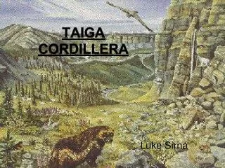
Arctic Cordillera. Adam Bell & JJ is a fag. Intro.

E N D
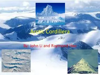
Arctic Cordillera Adam Bell & JJ is a fag
Intro Arctic Cordillera - The Arctic Cordillera is a mountainous area of ice and rock. Due to the cold dry climate, harsh winds, and limited soil, plant life is scarce. It tends to be found huddled in small, more favorable pockets in sheltered areas and south-facing slopes Purple saxifrage, bilberry, and mountain sorrel are some of the hardy species which can be found in these localized areas. Animal life is also limited except in the rich marine environment which supports important populations of polar bears, seals and whales. The warmer coastal areas welcome crowds of seabirds, including little ringed plover and black-legged kittiwake, among others.continued on next page
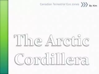
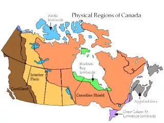
Ice and rock reign supreme in the Arctic Cordillera Ecozone, an area featuring some of the world's most spectacular mountain glacial scenery. Massive ice caps and tonguing glaciers mask many of the rugged mountains. Some of Canada's highest but least-known peaks are found here, towering over gaping U-shaped valleys and deep fiords that extend many kilometers inland. A vast mountain chain forms the spine of this ecozone. It runs along the northeastern fringe of the Northwest Territories and Labrador, dominating Labrador, eastern Baffin, and Devon islands and most of Ellesmere and Bylot islands. Because of the extreme cold, high winds, and lack of soil, the higher portions of this ecozone are largely devoid of plants and animals. Ice barrens and frost-shattered rock prevail over much of the landscape. Continued on next slide Location
Location At lower elevations, pockets of tundra meadow dotted with arctic flowers and ground-hugging shrubs occupy sheltered valleys, streambanks and coastlines. During the brief arctic summer, these sites are oases of concentrated life. In contrast to the biological impoverishment of the land, the adjacent fiords and nearshore waters are richly endowed with marine life. Complex current systems, localized upwellings of nutrients, and “polynyas” (which remain ice-free year round) create the Arctic's most productive aquatic ecosystems. Among the animals living here are globally significant populations of Polar Bear, Narwhal Whale, and the endangered Bowhead Whale. Although elements of the last ice age persist in the Arctic Cordillera, the region is a land of surprising vitality. Even the ice itself can come alive to the eyes and ears of patient observers.
Vegetation Ice and bald rock dominate 75% of the Arctic Cordillera. For plants and animals, this is one of the most inhospitable places on earth. To the north, ice caps prevail; to the south, glaciers are more common. Even lichens, which as a group are immensely adaptable, are largely absent from the area. Summer lasts just a few weeks and killing frosts are not unknown throughout the season. The average July temperature is only 5oC. Soils are virtually non-existent over much of the area due to ice cover and the slow rate of soil formation. Moreover, the area receives about the same amount of precipitation as the Sahara desert. What little moisture there is in the soil, or in plants themselves, is liable to be sucked away by fierce arctic winds. In spite of the generally severe conditions, several hardy plant species flourish where moisture, heat, and nutrients create favorable microhabitats. Isolated pockets of biological productivity can be found in sheltered stream banks and coastlines, south-facing slopes watered by late-melting snow, and fertilized areas near animal dens and bird perching sites. Continued on next page.
Vegetation Arctic plants share several characteristics that help them cope with the extreme conditions. Most hug the ground to avoid the chilling and drying effects of summer winds and to ensure protection beneath the snow in winter. Some species grow in dense mats or cushions, creating tiny forests where temperatures can be 10oC to 20oC warmer than the air just above the plants. For added insulation, many species are covered with thick heat-trapping and wind-stopping hairs. For those who know where to look, this seemingly desolate landscape will yield surprising floral treasures. Once discovered, the best way to enjoy them is on hands and knees, since few plants reach the height of a hiking boot. The inevitable rewards in color, fragrance, and, in some cases, taste will make the search worthwhile. Continued on next page
Vegetation Legend 1. Arctic Poppy2. Purple Saxifrage3. Mountain Avens4. Diapensia5. Crustose Lichens6. Cottongrass7. Mountain Sorrel8. River Beauty9. Moss Campion10. Arctic Willow11. Bilberry12. Arctic White Heather
Wildlife of Arctic Cordillera Land mammals are rare in the Arctic Cordillera. This is due mainly to the sparse plant life, which is the foundation of all mammalian food chains. Arctic Hare, Arctic Fox, Ermine, and the Collared Lemming are among the few species to call the region home. However, their densities and abundance are generally much lower than in arctic habitats endowed with more plant cover. In most cases these animals thrive in pockets of higher plant productivity along moist sheltered streams and coastal areas. Also favouring these habitats are the few species of songbirds and shorebirds that come to the far north to breed. Most common are Hoary Redpoll, Little Ringed Plover, and Snow Bunting. Continued on nexed slide
Wildlife of Arctic Cordillera This ecozone is mainly devoid of large land mammals, although in coastal areas the occasional Polar Bear strays as far as 100 km inland. For the most part, Polar Bears stay close to the sea, where biological productivity is many times higher than on land. In spring and early summer, Polar Bears take to the water and drifting ice floes in search of Ringed and Bearded Seals, their preferred prey. When the ice breaks up in August, Polar Bears come ashore to feed on mussels, starfish, birds' eggs, and carrion. Though Polar Bears are usually solitary, a beached Bowhead Whale carcass may attract a group of over 40 bears. Besides Polar Bears, seals, and whales, the region’s unusually productive marine waters support large concentrations of seabirds, which congregate by the thousands. The waters surrounding Bylot Island and within Lancaster Sound support huge breeding colonies of Northern Fulmars, Thick-billed Murres, and Black-legged Kittiwakes. Contineued on next slide
Wildlife Legend1. Thick-billed Murre2. Beluga Whale3. Northern Fulmar4. Hoary Redpoll5. Snow Bunting (female in foreground)6. Common Ringed Plover7. Walrus8. Ringed Seal9. Common Eider10. Black Guillemot11. Narwhal12. Polar Bear
Landforms The ecozone contains one of Canada's two major mountain chains. The mountains of the Arctic Cordillera span two geological "provinces," each with its own distinctive rock type. The mountains of volcanic rock range in age from 1.2 billion to 65 million years old. The mountains of southeastern Ellesmere and eastern Baffin Island belong to the older Churchill province, which is typified by Canadian Shield rock, a mix of granites, metamorphic gneisses, and ancient sediments. Glacial ice engulfed northern Canada near the beginning of the Pleistocene epoch 2 million years ago. Since then, huge glaciers, far exceeding the depth and extent of present ones, have swept over this landscape at least four times. The main paths of the Pleistocene glaciers are marked by deep U-shaped valleys, which in coastal areas merge with steep-sided fiords that may rise over 1 000 metres above the sea. Past and present glaciers have created bowl-like cirque basins, pyramidal peaks called horns, knife-edged ridges or aretes, and other landforms. Continued on next slide
Landforms The main paths of the Pleistocene glaciers are marked by deep U-shaped valleys, which in coastal areas merge with steep-sided fiords that may rise over 1 000 metres above the sea. Past and present glaciers have created bowl-like cirque basins, pyramidal peaks called horns, knife-edged ridges or aretes, and other landforms. After being depressed into the Earth's crust by the colossal weight of Pleistocene ice, the landscape is now rising, in places by as much as 30 cm per century. Raised beaches now well back from existing shorelines attest to this continuing process. The climate is typically harsh, with long, extremely cold winters and short, cool summers, although the brief summer growing season is enhanced by long periods of daylight. Only July and August have mean daily temperatures above the freezing point. Eureka, Canada's coldest and most northerly weather station, has an average annual temperature of -19.7oC and a February mean monthly temperature of -38oC. A typical year sees just 250 mm of precipitation, although it is much higher in Labrador.
Legend1. Sedimentary rock 2. Moraine3. Glacial erratic4. U-shaped valley5. Ice cap6. Valley glacier7. Calved ice from glacier8. Raised beach9. Talus slope10. Granitic and metamorphic rock11. Cirque glacier12. Iceberg13. Sea ice14. Outwash fan15. Horn16. Arete Landforms
Environmental Area: total: 14.056 million sq km note: includes Baffin Bay, Barents Sea, Beaufort Sea, Chukchi Sea, East Siberian Sea, Greenland Sea, Hudson Bay, Hudson Strait, Kara Sea, Laptev Sea, Northwest Passage, and other tributary water bodies. Related Resources• ANWR• Arctic Ecology• Future Area: comparative: slightly less than 1.5 times the size of the US.Coastline: 45,389 kmClimate: polar climate characterized by persistent cold and relatively narrow annual temperature ranges; winters characterized by continuous darkness, cold and stable weather conditions, and clear skies; summers characterized by continuous daylight, damp and foggy weather, and weak cyclones with rain or snow.
Legend1. Sedimentary rock 2. Moraine3. Glacial erratic4. U-shaped valley5. Ice cap6. Valley glacier7. Calved ice from glacier8. Raised beach9. Talus slope10. Granite and metamorphic rock11. Cirque glacier12. Iceberg13. Sea ice14. Outwash fan15. Horn16. Arete Environmental
Environmental Terrain: central surface covered by a perennial drifting polar icepack that averages about 3 meters in thickness, although pressure ridges may be three times that size; clockwise drift pattern in the Beaufort Gyral Stream, but nearly straight-line movement from the New Siberian Islands (Russia) to Denmark Strait (between Greenland and Iceland); the icepack is surrounded by open seas during the summer, but more than doubles in size during the winter and extends to the encircling landmasses; the ocean floor is about 50% continental shelf (highest percentage of any ocean) with the remainder a central basin interrupted by three submarine ridges (Alpha Cordillera, Nansen Cordillera, and Lomonosov Ridge).Elevation Extremes: lowest point: Fram Basin -4,665 m highest point: sea level 0 m.Natural Resources: sand and gravel aggregates, placer deposits, polymetallic nodules, oil and gas fields, fish, marine mammals (seals and whales).Natural Hazards: ice islands occasionally break away from northern Ellesmere Island; icebergs calved from glaciers in western Greenland and extreme northeastern Canada; permafrost in islands; virtually ice locked from October to June; ships subject to superstructure icing from October to May.Environment - current issues: endangered marine species include walruses and whales; fragile ecosystem slow to change and slow to recover from disruptions or damage; thinning polar icepack.Geography - note: major chokepoint is the southern Chukchi Sea (northern access to the Pacific Ocean via the Bering Strait); strategic location between North America and Russia; shortest marine link between the extremes of eastern and western Russia; floating research stations operated by the US and Russia; maximum snow cover in March or April about 20 to 50 centimeters over the frozen ocean; snow cover lasts about 10 months.
Human activities Canada's Arctic Cordillera Ecozone is one of the world’s most sparsely populated areas. The communities of Broughton Island and Clyde River are home to only about 1 000 people (1991). The Inuit, who have occupied the region for 1 000 years or more, form over 80% of the population. They consist of regional groups that share a unique heritage and one language with several dialects. Arctic communities feature a mixture of traditional and cash economies. Much of the local population depends on subsistence hunting, trapping, and fishing -- activities highly valued for their contributions to independence, self-esteem, tradition, and a healthy lifestyle. Residents are also involved in mining, oil and gas development, construction, services, and government activities. Those Inuit employed full-time as wage earners turn to weekend and part-time hunting to supplement their diet with preferred meats. Some tourism is linked with Bylot Island and Auyuittuq national parks.
Human Activities 1. Subsistence hunting, trapping, and fishing
The End. By: Adam Bell & Jonathan Johnson Thanks For Watching And Remember Keep Watching The Sky’s