Download
1 / 12
120 likes | 230 Views
Natural history c ollections and locality data. Biodiversity Data in Natural History Collections. 1 billion specimens in 1600 natural history collections Location information and environmental data Associated metadata: GenBank accession numbers

E N D
Biodiversity Data in Natural History Collections • 1 billion specimens in 1600 natural history collections • Location information and environmental data • Associated metadata: GenBank accession numbers • Associated collections: DNA, songs, calls
Label Data • Scientific name – including authority • Collector • Location – state, county, specific site, GPS coordinates • Associated species • Notes
Label Data • Scientific name – including authority • Collector • Location – state, county, specific site, GPS coordinates • Associated species • Notes
Locality Data: Callisiagraminea grassleafroseling • United States: Florida: Nassau County. Ralph Simmons State Forest. About 5 miles SE of Folkston, Georgia. From east entrance into Forest, go west and then north on dirt roads. Sandhills with young planted longleaf pines and patchy grass-forb understory.
What’s in a locality • A description of collection location. Written from specific to general, including a specific locality, offset(s) from a reference point, and administrative units such as county, state, and country.
Why do good localities matter? • Collecting data in the field sets the stage for good georeferencing procedures. • Contains useful information for biologists • Future collections, conservation, ecology, taxonomy, niche modeling…..
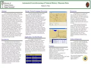
Occurrence Map • 5,942 occurrences • Over 190 species Overlaid with expert distribution map (Smith and Downs, 1977
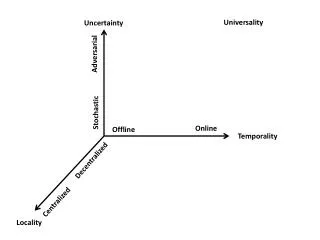
Less Precise More Precise x Less Accurate More Accurate What A Locality Should Be • Specific • Succinct • Unambiguous • Complete • Accurate • Precise
Habitat andelevation • Briefdescriptionofthe habitat theorganismwasfound (i.e. Coastalhammock) • Provideanelevationvalue • Reportthesourceofelevation (map, altimeter, seatofpants, etc.)
Coordinates • Itisnotenough to havelocalitydescriptionalone, coordinates are nowessential. • Decimal degrees are recommended. • More decimal places are better.
Examples of Good and Bad Localities • Vague localities • BAD: “Sacramento River Delta” - an extremely large geographic areaBETTER: “Locke, Sacramento River Delta, Sacramento Co., California” - names a town within the Delta • BAD: “3 mi W of San Jose/Cartago border” - without additional details, this would mean anywhere 3 mi W of the borderGOOD: “3 mi W of San Jose/Cartago border on Highway 2, San Jose Province, Costa Rica”