Download
1 / 25
260 likes | 267 Views
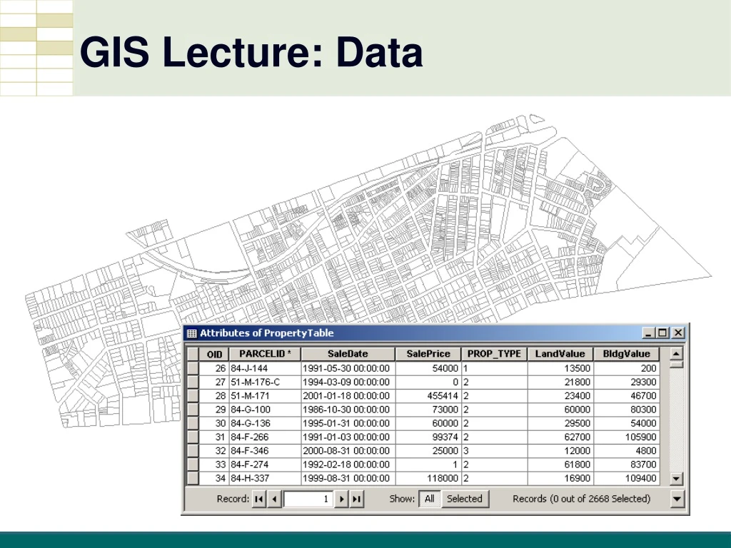
GIS Lecture: Data. Outline. Data Types, Tables, and Formats US Census Files Tabular Joins. Data Types, Tables, Formats. Directly Loadable Data Types. dBase (.dbf) - field name maximum length of 10 characters Text with comma- or tab-separated values (.csv) Microsoft Access (.mdb)

E N D
Outline • Data Types, Tables, and Formats • US Census Files • Tabular Joins
Directly Loadable Data Types • dBase (.dbf) - field name maximum length of 10 characters • Text with comma- or tab-separated values (.csv) • Microsoft Access (.mdb) • Excel (.xls)
Proper Data Table Formats • First row must be the field names • (e.g., Pop5To17, Area, and Capacity) • Field naming convention • first character is a letter • others can be letters, digits, or the underscore character (no spaces) • All other rows contain attribute values
Decennial census data • Every 10 years: • Population • Age • Sex • Race • Families • Households • Housing units
Randomly selects about 3 million addresses each year to participate Has rolling, 1-, 3-, and 5-year estimates and 90% confidence intervals American Community Survey (ACS)
Age Sex Race Family and relationships Income and benefits Health insurance Education Veteran status Disabilities Where you work and how you get there Where you live and how much you pay for certain essentials ACS Data
ACS estimates 1-year • Most current • Data with populations 65,000+ • Smallest sample size • Less reliable 3-year • Data with populations 20,000+ • Larger sample size than 1-year • More reliable than 1-year but less reliable than 5-year 5-year • Data for all areas (tracts and block groups) • Largest sample size • Most reliable but least current
U.S. Census Data Tables • http://factfinder2.census.gov • SF-1 vs ACS (American Community Survey)
File clean-up in Excel • Import into Excel • Text vs. Numeric data • Combine fields • Rename the file and save
Tabular Joins • Putting two tables together to make one table • Join with common field attributes • Common fields do not need to have the same field names • Must have the matching values and data type (e.g., text vs. numeric)
Tabular Join Example • Map parcels according to their value • Data Table – parcel values • Parcels Shapefile
Property Value Data • Has no geography • Does have fields for Parcel ID and LandValue
Join Result • Property fields are added to the Parcels attribute table
Must remove dashes! Problems with Joins Data in fields not exactly the same
Problems with Joins Different data field types • text • numeric
Summary • Data Types, Tables, and Formats • Geodatabase • Tabular Joins