Download
1 / 22
230 likes | 391 Views
Wildlife Conservation Lands Program. Introduction. Legislation that recognizes wildlife conservation land as a special class of property that must be assessed at a reduced value Signed into law in 2008 Effective January 1, 2010 Administered by NCWRC

E N D
Introduction • Legislation that recognizes wildlife conservation land as a special class of property that must be assessed at a reduced value • Signed into law in 2008 • Effective January 1, 2010 • Administered by NCWRC • Incorporates priorities from the NC Wildlife Action Plan
Program Structure • Modeled after the Present Use Value programs, but NOT one of them • Tax evaluation at agricultural PUV rate • Carries the same penalties as PUV programs
Benefits of WCLP • Provides deferred taxes for landowners whose management objectives are: • Conserving priority wildlife habitat • Providing habitat for protected species
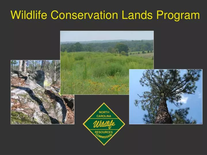
Priority Habitats • Longleaf pine forest • Early successional habitat • Small wetland community • Stream and riparian zone • Rock outcrops • Bat caves
Conservation Recommendations for Priority Terrestrial Wildlife Species and Habitats in North Carolina
Longleaf Pine Forest (Ecosystem) • Longleaf dominant • Mixed stands acceptable • No maximum BA/density • Suitable ground cover • Native grasses, forbs, legumes • More important than % canopy • Active management • Prescribed fire (preferred), herbicides, and/or mechanical • Timber harvest acceptable • Must perpetuate longleaf and retain ground cover • Longleaf restoration acceptable • 300-500 trees/ac • Managed for plant diversity during site prep and establishment • No pine straw raking
Early Successional Habitat • Mix of grasses, legumes, wildflowers, vines, shrubs, and saplings • At least 20% of ground cover must be grasses and forbs • Tree density ≤50 BA • Acceptable habitats • Abandoned farm fields, clear cuts, field borders, savannas, prairies, and meadows • Must be beneficial for wildlife • Active management • Frequent disturbance • Burning, disking, timber harvest, mowing, and/or herbicides • Not all open lands are acceptable • Fescue pastures, agricultural crops, lawns, golf courses, etc
Small Wetlands • Hydric soils and hydrophilic vegetation • Presence of water on surface at least some portion of the year • Acceptable habitats • Vernal pools, upland seeps, ephemeral wetlands, beaver ponds, depression ponds, pocosins, Carolina bays, and bogs • Includes upland buffer for water quality and foraging/nesting needs • Active management • Controlling tree encroachment, protecting water quality, limiting ATV/recreation use, and/or proper installation of crossings/roads • No introduction of fish, bullfrogs, or other predatory species
Stream & Riparian Zones • Perennial or intermittent water body • Buffer width 30-300ft • From stream bank to edge of floodplain • Acceptable habitats • Riverine communities, floodplain forests, river basins, blue-line streams, springs, and seeps • Active management • Protecting water quality and associated upland habitat, exclusion of livestock, controlling invasive species, and/or promoting plant diversity and structure • No highly eroded areas
Rock Outcrops • Forest canopy generally open with patchy understory • Rock dominates land surface • Lichens and mosses are characteristic • Acceptable habitats • Boulderfields, rocky summits, granitic flatrocks and domes, acidic and mafic cliffs, and talus slopes • Active management • Limiting recreational use, controlling tree/shrub encroachment, minimizing or eliminating human disturbance • Conservation easements strongly encouraged • No artificial rock piles
Bat Caves • Subterranean caves/excavations • Must have documented use by aggregations of bats • Acceptable habitats • Solution caves, fissure caves, and rock shelter/boulder caves • Mining caves are acceptable • Must have shafts/tunnels that resemble natural caves (temp, humidity, structure, etc) • Includes entrance buffers • Active management • Reduction or elimination of human disturbance, gating cave entrances, and limiting habitat alterations around cave entrances • Survey required to confirm presence of bats
Priority Species • Must document the presence of a protected species • Must “live on the land” • Must manage their land in a manner that protects the species and its habitat • WRC must approve the management
Protected Species Photos courtesy of the USFWS
Acreage & Mgmt • Qualifying acreage 20-100 contiguous acres • Within each county • Land managed for WCLP purposes for ≥3yrs prior to application or it must be enrolled in one of the PUV programs • Signed agreement and management plan/map
Ownership • Property ownership of ≥5yrs prior to WCLP application • Property must be owned by individual, family business, or family trust • No publicly traded corporations • WCLP transfers with property if new owner files application with county within 60 days of land transfer
Application Process • Landowner submits the Application for Assistance to WRC • WRC conducts site visit to determine eligibility • WRC provides assistance to prepare the Wildlife Habitat Conservation Agreement
Application Process • Landowner submits the Wildlife Habitat Conservation Agreement and the tax assessment application to the county tax office • The county assessor will determine if the property qualifies for tax deferment
Components of the WCLA • Landowner information • Tract location and Property Tax ID number • Priority habitat or species managed • Parcel acre and mgmt acre • Enrolled in PUV? • Tract map with aerial and mgmt acreage indicated • Planned mgmt actions
WRC Provided Assistance • Help landowner decide if WCLP is the right program for them • Help landowner understand the requirements of WCLP • Assist landowner with the documentation process (species and habitats)
WRC Provided Assistance • Assist landowner with the application process • Connect the landowner to the appropriate resources (WRC biologist, county tax office, private consultants, habitat or species specialists)
Contact Information For additional information on the WCLP or for applications, contact the WRC at: http://www.ncwildlife.org/Wildlife_Species_Con/index.htm 1722 Mail Service Center, Raleigh, NC 27699-1722 919-707-0050