Download
1 / 4
40 likes | 113 Views
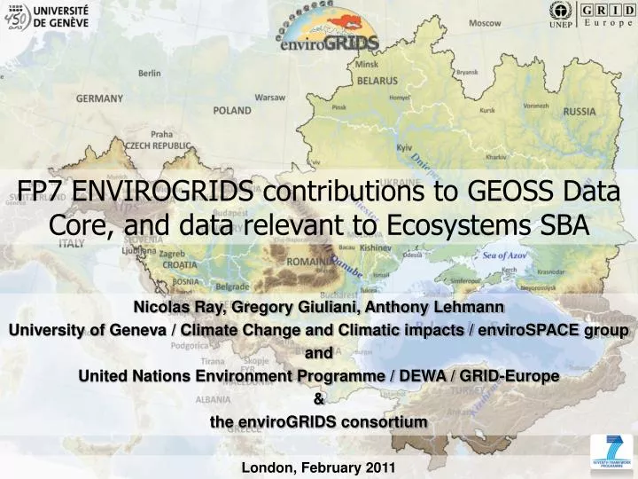
FP7 ENVIROGRIDS contributions to GEOSS Data Core, and data relevant to Ecosystems SBA. Nicolas Ray, Gregory Giuliani, Anthony Lehmann University of Geneva / Climate Change and Climatic impacts / enviroSPACE group and United Nations Environment Programme / DEWA / GRID-Europe &

E N D
FP7 ENVIROGRIDS contributions to GEOSS Data Core, and data relevant to Ecosystems SBA Nicolas Ray, Gregory Giuliani, Anthony Lehmann University of Geneva / Climate Change and Climatic impacts / enviroSPACE group and United Nations Environment Programme / DEWA / GRID-Europe & the enviroGRIDS consortium London, February 2011
Clipping data sets (vector, raster) • Population (mosaic from different sources) • Climate • Landuse/Landcover (MODIS, CORINE, GLOBECOVER) • DEM (SRTM, ASTER) • Protected areas • Soil • Regional data sets • e.g., Crimea, Ukraine: • map of fires in the Yalta Reserve • distribution map of rare plant species • distribution map of forest pest species • characterisation of Black Sea beaches
Hydrological results (long term average) Riverdischarge Actual ET Precipitation Demography Land cover Potential ET Aquifer Recharge Soil Moisture Climate
Web Processing Services (WPS) • Computation on demand through a registered WPS (CORE geoprocessing service?) • Tested with NDVI computation • In progress: • DEM processing (slopes, flood, etc.) • Remote sensing imagery